How to get to Normandy Insurance Company by bus?
Click on the bus route to see step by step directions with maps, line arrival times and updated time schedules.
From Intersection : N Andrews Ave & Sample Rd., Pompano Beach
84 minFrom Town Center at Boca Raton-East, Boca Raton
37 minFrom Bethesda Hospital East-ER, Boynton Beach-Delray Beach
45 minFrom Ollie's Bargain Outlet, Boynton Beach-Delray Beach
53 minFrom Tri-Rail-Deerfield Beach Station, Deerfield Beach
74 minFrom Boynton Beach, FL, Boynton Beach-Delray Beach
48 minFrom Pretty in Palm Beach, Boynton Beach-Delray Beach
62 minFrom Tri-Rail-Pompano Beach Station, Pompano Beach
83 min
How to get to Normandy Insurance Company by train?
Click on the train route to see step by step directions with maps, line arrival times and updated time schedules.
Bus stop near Normandy Insurance Company in Boca Raton
- FEDERAL HWY at YAMATO, 2 min walk,VIEW
Train station near Normandy Insurance Company in Boca Raton
- Boca Raton Station, 2 min walk,VIEW
Bus lines to Normandy Insurance Company in Boca Raton
- 1, Rt 1 Southbound,VIEW
What are the closest stations to Normandy Insurance Company?
The closest stations to Normandy Insurance Company are:
- FEDERAL HWY at YAMATO is 54 yards away, 2 min walk.
- Boca Raton Station is 129 yards away, 2 min walk.
Which bus line stops near Normandy Insurance Company?
1 (Rt 1 Northbound)
Which train line stops near Normandy Insurance Company?
TRIRAIL (Northbound To Mangonia Park)
What’s the nearest train station to Normandy Insurance Company in Boca Raton?
The nearest train station to Normandy Insurance Company in Boca Raton is Boca Raton Station. It’s a 2 min walk away.
What’s the nearest bus station to Normandy Insurance Company in Boca Raton?
The nearest bus station to Normandy Insurance Company in Boca Raton is FEDERAL HWY at YAMATO. It’s a 2 min walk away.
What time is the first train to Normandy Insurance Company in Boca Raton?
The TRIRAIL is the first train that goes to Normandy Insurance Company in Boca Raton. It stops nearby at 4:28 AM.
What time is the last train to Normandy Insurance Company in Boca Raton?
The TRIRAIL is the last train that goes to Normandy Insurance Company in Boca Raton. It stops nearby at 11:03 PM.
What time is the first bus to Normandy Insurance Company in Boca Raton?
The 1 is the first bus that goes to Normandy Insurance Company in Boca Raton. It stops nearby at 6:16 AM.
What time is the last bus to Normandy Insurance Company in Boca Raton?
The 1 is the last bus that goes to Normandy Insurance Company in Boca Raton. It stops nearby at 9:54 PM.
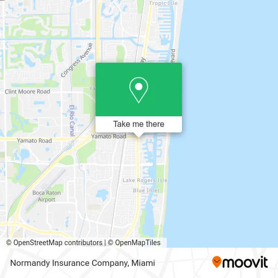
See Normandy Insurance Company, Boca Raton, on the map
Public Transit to Normandy Insurance Company in Boca Raton
Wondering how to get to Normandy Insurance Company in Boca Raton? Moovit helps you find the best way to get to Normandy Insurance Company with step-by-step directions from the nearest public transit station.
Moovit provides free maps and live directions to help you navigate through your city. View schedules, routes, timetables, and find out how long does it take to get to Normandy Insurance Company in real time.
Looking for the nearest stop or station to Normandy Insurance Company? Check out this list of stops closest to your destination: FEDERAL HWY at YAMATO; Boca Raton Station.
Bus: 1.Train: TRIRAIL.
Want to see if there’s another route that gets you there at an earlier time? Moovit helps you find alternative routes or times. Get directions from and directions to Normandy Insurance Company easily from the Moovit App or Website.
We make riding to Normandy Insurance Company easy, which is why over 1.5 million users, including users in Boca Raton, trust Moovit as the best app for public transit. You don’t need to download an individual bus app or train app, Moovit is your all-in-one transit app that helps you find the best bus time or train time available.
For information on prices of bus and train, costs and ride fares to Normandy Insurance Company, please check the Moovit app.
Use the app to navigate to popular places including to the airport, hospital, stadium, grocery store, mall, coffee shop, school, college, and university.
Normandy Insurance Company Address: 4800 N Federal Hwy Boca Raton, FL 33431 street in Boca Raton
- Florida Pip Law Firm,
- Prescott Associates,
- The Appliance Fixers Fl,
- Robert Michaelson - Unitedhealthcare Licensed Sales Agent,
- smart for Life Weight Management Centers,
- Equipo Legal,
- Sunset Cafe,
- Commercial Florida Realty SVC,
- Plumbing,
- Marcio Pinheiro Costa,
- Royal Financial Propeties,
- Goosehead Insurance - al Dhanji,
- Netone Technologies,
- Mitchell Taylor CPA Pa,
- Metro Hop Relocation,
- J Alexander Group,
- Gynecomastia Surgery,
- Pink's Windows Palm Beach,
- North Federal Highway & Yamato Road,
- Jim Nesbit
Places Near Normandy Insurance Company (Boca Raton)
- Wynwood, Miami,
- Marlins Park, Miami,
- Sawgrass Mall, Miami,
- Keiser University Flagship Campus, West Palm Beach,
- Bayside Marketplace, Miami,
- Richard E. Gerstein Justice Building, Miami,
- Port of Miami Cruise Terminal, Miami,
- Miami Freedom Park, Miami,
- Miami Design District, Miami,
- Brickell City Centre, Miami,
- Miami-Dade County Courthouse, Miami,
- Aventura Mall, Miami Beach,
- Dolphin Mall, Miami,
- Zoo Miami, Miami,
- Miami VA Hospital, Miami,
- Hard Rock Stadium, Miami Gardens,
- Sawgrass mall ( FL ), Miami Beach,
- Aventura Mall, Miami,
- Dolphin Mall Bus, Miami,
- Little Havana, Miami
How to get to popular places in Miami with public transit
Get around Boca Raton by public transit!
Traveling around Boca Raton has never been so easy. See step by step directions as you travel to any attraction, street or major public transit station. View bus and train schedules, arrival times, service alerts and detailed routes on a map, so you know exactly how to get to anywhere in Boca Raton.
When traveling to any destination around Boca Raton use Moovit's Live Directions with Get Off Notifications to know exactly where and how far to walk, how long to wait for your line, and how many stops are left. Moovit will alert you when it's time to get off — no need to constantly re-check whether yours is the next stop.
Wondering how to use public transit in Boca Raton or how to pay for public transit in Boca Raton? Moovit public transit app can help you navigate your way with public transit easily, and at minimum cost. It includes public transit fees, ticket prices, and costs. Looking for a map of Boca Raton public transit lines? Moovit public transit app shows all public transit maps in Boca Raton with all Bus, Train, Light Rail and Ferry routes and stops on an interactive map.
Miami has 4 transit type(s), including: Bus, Train, Light Rail and Ferry, operated by several transit agencies, including Broward County Transit, Miami-Dade Transit, Metrorail, Palm Tran, Tri-Rail, Brightline, MARTY, City of Homestead Trolley, Key West Transit, Treasure Coast Connector, GoLine IRT, Amtrak, Greyhound-us, FlixBus-us and Aventura Express Shuttle Bus