How to get to North Miami Beach Lock Channge Service by bus?
Click on the bus route to see step by step directions with maps, line arrival times and updated time schedules.
From Joe Dimaggio Children's Hospital at Memorial
65 minFrom Calder Casino
56 minFrom South Broward High School
87 minFrom The Haul (Haulover Clothing Optional Beach - Lifeguard Tower #14)
68 minFrom Opa-Locka Hialeah Flea Market
87 minFrom Northwest 57th Avenue
71 minFrom North Shore Medical Center
55 minFrom Hollywood Beach
80 minFrom Oleta River State Recreation (Temptation Island in Oleta River State Park)
51 minFrom Tidal Cove
43 min
Bus stops near North Miami Beach Lock Channge Service
Bus lines to North Miami Beach Lock Channge Service
What are the closest stations to North Miami Beach Lock Channge Service?
The closest stations to North Miami Beach Lock Channge Service are:
- Ne 2 Av & Ne 191 St is 489 yards away, 7 min walk.
- California Dr & Op # 441 is 2394 yards away, 29 min walk.
Which bus lines stop near North Miami Beach Lock Channge Service?
These bus lines stop near North Miami Beach Lock Channge Service: 17, 18, 199.
What’s the nearest bus station to North Miami Beach Lock Channge Service?
The nearest bus station to North Miami Beach Lock Channge Service is Ne 2 Av & Ne 191 St. It’s a 7 min walk away.
What time is the first bus to North Miami Beach Lock Channge Service?
The 17 is the first bus that goes to North Miami Beach Lock Channge Service. It stops nearby at 3:41 AM.
What time is the last bus to North Miami Beach Lock Channge Service?
The 17 is the last bus that goes to North Miami Beach Lock Channge Service. It stops nearby at 1:36 AM.
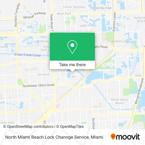
See North Miami Beach Lock Channge Service on the map
Public Transportation to North Miami Beach Lock Channge Service
Wondering how to get to North Miami Beach Lock Channge Service? Moovit helps you find the best way to get to North Miami Beach Lock Channge Service with step-by-step directions from the nearest public transit station.
Moovit provides free maps and live directions to help you navigate through your city. View schedules, routes, timetables, and find out how long does it take to get to North Miami Beach Lock Channge Service in real time.
Looking for the nearest stop or station to North Miami Beach Lock Channge Service? Check out this list of stops closest to your destination: Ne 2 Av & Ne 191 St; California Dr & Op # 441.
Bus: 17, 18, 199.
Want to see if there’s another route that gets you there at an earlier time? Moovit helps you find alternative routes or times. Get directions from and directions to North Miami Beach Lock Channge Service easily from the Moovit App or Website.
We make riding to North Miami Beach Lock Channge Service easy, which is why over 1.5 million users, including users in Miami, trust Moovit as the best app for public transit. You don’t need to download an individual bus app or train app, Moovit is your all-in-one transit app that helps you find the best bus time or train time available.
For information on prices of bus, costs and ride fares to North Miami Beach Lock Channge Service, please check the Moovit app.
Use the app to navigate to popular places including to the airport, hospital, stadium, grocery store, mall, coffee shop, school, college, and university.
North Miami Beach Lock Channge Service Address: 390 NE 191st St Miami, FL 33179 street in Miami
- Nsure,
- E&N Entertainment,
- Brandy's Right Now Notary,
- Advanced Telemed Services Technology,
- Not Just Hair Boutique,
- Aventura Direct Cars,
- Excel Impact, LLC,
- Andrade Marcio Newfox Engineers,
- Medigap Policy,
- Serene Construction,
- Vivian Thomas, PMHNP,
- Aurum Queen Designs,
- Ocean Air Maintenance,
- Endless Events,
- Everyday Valet Trash,
- Vital Source Health,
- Vice City,
- Baron Delivery on Demand,
- J.R. Carpet Express 24 HRS,
- Fuzion House
Places Near North Miami Beach Lock Channge Service
- Miami Freedom Park, Miami,
- Wynwood, Miami,
- Hard Rock Stadium, Miami Gardens,
- Sawgrass mall ( FL ), Miami Beach,
- Aventura Mall, Miami,
- Sawgrass Mall, Miami,
- Dolphin Mall, Miami,
- Miami VA Hospital, Miami,
- Zoo Miami, Miami,
- Aventura Mall, Miami Beach,
- Richard E. Gerstein Justice Building, Miami,
- Keiser University Flagship Campus, West Palm Beach,
- Port of Miami Cruise Terminal, Miami,
- Little Havana, Miami,
- Brickell City Centre, Miami,
- Bayside Marketplace, Miami,
- Marlins Park, Miami,
- Dolphin Mall Bus, Miami,
- Miami-Dade County Courthouse, Miami,
- Miami Design District, Miami
How to get to popular places in Miami with public transit
Get around Miami by public transit!
Traveling around Miami has never been so easy. See step by step directions as you travel to any attraction, street or major public transit station. View bus and train schedules, arrival times, service alerts and detailed routes on a map, so you know exactly how to get to anywhere in Miami.
When traveling to any destination around Miami use Moovit's Live Directions with Get Off Notifications to know exactly where and how far to walk, how long to wait for your line, and how many stops are left. Moovit will alert you when it's time to get off — no need to constantly re-check whether yours is the next stop.
Wondering how to use public transit in Miami or how to pay for public transit in Miami? Moovit public transit app can help you navigate your way with public transit easily, and at minimum cost. It includes public transit fees, ticket prices, and costs. Looking for a map of Miami public transit lines? Moovit public transit app shows all public transit maps in Miami with all Bus, Train, Light Rail and Ferry routes and stops on an interactive map.
Miami has 4 transit type(s), including: Bus, Train, Light Rail and Ferry, operated by several transit agencies, including Broward County Transit, Miami-Dade Transit, Metrorail, Palm Tran, Tri-Rail, Brightline, MARTY, City of Homestead Trolley, Key West Transit, Treasure Coast Connector, GoLine IRT, Amtrak, Greyhound-us, FlixBus-us and Aventura Express Shuttle Bus