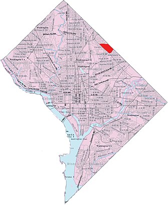
See North Michigan Park, North Michigan Park, Washington, DC, USA on the map
Directions to North Michigan Park, North Michigan Park, Washington, DC, USA with public transportation
The following transit lines have routes that pass near North Michigan Park, North Michigan Park, Washington, DC, USA
 Bus:
Bus: - Metro:
How to get to North Michigan Park, North Michigan Park, Washington, DC, USA by bus?
Click on the bus route to see step by step directions with maps, line arrival times and updated time schedules.
How to get to North Michigan Park, North Michigan Park, Washington, DC, USA by metro?
Click on the metro route to see step by step directions with maps, line arrival times and updated time schedules.
Bus stations near North Michigan Park, North Michigan Park, Washington, DC, USA
- South Dakota Ave & 16th St,9 min walk,
- Michigan Ave Ne & South Dakota Ave Ne,9 min walk,
Bus lines to North Michigan Park, North Michigan Park, Washington, DC, USA
- E2,South To Ivy City,
- R4,North To Highview,
What are the closest stations to North Michigan Park, North Michigan Park, Washington, DC, USA?
The closest stations to North Michigan Park, North Michigan Park, Washington, DC, USA are:
- South Dakota Ave & 16th St is 743 yards away, 9 min walk.
- Michigan Ave Ne & South Dakota Ave Ne is 758 yards away, 9 min walk.
Which bus lines stop near North Michigan Park, North Michigan Park, Washington, DC, USA?
These bus lines stop near North Michigan Park, North Michigan Park, Washington, DC, USA: G8, R4.
Which metro line stops near North Michigan Park, North Michigan Park, Washington, DC, USA?
METRORAIL RED LINE
What’s the nearest bus stop to North Michigan Park, North Michigan Park, Washington, DC, USA?
The nearest bus stops to North Michigan Park, North Michigan Park, Washington, DC, USA are South Dakota Ave & 16th St and Michigan Ave Ne & South Dakota Ave Ne. The closest one is a 9 min walk away.
See North Michigan Park, North Michigan Park, Washington, DC, USA on the map
Public Transportation to North Michigan Park, North Michigan Park, Washington, DC, USA
Wondering how to get to North Michigan Park, North Michigan Park, Washington, DC, USA, United States? Moovit helps you find the best way to get to North Michigan Park, North Michigan Park, Washington, DC, USA with step-by-step directions from the nearest public transit station.
Moovit provides free maps and live directions to help you navigate through your city. View schedules, routes, timetables, and find out how long does it take to get to North Michigan Park, North Michigan Park, Washington, DC, USA in real time.
Looking for the nearest stop or station to North Michigan Park, North Michigan Park, Washington, DC, USA? Check out this list of stops closest to your destination: South Dakota Ave & 16th St; Michigan Ave Ne & South Dakota Ave Ne.
Bus:Metro:
Want to see if there’s another route that gets you there at an earlier time? Moovit helps you find alternative routes or times. Get directions from and directions to North Michigan Park, North Michigan Park, Washington, DC, USA easily from the Moovit App or Website.
We make riding to North Michigan Park, North Michigan Park, Washington, DC, USA easy, which is why over 1.5 million users, including users in Washington, trust Moovit as the best app for public transit. You don’t need to download an individual bus app or train app, Moovit is your all-in-one transit app that helps you find the best bus time or train time available.
For information on prices of bus and metro, costs and ride fares to North Michigan Park, North Michigan Park, Washington, DC, USA, please check the Moovit app.
Use the app to navigate to popular places including to the airport, hospital, stadium, grocery store, mall, coffee shop, school, college, and university.
North Michigan Park, North Michigan Park, Washington, DC, USA Address: North Michigan Park, Washington, DC, USA street in Washington
Attractions near North Michigan Park, North Michigan Park, Washington, DC, USA
White Friars Hall School,Whitefriars Hall,Buchanan St NE (16th st & buchanan st),16th Buchanan,Buchanan St NE (16th buchanan),Buchanan Street Northeast,Webster St NE (webster & 16th st),Webster St,Webster St NE (16th st ne & webster),Webster St NE,17th St NE,1631 Webster St NE,Michigan Park,Hugh Marketing Solutions,4514 17th St NE,4405 16th St NE (16th St NE,4405),1707 Allison St NE,Calvin C Sampson Dr,Webster Street Northeast,National Assoc of Black SHow to get to popular attractions in Washington with public transit
Coastal Flats, Fairfax County,Earth Treks Climbing Center, Montgomery County,Tunnicliff's Tavern, Washington,Dumfries, VA, Prince William County,Dundalk, Maryland, Baltimore County,The Ugly Mug, Washington,Sweetwater Tavern, Fairfax County,Biergarten Haus, Washington,Damascus, MD, Montgomery County,Towson, MD, Baltimore County,Hank's Oyster Bar, Washington,O'Sullivan's Irish Pub & Restaurant, Arlington County,Herndon, Virginia, Fairfax County,Ebenezers Coffeehouse, Washington,Miss Shirley's Cafe, Baltimore,Columbia, MD, Howard County,Merritt Downtown Athletic Club, Baltimore,Shaw's Tavern, Washington,Green Lantern, Washington,I-95 Exit 158: Prince William Pkwy, Prince William CountyGet around Washington by public transit!
Traveling around Washington has never been so easy. See step by step directions as you travel to any attraction, street or major public transit station. View bus and train schedules, arrival times, service alerts and detailed routes on a map, so you know exactly how to get to anywhere in Washington.
When traveling to any destination around Washington use Moovit's Live Directions with Get Off Notifications to know exactly where and how far to walk, how long to wait for your line, and how many stops are left. Moovit will alert you when it's time to get off — no need to constantly re-check whether yours is the next stop.
Wondering how to use public transit in Washington or how to pay for public transit in Washington? Moovit public transit app can help you navigate your way with public transit easily, and at minimum cost. It includes public transit fees, ticket prices, and costs. Looking for a map of Washington public transit lines? Moovit public transit app shows all public transit maps in Washington with all bus or metro routes and stops on an interactive map.
Washington has 2 transit type(s), including: bus or metro, operated by several transit agencies, including WMATA, WMATA, Montgomery County Ride On, Fairfax Connector, TheBus, DC Circulator, MDOT MTA, Marc, MDOT MTA, MDOT MTA, Virginia Railway Express (VRE), PRTC, DASH - Alexandria, Arlington Transit (ART) and DC Streetcar