Directions to North Springfield Irving (Windsor) with public transportation
The following transit lines have routes that pass near North Springfield Irving
 Bus: 57.
How to get to North Springfield Irving by bus?
Click on the bus route to see step by step directions with maps, line arrival times and updated time schedules.
Bus stop near North Springfield Irving in Windsor
- Jc's Market, 5 min walk,VIEW
Bus lines to North Springfield Irving in Windsor
- 57, Bellows Falls Amtrak Station,VIEW
What are the closest stations to North Springfield Irving?
The closest stations to North Springfield Irving are:
- Jc's Market is 386 yards away, 5 min walk.
Which bus line stops near North Springfield Irving?
57 (Okemo→Penguin Mart)
What’s the nearest bus station to North Springfield Irving in Windsor?
The nearest bus station to North Springfield Irving in Windsor is Jc's Market. It’s a 5 min walk away.
What time is the first bus to North Springfield Irving in Windsor?
The 57 is the first bus that goes to North Springfield Irving in Windsor. It stops nearby at 7:06 AM.
What time is the last bus to North Springfield Irving in Windsor?
The 57 is the last bus that goes to North Springfield Irving in Windsor. It stops nearby at 5:39 PM.
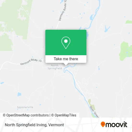
See North Springfield Irving, Windsor, on the map
Public Transit to North Springfield Irving in Windsor
Wondering how to get to North Springfield Irving in Windsor? Moovit helps you find the best way to get to North Springfield Irving with step-by-step directions from the nearest public transit station.
Moovit provides free maps and live directions to help you navigate through your city. View schedules, routes, timetables, and find out how long does it take to get to North Springfield Irving in real time.
Looking for the nearest stop or station to North Springfield Irving? Check out this list of stops closest to your destination: Jc's Market.
Bus: 57.
Want to see if there’s another route that gets you there at an earlier time? Moovit helps you find alternative routes or times. Get directions from and directions to North Springfield Irving easily from the Moovit App or Website.
We make riding to North Springfield Irving easy, which is why over 1.5 million users, including users in Windsor, trust Moovit as the best app for public transit. You don’t need to download an individual bus app or train app, Moovit is your all-in-one transit app that helps you find the best bus time or train time available.
For information on prices of bus and train, costs and ride fares to North Springfield Irving, please check the Moovit app.
Use the app to navigate to popular places including to the airport, hospital, stadium, grocery store, mall, coffee shop, school, college, and university.
North Springfield Irving Address: 16 Rte 106 street in Windsor
- Home Systems Construction,
- Dec-Tech Computer,
- Honey Hill Farm,
- Eclectic Technologies,
- Ubs,
- USPS Collection Box - Po Lobby,
- Main Street Market,
- Morse's Market,
- North Springfield Baptist Church,
- KDB Bass Fishing Guide Service,
- P & M Auto,
- Daggi's Reptiles,
- Network MGMT Services,
- Connecticut River Bank,
- One Spa Massage Springfield,
- Bar Bee G's Tagging Nook,
- Brook Rd,
- 10 Mile Hill Rd,
- Crown Point Country Club,
- Plaza Bowl
Places Near North Springfield Irving (Windsor)
- Barre, VT,
- Hannaford, Rutland,
- Missisquoi River Basin Association,
- Castleton University, Rutland,
- Springfield, VT, Windsor,
- MVU,
- Castleton, VT, Rutland,
- Dartmouth-Hitchcock Medical Center, Clinical Systems, Grafton,
- Richford Auto,
- Waterbury, VT,
- WXXX, Chittenden,
- Champlain Valley Exposition, Chittenden,
- GLOBALFOUNDRIES, Chittenden,
- Derby Line Stanstead Border Crossing,
- Spring Step,
- Ecco,
- Xxxxxxxxxxxxx, Chittenden,
- University of Vermont Medical Center - Fanny Allen Campus, Chittenden,
- Sugarbush Resort,
- Rutland, VT, Rutland
How to get to popular places in Vermont with public transit
Get around Windsor by public transit!
Traveling around Windsor has never been so easy. See step by step directions as you travel to any attraction, street or major public transit station. View bus and train schedules, arrival times, service alerts and detailed routes on a map, so you know exactly how to get to anywhere in Windsor.
When traveling to any destination around Windsor use Moovit's Live Directions with Get Off Notifications to know exactly where and how far to walk, how long to wait for your line, and how many stops are left. Moovit will alert you when it's time to get off — no need to constantly re-check whether yours is the next stop.
Wondering how to use public transit in Windsor or how to pay for public transit in Windsor? Moovit public transit app can help you navigate your way with public transit easily, and at minimum cost. It includes public transit fees, ticket prices, and costs. Looking for a map of Windsor public transit lines? Moovit public transit app shows all public transit maps in Windsor with all Bus, Train and Ferry routes and stops on an interactive map.
Vermont has 3 transit type(s), including: Bus, Train and Ferry, operated by several transit agencies, including Green Mountain Transit, Wilmington MOOver, Advance Transit, Vermont Translines, Rockingham MOOver, The Bus (Marble Valley Regional Transit District), Green Mountain Express, Rural Community Transportation, Addison County Transit Resources, Stagecoach Transportation Services, Amtrak, Greyhound-us, Dartmouth Campus Connector and Lake Champlain Ferries