Directions to North York (Toronto) with public transportation
The following transit lines have routes that pass near North York
 Bus: 19, 27, 97A, 97B, 67.
- Subway: 1, 4.
How to get to North York by bus?
Click on the bus route to see step by step directions with maps, line arrival times and updated time schedules.
How to get to North York by subway?
Click on the subway route to see step by step directions with maps, line arrival times and updated time schedules.
Subway stations near North York in Toronto
- Finch, 1 min walk,
- Sheppard - Yonge, 29 min walk,
Bus stops near North York in Toronto
- Yonge St At Norton Ave, 2 min walk,
- Yonge St at Norton Ave, 3 min walk,
- Yonge St at Park Home Ave, 3 min walk,
Bus lines to North York in Toronto
- 19, 19 - Finch Terminal,
- 27, 27d - Meadowvale Go,
- 67, 67 - Woodbine/404,
- 96, 96z - Finch Terminal,
- 97A, South - 97a Yonge Towards St Clair Station,
- 97B, North - 97b Yonge Towards Steeles Via Yonge Blvd,
- 320A, North - 320a Yonge Towards Steeles,
- 320S, North - 320s Yonge Short Turn Towards Eglinton Station,
- 320, South - 320 Yonge Towards Queens Quay,
What are the closest stations to North York?
The closest stations to North York are:
- Finch station is 5 meters away, 1 min walk.
- Yonge St At Norton Ave stop is 143 meters away, 2 min walk.
- Yonge St at Norton Ave stop is 166 meters away, 3 min walk.
- Yonge St at Park Home Ave stop is 172 meters away, 3 min walk.
- Sheppard - Yonge station is 2200 meters away, 29 min walk.
Which bus lines stop near North York?
These bus lines stop near North York: 19, 27, 97A, 97B.
Which subway line stops near North York?
1 (Vaughan Metropolitan Centre)
What’s the nearest subway station to North York in Toronto?
The nearest subway station to North York in Toronto is Finch. It’s a 1 min walk away.
What’s the nearest bus station to North York in Toronto?
The nearest bus station to North York in Toronto is Yonge St At Norton Ave. It’s a 2 min walk away.
What time is the first subway to North York in Toronto?
The 1 is the first subway that goes to North York in Toronto. It stops nearby at 5:31 AM.
What time is the last subway to North York in Toronto?
The 4 is the last subway that goes to North York in Toronto. It stops nearby at 2:33 AM.
What time is the first bus to North York in Toronto?
The 320A is the first bus that goes to North York in Toronto. It stops nearby at 3:00 AM.
What time is the last bus to North York in Toronto?
The 320A is the last bus that goes to North York in Toronto. It stops nearby at 3:35 AM.
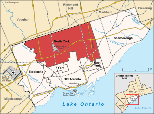
See North York, Toronto, on the map
Public Transit to North York in Toronto
Wondering how to get to North York in Toronto? Moovit helps you find the best way to get to North York with step-by-step directions from the nearest public transit station.
Moovit provides free maps and live directions to help you navigate through your city. View schedules, routes, timetables, and find out how long does it take to get to North York in real time.
Looking for the nearest stop or station to North York? Check out this list of stops closest to your destination: Finch; Yonge St At Norton Ave; Yonge St at Norton Ave; Yonge St at Park Home Ave; Sheppard - Yonge.
Bus: 19, 27, 97A, 97B, 67, 96, 320A, 320S, 320.Subway: 1, 4.
Want to see if there’s another route that gets you there at an earlier time? Moovit helps you find alternative routes or times. Get directions from and directions to North York easily from the Moovit App or Website.
We make riding to North York easy, which is why over 1.7 billion users, including users in Toronto, trust Moovit as the best app for public transit. You don’t need to download an individual bus app or train app, Moovit is your all-in-one transit app that helps you find the best bus time or train time available.
For information on prices of bus, subway and Streetcar, costs and ride fares to North York, please check the Moovit app.
Use the app to navigate to popular places including to the airport, hospital, stadium, grocery store, mall, coffee shop, school, college, and university.
North York Address: Yonge Street street in Toronto
- Simple Closings,
- Carefully Fit Home Care Solutions,
- Amazon Counter-Anytime Convenience (Pudo),
- Good Taste Casserole Rice,
- North York Roofing Team,
- Teta's Kitchen,
- Qing Shu Malatang,
- Speedy Muffler Brake & Wheel,
- Kaiyao Corporation,
- Ded Agency,
- Boston Pizza,
- 25 Canterbury Place,
- Duzz,
- 28 Empress Avenue,
- Kinton Ramen,
- Sonoline.Ca,
- 55 Ellerslie Avenue,
- Grisanti Casual Italian Restaurant,
- Kadish Joel,
- Deborah da Silva - Duca Financial
Places Near North York (Toronto)
- St Lawrence Market, Toronto,
- Toronto Courthouse, Toronto,
- Medieval Times, Toronto,
- St Michael s Hospital, Toronto,
- Toronto General Hospital, Toronto,
- Great Canadian Casino Resort, Toronto,
- Enercare Centre, Toronto,
- Toronto Eaton Centre, Toronto,
- Scarborough Town Centre, Toronto,
- Brandy Melville, Toronto,
- Exhibition Place, Toronto,
- 777 Bay Street, Toronto,
- Ripley's Aquarium Of Canada, Toronto,
- Vaughan Mills Shopping Centre, Vaughan,
- BMO Field, Toronto,
- Toronto Western Hospital, Toronto,
- Sunnybrook Hospital, Toronto,
- St. Joseph's Health Centre, Toronto,
- Rogers Centre, Toronto,
- St. Michael's Hospital, Toronto
How to get to popular places in Toronto with public transit
Get around Toronto by public transit!
Traveling around Toronto has never been so easy. See step by step directions as you travel to any attraction, street or major public transit station. View bus and train schedules, arrival times, service alerts and detailed routes on a map, so you know exactly how to get to anywhere in Toronto.
When traveling to any destination around Toronto use Moovit's Live Directions with Get Off Notifications to know exactly where and how far to walk, how long to wait for your line, and how many stops are left. Moovit will alert you when it's time to get off — no need to constantly re-check whether yours is the next stop.
Wondering how to use public transit in Toronto or how to pay for public transit in Toronto? Moovit public transit app can help you navigate your way with public transit easily, and at minimum cost. It includes public transit fees, ticket prices, and costs. Looking for a map of Toronto public transit lines? Moovit public transit app shows all public transit maps in Toronto with all Bus, Train, Subway, Streetcar and Ferry routes and stops on an interactive map.
Toronto has 5 transit type(s), including: Bus, Train, Subway, Streetcar and Ferry, operated by several transit agencies, including TTC, Toronto Subway, Brampton Transit, MiWay, York Region Transit, GO Transit Bus, GO Transit, Durham Region Transit, UP Express, Grand River Transit, Guelph Transit, Hamilton Street Railway, Burlington Transit, Oakville Transit and pererborough