How to get to Northwell Health Mmtp Program by bus?
Click on the bus route to see step by step directions with maps, line arrival times and updated time schedules.
From One State Street Plaza, Manhattan
41 minFrom Staten Island Mall, Staten Island
59 minFrom Wagner Park, Manhattan
43 minFrom 1 New York Plaza, Manhattan
44 minFrom One Battery Park Plaza, Manhattan
39 minFrom Castle Clinton National Monument, Manhattan
41 minFrom Bayonne Golf Club Ferry, Manhattan
42 min
Bus stops near Northwell Health Mmtp Program in Staten Island
Subway station near Northwell Health Mmtp Program in Staten Island
- Clifton, 5 min walk,VIEW
Ferry station near Northwell Health Mmtp Program in Staten Island
- St. George Ferry Terminal, 30 min walk,VIEW
Bus lines to Northwell Health Mmtp Program in Staten Island
What are the closest stations to Northwell Health Mmtp Program?
The closest stations to Northwell Health Mmtp Program are:
- Canal St/Wright St is 31 yards away, 1 min walk.
- Bay St/Water St is 185 yards away, 3 min walk.
- Clifton is 336 yards away, 5 min walk.
- St. George Ferry Terminal is 2478 yards away, 30 min walk.
Which bus lines stop near Northwell Health Mmtp Program?
These bus lines stop near Northwell Health Mmtp Program: S52, S74, S76, S78.
Which subway line stops near Northwell Health Mmtp Program?
SIR (St. George Terminal)
What’s the nearest subway station to Northwell Health Mmtp Program in Staten Island?
The nearest subway station to Northwell Health Mmtp Program in Staten Island is Clifton. It’s a 5 min walk away.
What’s the nearest bus station to Northwell Health Mmtp Program in Staten Island?
The nearest bus station to Northwell Health Mmtp Program in Staten Island is Canal St/Wright St. It’s a 1 min walk away.
What’s the nearest ferry station to Northwell Health Mmtp Program in Staten Island?
The nearest ferry station to Northwell Health Mmtp Program in Staten Island is St. George Ferry Terminal. It’s a 30 min walk away.
What time is the first subway to Northwell Health Mmtp Program in Staten Island?
The SIR is the first subway that goes to Northwell Health Mmtp Program in Staten Island. It stops nearby at 3:06 AM.
What time is the last subway to Northwell Health Mmtp Program in Staten Island?
The SIR is the last subway that goes to Northwell Health Mmtp Program in Staten Island. It stops nearby at 3:13 AM.
What time is the first bus to Northwell Health Mmtp Program in Staten Island?
The S74 is the first bus that goes to Northwell Health Mmtp Program in Staten Island. It stops nearby at 3:03 AM.
What time is the last bus to Northwell Health Mmtp Program in Staten Island?
The S78 is the last bus that goes to Northwell Health Mmtp Program in Staten Island. It stops nearby at 3:45 AM.
What time is the first ferry to Northwell Health Mmtp Program in Staten Island?
The STATEN ISLAND FERRY is the first ferry that goes to Northwell Health Mmtp Program in Staten Island. It stops nearby at 3:00 AM.
What time is the last ferry to Northwell Health Mmtp Program in Staten Island?
The STATEN ISLAND FERRY is the last ferry that goes to Northwell Health Mmtp Program in Staten Island. It stops nearby at 2:55 AM.
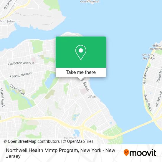
See Northwell Health Mmtp Program, Staten Island, on the map
Public Transit to Northwell Health Mmtp Program in Staten Island
Wondering how to get to Northwell Health Mmtp Program in Staten Island? Moovit helps you find the best way to get to Northwell Health Mmtp Program with step-by-step directions from the nearest public transit station.
Moovit provides free maps and live directions to help you navigate through your city. View schedules, routes, timetables, and find out how long does it take to get to Northwell Health Mmtp Program in real time.
Looking for the nearest stop or station to Northwell Health Mmtp Program? Check out this list of stops closest to your destination: Canal St/Wright St; Bay St/Water St; Clifton; St. George Ferry Terminal.
Bus: S52, S74, S76, S78, SIM30, S51, S81.Subway: SIR.Ferry: STATEN ISLAND FERRY.
Want to see if there’s another route that gets you there at an earlier time? Moovit helps you find alternative routes or times. Get directions from and directions to Northwell Health Mmtp Program easily from the Moovit App or Website.
We make riding to Northwell Health Mmtp Program easy, which is why over 1.5 million users, including users in Staten Island, trust Moovit as the best app for public transit. You don’t need to download an individual bus app or train app, Moovit is your all-in-one transit app that helps you find the best bus time or train time available.
For information on prices of bus, subway and ferry, costs and ride fares to Northwell Health Mmtp Program, please check the Moovit app.
Use the app to navigate to popular places including to the airport, hospital, stadium, grocery store, mall, coffee shop, school, college, and university.
Northwell Health Mmtp Program Address: 111 Water St street in Staten Island
- The Church Of Pentecost Usa Inc. Staten Island Assembly,
- Dmitry B Aniskin, Md,
- Mmtp Clinic Of Staten Island University Hospital,
- Golden Years Adult Day Care Center,
- Oh Oh Coquito,
- Western Union,
- 103 Canal St,
- Dollar Tree,
- Tappan Park, Staten Island,
- Santander Bank Atm,
- Iglesia Christiana De La Nueva,
- Marketing Mindset,
- The Apostolic Church,
- Sisters African Senagalese,
- Eden II Programs,
- Staten Island Parish,
- Celestial Church Of Christ,
- Against the Grain Barber Shop,
- God First Spiritual Store,
- Boyd Apartment
Places Near Northwell Health Mmtp Program (Staten Island)
- Hudson Yards, Manhattan,
- SoHo, Manhattan,
- 911 Memorial, Manhattan,
- Katz's Deli, Manhattan,
- 26 Federal Plaza, Manhattan,
- 376 Hudson Street, Manhattan,
- Times Square, Manhattan,
- Chinatown, Manhattan,
- Wall Street, Manhattan,
- qqqq, Manhattan,
- Queens Center Mall, Queens,
- 1 Police Plaza, Manhattan,
- 3 Stone St, Manhattan,
- 66 John Street, Manhattan,
- Pier 83, Manhattan,
- 111 Centre New York City Supreme Court, Manhattan,
- Rockefeller Center, Manhattan,
- Mountainside Hospital, Glen Ridge,
- San Gennaro Feast, Manhattan,
- Bellevue Hospital, Manhattan
How to get to popular places in New York - New Jersey with public transit
Get around Staten Island by public transit!
Traveling around Staten Island has never been so easy. See step by step directions as you travel to any attraction, street or major public transit station. View bus and train schedules, arrival times, service alerts and detailed routes on a map, so you know exactly how to get to anywhere in Staten Island.
When traveling to any destination around Staten Island use Moovit's Live Directions with Get Off Notifications to know exactly where and how far to walk, how long to wait for your line, and how many stops are left. Moovit will alert you when it's time to get off — no need to constantly re-check whether yours is the next stop.
Wondering how to use public transit in Staten Island or how to pay for public transit in Staten Island? Moovit public transit app can help you navigate your way with public transit easily, and at minimum cost. It includes public transit fees, ticket prices, and costs. Looking for a map of Staten Island public transit lines? Moovit public transit app shows all public transit maps in Staten Island with all Bus, Train, Subway, Light Rail, Ferry and Cable Car routes and stops on an interactive map.
New York - New Jersey has 6 transit type(s), including: Bus, Train, Subway, Light Rail, Ferry and Cable Car, operated by several transit agencies, including MTA Subway, Metro-North Railroad, LIRR, PATH, MTA New York City Transit - Express routes, MTA Bus, NJ Transit, NYC Ferry, NICE bus, Bee-Line Bus, NJ Transit Rail, Norwalk Transit District, Hartford Line, River Valley Transit and HART