How to get to Novgen-Group by bus?
Click on the bus route to see step by step directions with maps, line arrival times and updated time schedules.
From Dirección General de Tráfico (DGT), Alcalá De Henares
50 minFrom C.C. Cuadernillos, Alcalá De Henares
25 minFrom Centro Penitenciario Alcalá Meco - Madrid II, Alcalá De Henares
82 minFrom Hospital Universitario De Guadalajara, Guadalajara
49 minFrom Cementerio Jardín, Área Metropolitana De Madrid Y Corredor Del Henares
56 minFrom Autobús 227 EXPRESS, Alcalá De Henares
59 minFrom Hospital Príncipe De Asturias, Alcalá De Henares
60 minFrom Centro Comercial Ferial Plaza, Guadalajara
84 minFrom Centro Comercial Alcalá Magna, Área Metropolitana De Madrid Y Corredor Del Henares
60 minFrom Centro Francisco Díaz, Alcalá De Henares
37 min
How to get to Novgen-Group by train?
Click on the train route to see step by step directions with maps, line arrival times and updated time schedules.
From Hospital Príncipe De Asturias, Alcalá De Henares
52 minFrom Dirección General de Tráfico (DGT), Alcalá De Henares
51 minFrom Centro Francisco Díaz, Alcalá De Henares
57 minFrom Autobús 227 EXPRESS, Alcalá De Henares
48 minFrom C.C. Cuadernillos, Alcalá De Henares
35 minFrom Centro Comercial Alcalá Magna, Área Metropolitana De Madrid Y Corredor Del Henares
50 min
Bus stops near Novgen-Group in Azuqueca De Henares
Train station near Novgen-Group in Azuqueca De Henares
- Azuqueca, 46 min walk,VIEW
Bus lines to Novgen-Group in Azuqueca De Henares
What are the closest stations to Novgen-Group?
The closest stations to Novgen-Group are:
- Azuqueca - Polideportivo La Paz is 135 meters away, 2 min walk.
- Río Ebro (Centro De Salud) is 209 meters away, 3 min walk.
- Azuqueca is 3597 meters away, 46 min walk.
Which bus lines stop near Novgen-Group?
These bus lines stop near Novgen-Group: VAC243, VCM-048.
Which train line stops near Novgen-Group?
C2 (Guadalajara)
What’s the nearest bus station to Novgen-Group in Azuqueca De Henares?
The nearest bus station to Novgen-Group in Azuqueca De Henares is Azuqueca - Polideportivo La Paz. It’s a 2 min walk away.
What time is the first train to Novgen-Group in Azuqueca De Henares?
The C2 is the first train that goes to Novgen-Group in Azuqueca De Henares. It stops nearby at 5:38 AM.
What time is the last train to Novgen-Group in Azuqueca De Henares?
The C2 is the last train that goes to Novgen-Group in Azuqueca De Henares. It stops nearby at 12:42 AM.
What time is the first bus to Novgen-Group in Azuqueca De Henares?
The VCM-048 is the first bus that goes to Novgen-Group in Azuqueca De Henares. It stops nearby at 6:35 AM.
What time is the last bus to Novgen-Group in Azuqueca De Henares?
The VCM-048 is the last bus that goes to Novgen-Group in Azuqueca De Henares. It stops nearby at 11:33 PM.
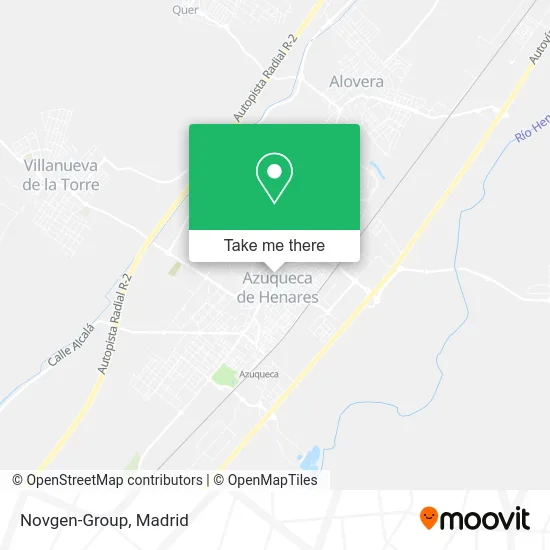
See Novgen-Group, Azuqueca De Henares, on the map
Public Transit to Novgen-Group in Azuqueca De Henares
Wondering how to get to Novgen-Group in Azuqueca De Henares? Moovit helps you find the best way to get to Novgen-Group with step-by-step directions from the nearest public transit station.
Moovit provides free maps and live directions to help you navigate through your city. View schedules, routes, timetables, and find out how long does it take to get to Novgen-Group in real time.
Looking for the nearest stop or station to Novgen-Group? Check out this list of stops closest to your destination: Azuqueca - Polideportivo La Paz; Río Ebro (Centro De Salud); Azuqueca.
Bus: VAC243, VCM-048, L1.Train: C2, C7.
Want to see if there’s another route that gets you there at an earlier time? Moovit helps you find alternative routes or times. Get directions from and directions to Novgen-Group easily from the Moovit App or Website.
We make riding to Novgen-Group easy, which is why over 1.5 million users, including users in Azuqueca De Henares, trust Moovit as the best app for public transit. You don’t need to download an individual bus app or train app, Moovit is your all-in-one transit app that helps you find the best bus time or train time available.
For information on prices of bus and train, costs and ride fares to Novgen-Group, please check the Moovit app.
Use the app to navigate to popular places including to the airport, hospital, stadium, grocery store, mall, coffee shop, school, college, and university.
Novgen-Group Address: Calle Río Tajuña, 19200 Azuqueca de Henares street in Azuqueca De Henares
- Jeremy Josue Conejo Ch,
- Juyu,
- Iveth Gomez Ga,
- Laura Mercedes Potosi,
- Imperial Vitória Massa de Pastel,
- Memora Servicios Funerarios,
- Calle Río Gallo / Calle Río Dulce,
- Bar Rosito,
- Azuqueca de Henares Cr.Alovera,
- Pescados Mariscos Javi,
- Lámparas Monzo S.L.,
- Sushi Boss Restaurante Cafetería,
- Calpisi,
- Rozas Badiel Obras y Servicios,
- Allianz Seguros-Delia Grande Paris,
- Calle Río Badiel 10,
- Centro de Educacion Ifantil y Primaria Maestra Placida Herranz,
- J Mercadito,
- D&Lrentalbusiness,
- Admon
Places Near Novgen-Group (Azuqueca De Henares)
- Rastro De Madrid, Área Metropolitana De Madrid Y Corredor Del Henares,
- Mendez Alvaro, Madrid,
- Centro Comercial Islazul, Área Metropolitana De Madrid Y Corredor Del Henares,
- Plenilunio, Área Metropolitana De Madrid Y Corredor Del Henares,
- Plaza Mayor, Madrid,
- Wizink Center, Madrid,
- Hospital Universitario La Paz, Madrid,
- Calle de López de Hoyos 169, Madrid,
- Centro Comercial La Vaguada, Área Metropolitana De Madrid Y Corredor Del Henares,
- Sala La Riviera, Madrid,
- Mercadillo de Majadahonda, Majadahonda,
- Tres Aguas, Alcorcón,
- Nassica, Área Metropolitana De Madrid Y Corredor Del Henares,
- Centro Comercial La Gavia, Área Metropolitana De Madrid Y Corredor Del Henares,
- Estadio Wanda Metropolitano, Área Metropolitana De Madrid Y Corredor Del Henares,
- Centro Comercial Oasiz Madrid, Área Metropolitana De Madrid Y Corredor Del Henares,
- Hospital Clínico Universitario San Carlos, Madrid,
- Hospital Universitario Ramón y Cajal, Madrid,
- Estacion de Chamartin, Madrid,
- Palacio De Vistalegre, Área Metropolitana De Madrid Y Corredor Del Henares
How to get to popular places in Madrid with public transit
Get around Azuqueca De Henares by public transit!
Traveling around Azuqueca De Henares has never been so easy. See step by step directions as you travel to any attraction, street or major public transit station. View bus and train schedules, arrival times, service alerts and detailed routes on a map, so you know exactly how to get to anywhere in Azuqueca De Henares.
When traveling to any destination around Azuqueca De Henares use Moovit's Live Directions with Get Off Notifications to know exactly where and how far to walk, how long to wait for your line, and how many stops are left. Moovit will alert you when it's time to get off — no need to constantly re-check whether yours is the next stop.
Wondering how to use public transit in Azuqueca De Henares or how to pay for public transit in Azuqueca De Henares? Moovit public transit app can help you navigate your way with public transit easily, and at minimum cost. It includes public transit fees, ticket prices, and costs. Looking for a map of Azuqueca De Henares public transit lines? Moovit public transit app shows all public transit maps in Azuqueca De Henares with all Bus, Train, Metro and Light Rail routes and stops on an interactive map.
Madrid has 4 transit type(s), including: Bus, Train, Metro and Light Rail, operated by several transit agencies, including Metro de Madrid, Metro Ligero, Tranvía de Parla, Renfe Cercanías - Servicios de Autobús especiales, Renfe Cercanias, Renfe Cercanías, EMT, Interurbanos, Urbanos de Alcalá de Henares, Urbanos de Alcobendas, Urbanos de Alcorcón, Urbanos de Algete, Urbanos de Aranjuez, Urbanos de Arganda del Rey and Urbanos de Arroyomolinos