How to get to Numbersquad by bus?
Click on the bus route to see step by step directions with maps, line arrival times and updated time schedules.
From Tysons Galleria, Fairfax County
44 minFrom Northern Virginia Community College - Annandale Campus, Fairfax County
43 minFrom Freddie Mac, Fairfax County
59 minFrom Vienna, Virginia, Fairfax County
41 minFrom The Watermark Hotel, Fairfax County
65 minFrom Kaiser Permanente Tysons Corner Medical Center, Fairfax County
47 minFrom [I-495] Exit 54 - Braddock Road, Fairfax County
79 minFrom Hollywood Casino at Charles Town Races, Fairfax County
61 minFrom Hilton McLean Tysons Corner, Fairfax County
58 minFrom Falls Church Marriott Fairview Park, Fairfax County
51 min
Bus stops near Numbersquad in Fairfax
Metro station near Numbersquad in Fairfax
- Vienna Metro Station, 48 min walk,VIEW
Bus lines to Numbersquad in Fairfax
What are the closest stations to Numbersquad?
The closest stations to Numbersquad are:
- Eaton Place at Best Western Hotel is 197 yards away, 3 min walk.
- Eaton Place at Chain Bridge Rd (Wb) is 205 yards away, 3 min walk.
- Fairfax Blvd at University Dr (Wb) is 436 yards away, 6 min walk.
- Fairfax Blvd at University Dr is 464 yards away, 6 min walk.
- Fairfax Bl+University Dr is 468 yards away, 6 min walk.
- Vienna Metro Station is 4113 yards away, 48 min walk.
Which bus lines stop near Numbersquad?
These bus lines stop near Numbersquad: F60, GOLD 1, GOLD 2, GREEN 2.
What’s the nearest bus station to Numbersquad in Fairfax?
The nearest bus stations to Numbersquad in Fairfax are Eaton Place at Best Western Hotel and Eaton Place at Chain Bridge Rd (Wb). The closest one is a 3 min walk away.
What time is the first metro to Numbersquad in Fairfax?
The ORANGE is the first metro that goes to Numbersquad in Fairfax. It stops nearby at 5:00 AM.
What time is the last metro to Numbersquad in Fairfax?
The ORANGE is the last metro that goes to Numbersquad in Fairfax. It stops nearby at 12:32 AM.
What time is the first bus to Numbersquad in Fairfax?
The F60 is the first bus that goes to Numbersquad in Fairfax. It stops nearby at 5:13 AM.
What time is the last bus to Numbersquad in Fairfax?
The GOLD 1 is the last bus that goes to Numbersquad in Fairfax. It stops nearby at 11:00 PM.
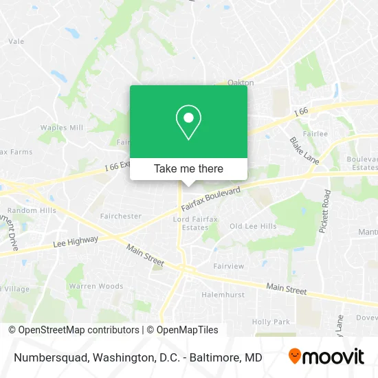
See Numbersquad, Fairfax, on the map
Public Transit to Numbersquad in Fairfax
Wondering how to get to Numbersquad in Fairfax? Moovit helps you find the best way to get to Numbersquad with step-by-step directions from the nearest public transit station.
Moovit provides free maps and live directions to help you navigate through your city. View schedules, routes, timetables, and find out how long does it take to get to Numbersquad in real time.
Looking for the nearest stop or station to Numbersquad? Check out this list of stops closest to your destination: Eaton Place at Best Western Hotel; Eaton Place at Chain Bridge Rd (Wb); Fairfax Blvd at University Dr (Wb); Fairfax Blvd at University Dr; Fairfax Bl+University Dr; Vienna Metro Station.
Bus: F60, GOLD 1, GOLD 2, GREEN 2, GREEN 1.Metro: ORANGE.
Want to see if there’s another route that gets you there at an earlier time? Moovit helps you find alternative routes or times. Get directions from and directions to Numbersquad easily from the Moovit App or Website.
We make riding to Numbersquad easy, which is why over 1.5 million users, including users in Fairfax, trust Moovit as the best app for public transit. You don’t need to download an individual bus app or train app, Moovit is your all-in-one transit app that helps you find the best bus time or train time available.
For information on prices of bus and metro, costs and ride fares to Numbersquad, please check the Moovit app.
Use the app to navigate to popular places including to the airport, hospital, stadium, grocery store, mall, coffee shop, school, college, and university.
Numbersquad Address: 10400 Eaton Pl Fairfax, VA 22030 street in Fairfax
- Re smart,
- Angel Holistic Acupuncture Clinic,
- The Law Offices of Andrew S. Kasmer, P.C.,
- Lifelong Wellness & Gynecology,
- MS Jacques,
- Imposta,
- Mortgage Center of America Rick Saunders, Loan Officer,
- Support and Management Services,
- Oasis Office,
- DTZ,
- Courtyard Restaurant,
- Best Western Fairfax,
- I-7,
- Nicholas Renner at Comparion Insurance Agency,
- Free Estimate,
- District Clean,
- Kleen R,
- RJN Group,
- Diginetplore,
- Ifixnrepair
Places Near Numbersquad (Fairfax)
- Warner Theatre, Washington,
- Marriott Marquis Washington, DC, Washington,
- PG Mall, Prince George's County,
- Georgetown, Washington,
- Westfield Montgomery Mall, Montgomery County,
- National Museum of African American History and Culture, Washington,
- National Mall, Washington,
- Washington DC VA Medical Center, Washington,
- Camden Yards, Baltimore,
- The Anthem, Washington,
- Sibley Memorial Hospital, Washington,
- Rock Creek Tennis Center, Washington,
- Basilica of the National Shrine, Washington,
- Museum Of The Bible, Washington,
- Pennsylvania Ave NW (3rd st and pennsylvania), Washington,
- Washington National Cathedral, Washington,
- Amazon Hq2, Arlington County,
- Capital One Arena, Washington,
- National Zoo, Washington,
- M&T Bank Stadium, Baltimore
How to get to popular places in Washington, D.C. - Baltimore, MD with public transit
Get around Fairfax by public transit!
Traveling around Fairfax has never been so easy. See step by step directions as you travel to any attraction, street or major public transit station. View bus and train schedules, arrival times, service alerts and detailed routes on a map, so you know exactly how to get to anywhere in Fairfax.
When traveling to any destination around Fairfax use Moovit's Live Directions with Get Off Notifications to know exactly where and how far to walk, how long to wait for your line, and how many stops are left. Moovit will alert you when it's time to get off — no need to constantly re-check whether yours is the next stop.
Wondering how to use public transit in Fairfax or how to pay for public transit in Fairfax? Moovit public transit app can help you navigate your way with public transit easily, and at minimum cost. It includes public transit fees, ticket prices, and costs. Looking for a map of Fairfax public transit lines? Moovit public transit app shows all public transit maps in Fairfax with all Bus, Train, Metro, Light Rail and Ferry routes and stops on an interactive map.
Washington, D.C. - Baltimore, MD has 5 transit type(s), including: Bus, Train, Metro, Light Rail and Ferry, operated by several transit agencies, including WMATA, Montgomery County Ride On, Fairfax Connector, TheBus, PRTC, DASH - Alexandria, Arlington Transit (ART), RTA of Central Maryland, MDOT MTA, MDOT MTA Light RailLink, MDOT MTA Commuter Bus, MDOT MTA Local Bus, FXBGO!, Virginia Railway Express (VRE) and MARC