How to get to Nvision Virtual Solutions by bus?
Click on the bus route to see step by step directions with maps, line arrival times and updated time schedules.
From Quarterdeck, Arlington County
99 minFrom Old Town Alexandria, Alexandria
38 minFrom Pentagon Library and Conference Center, Arlington County
61 minFrom Quarterdeck Restaurant, Arlington County
98 minFrom Mosaic District, Fairfax County
66 minFrom U.S. Department of State SA-28, Fairfax County
73 minFrom FSI, Arlington County
70 minFrom Inova Mount Vernon Hospital, Fairfax County
71 minFrom Joint Base Myer – Henderson Hall (JBMHH) | Fort Myer area, Arlington County
69 minFrom Arlington, VA, Arlington County
86 min
How to get to Nvision Virtual Solutions by metro?
Click on the metro route to see step by step directions with maps, line arrival times and updated time schedules.
Bus stops near Nvision Virtual Solutions in Alexandria
Metro station near Nvision Virtual Solutions in Alexandria
- Van Dorn Street Metro Station, 11 min walk,VIEW
Bus lines to Nvision Virtual Solutions in Alexandria
What are the closest stations to Nvision Virtual Solutions?
The closest stations to Nvision Virtual Solutions are:
- Yoakum Pkwy+Cascade at Landmark Apt is 65 yards away, 2 min walk.
- Cascade at Landmark is 72 yards away, 2 min walk.
- Terminal;Stevenson Av & Whiting St is 315 yards away, 5 min walk.
- Van Dorn Street Metro Station is 909 yards away, 11 min walk.
Which bus lines stop near Nvision Virtual Solutions?
These bus lines stop near Nvision Virtual Solutions: 30, 322, 35.
Which metro line stops near Nvision Virtual Solutions?
BLUE (Franconia-Springfield)
What’s the nearest metro station to Nvision Virtual Solutions in Alexandria?
The nearest metro station to Nvision Virtual Solutions in Alexandria is Van Dorn Street Metro Station. It’s a 11 min walk away.
What’s the nearest bus station to Nvision Virtual Solutions in Alexandria?
The nearest bus stations to Nvision Virtual Solutions in Alexandria are Yoakum Pkwy+Cascade at Landmark Apt and Cascade at Landmark. The closest one is a 2 min walk away.
What time is the first metro to Nvision Virtual Solutions in Alexandria?
The BLUE is the first metro that goes to Nvision Virtual Solutions in Alexandria. It stops nearby at 5:05 AM.
What time is the last metro to Nvision Virtual Solutions in Alexandria?
The BLUE is the last metro that goes to Nvision Virtual Solutions in Alexandria. It stops nearby at 12:39 AM.
What time is the first bus to Nvision Virtual Solutions in Alexandria?
The 35 is the first bus that goes to Nvision Virtual Solutions in Alexandria. It stops nearby at 4:28 AM.
What time is the last bus to Nvision Virtual Solutions in Alexandria?
The 35 is the last bus that goes to Nvision Virtual Solutions in Alexandria. It stops nearby at 2:56 AM.
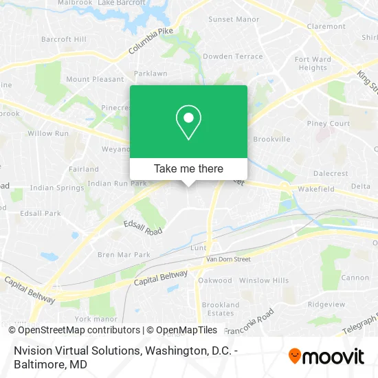
See Nvision Virtual Solutions, Alexandria, on the map
Public Transit to Nvision Virtual Solutions in Alexandria
Wondering how to get to Nvision Virtual Solutions in Alexandria? Moovit helps you find the best way to get to Nvision Virtual Solutions with step-by-step directions from the nearest public transit station.
Moovit provides free maps and live directions to help you navigate through your city. View schedules, routes, timetables, and find out how long does it take to get to Nvision Virtual Solutions in real time.
Looking for the nearest stop or station to Nvision Virtual Solutions? Check out this list of stops closest to your destination: Yoakum Pkwy+Cascade at Landmark Apt; Cascade at Landmark; Terminal;Stevenson Av & Whiting St; Van Dorn Street Metro Station.
Bus: 30, 322, 35, A28.Metro: BLUE.
Want to see if there’s another route that gets you there at an earlier time? Moovit helps you find alternative routes or times. Get directions from and directions to Nvision Virtual Solutions easily from the Moovit App or Website.
We make riding to Nvision Virtual Solutions easy, which is why over 1.5 million users, including users in Alexandria, trust Moovit as the best app for public transit. You don’t need to download an individual bus app or train app, Moovit is your all-in-one transit app that helps you find the best bus time or train time available.
For information on prices of bus and metro, costs and ride fares to Nvision Virtual Solutions, please check the Moovit app.
Use the app to navigate to popular places including to the airport, hospital, stadium, grocery store, mall, coffee shop, school, college, and university.
Nvision Virtual Solutions Address: 260 Yoakum Pkwy Alexandria, VA 22304 street in Alexandria
- Gym at the Strand,
- Im Taxi,
- Yoakum Parkway,
- Arrive Alexandria Luxury Apartments,
- C & A Soy Candles,
- Cascade at Landmark Apartments,
- 205,
- Jobin Realty,
- Yfg Structural Engineering,
- Tracy J Solutions,
- Dr Hanna Schmittat ND Lac,
- UPS,
- GLS Tech Electric,
- Margaret Luckey,
- Tia Hair Boutique,
- Insurance Coverage Auto Glass Glass Auto,
- Apostle Dr Emmanuel O Lamptey Worldwide Ministries,
- 300 S Whiting St,
- Suite D Alexandria VA,
- Dr. Goldberg & Associates
Places Near Nvision Virtual Solutions (Alexandria)
- PG Mall, Prince George's County,
- Camden Yards, Baltimore,
- National Zoo, Washington,
- Rock Creek Tennis Center, Washington,
- Washington National Cathedral, Washington,
- Pennsylvania Ave NW (3rd st and pennsylvania), Washington,
- Museum Of The Bible, Washington,
- The Anthem, Washington,
- Washington DC VA Medical Center, Washington,
- M&T Bank Stadium, Baltimore,
- Georgetown, Washington,
- Capital One Arena, Washington,
- Warner Theatre, Washington,
- Amazon Hq2, Arlington County,
- National Museum of African American History and Culture, Washington,
- Sibley Memorial Hospital, Washington,
- Marriott Marquis Washington, DC, Washington,
- Basilica of the National Shrine, Washington,
- Westfield Montgomery Mall, Montgomery County,
- National Mall, Washington
How to get to popular places in Washington, D.C. - Baltimore, MD with public transit
Get around Alexandria by public transit!
Traveling around Alexandria has never been so easy. See step by step directions as you travel to any attraction, street or major public transit station. View bus and train schedules, arrival times, service alerts and detailed routes on a map, so you know exactly how to get to anywhere in Alexandria.
When traveling to any destination around Alexandria use Moovit's Live Directions with Get Off Notifications to know exactly where and how far to walk, how long to wait for your line, and how many stops are left. Moovit will alert you when it's time to get off — no need to constantly re-check whether yours is the next stop.
Wondering how to use public transit in Alexandria or how to pay for public transit in Alexandria? Moovit public transit app can help you navigate your way with public transit easily, and at minimum cost. It includes public transit fees, ticket prices, and costs. Looking for a map of Alexandria public transit lines? Moovit public transit app shows all public transit maps in Alexandria with all Bus, Train, Metro, Light Rail and Ferry routes and stops on an interactive map.
Washington, D.C. - Baltimore, MD has 5 transit type(s), including: Bus, Train, Metro, Light Rail and Ferry, operated by several transit agencies, including WMATA, Montgomery County Ride On, Fairfax Connector, TheBus, PRTC, DASH - Alexandria, Arlington Transit (ART), RTA of Central Maryland, MDOT MTA, MDOT MTA Light RailLink, MDOT MTA Commuter Bus, MDOT MTA Local Bus, FXBGO!, Virginia Railway Express (VRE) and MARC