Nybroplan station - Sunday schedule
| Line | Direction | Time |
|---|---|---|
| 80 | Ropsten | 7:00 AM |
| 80 | Nybroplan | 7:52 AM |
| 80 | Ropsten | 8:00 AM |
| 80 | Ropsten | 8:30 AM |
| 80 | Nybroplan | 8:52 AM |
| 80 | Ropsten | 9:00 AM |
| 80X | Nacka Strand | 9:00 AM |
| 80 | Nacka Strand | 9:00 AM |
| 80 | Nybroplan | 9:22 AM |
| 80X | Nacka Strand | 9:25 AM |
| 80 | Ropsten | 9:30 AM |
| 80 | Nacka Strand | 9:30 AM |
| 80X | Nacka Strand | 9:35 AM |
| 80 | Nybroplan | 9:55 AM |
| 80X | Nacka Strand | 9:55 AM |
| 80 | Ropsten | 10:00 AM |
| 80 | Nacka Strand | 10:00 AM |
| 80 | Nybroplan | 10:10 AM |
| 80X | Nacka Strand | 10:10 AM |
| 80 | Nybroplan | 10:25 AM |
| 80 | Ropsten | 10:30 AM |
| 80 | Nacka Strand | 10:30 AM |
| 80X | Nacka Strand | 10:35 AM |
| 80 | Nybroplan | 10:40 AM |
| 80 | Nybroplan | 10:55 AM |
Directions to Nybroplan station (Stockholm) with public transit
The following transit lines have routes that pass near Nybroplan
 Bus: 1, 516, 57, 608, 69.
- Train: PENDELTÅG, STOCKHOLM ÖSTRA STATION - NÄSBYPARK STATION.
- Metro: 10, 11, 13, 14.
- Ferry: 4, STOCKHOLM NYBROKAJEN - HENRIKSDAL BRYGGA, 80, 80X.
How to get to Nybroplan station by bus?
Click on the bus route to see step by step directions with maps, line arrival times and updated time schedules.
How to get to Nybroplan station by train?
Click on the train route to see step by step directions with maps, line arrival times and updated time schedules.
How to get to Nybroplan station by metro?
Click on the metro route to see step by step directions with maps, line arrival times and updated time schedules.
Bus stops near Nybroplan stop in Stockholm
- Nybroplan, 2 min walk,
- Stockholm Nybroplan, 2 min walk,
- Stureplan, 5 min walk,
- Stockholm Kungsträdgården, 5 min walk,
- Kungsträdgården, 6 min walk,
- Stockholm Karl Xii:S Torg, 6 min walk,
Ferry stations near Nybroplan station in Stockholm
- Stockholm Nybrokajen, 2 min walk,
Metro stations near Nybroplan station in Stockholm
- Kungsträdgården T-Bana, 5 min walk,
- Kungsträdgården, 5 min walk,
Bus lines to Nybroplan station in Stockholm
- 69, Djurgårdsbrunn,
- 76, Ljusterögatan,
- 7, Waldemarsudde,
- 7, T-Centralen Spårv,
- 57, Motalavägen,
- 69, Stockholm C Klarabergsviadukte,
- 76, Stockholm Frihamnen,
- 2, Barnängen,
- 96, Odenplan,
- 2, Stockholm Barnängen - Ynglingagatan,
- 96, Stockholm Sickla udde - Odenplan T-bana,
- 191, Norsborg T-bana - Stockholm C Klarabergsviadukte,
- 192, Stockholm C Klarabergsviadukte - Fruängen T-bana,
- 193, Farsta Strand T-bana - Stockholm C Klarabergsviadukte,
- 194, Bagarmossen T-bana - Stockholm C Klarabergsviadukte,
- 195, Stockholm C Klarabergsviadukte - Hagsätra,
- 491, Stockholm C Klarabergsviadukte - Nyfors,
- 191, Norsborg - Centralen,
- 192, Fruängen - Centralen,
- 193, Gullmarsplan - Farsta strand,
What are the closest stations to Nybroplan?
The closest stations to Nybroplan are:
- Nybroplan is 81 meters away, 2 min walk.
- Stockholm Nybrokajen is 82 meters away, 2 min walk.
- Stockholm Nybroplan is 105 meters away, 2 min walk.
- Stureplan is 298 meters away, 5 min walk.
- Stockholm Kungsträdgården is 347 meters away, 5 min walk.
- Kungsträdgården T-Bana is 365 meters away, 5 min walk.
- Kungsträdgården is 374 meters away, 5 min walk.
- Stockholm Karl Xii:S Torg is 409 meters away, 6 min walk.
Which bus lines stop near Nybroplan?
These bus lines stop near Nybroplan: 1, 516, 57, 608, 69, 690, 76.
Which train lines stop near Nybroplan?
These train lines stop near Nybroplan: PENDELTÅG, STOCKHOLM ÖSTRA STATION - NÄSBYPARK STATION.
Which metro lines stop near Nybroplan?
These metro lines stop near Nybroplan: 10, 11, 13, 14.
Which ferry line stops near Nybroplan?
4 (Strömkajen)
What’s the nearest metro station to Nybroplan in Stockholm?
The nearest metro stations to Nybroplan in Stockholm are Kungsträdgården T-Bana and Kungsträdgården. The closest one is a 5 min walk away.
What’s the nearest bus station to Nybroplan in Stockholm?
The nearest bus stations to Nybroplan in Stockholm are Nybroplan and Stockholm Nybroplan. The closest one is a 2 min walk away.
What’s the nearest ferry station to Nybroplan in Stockholm?
The nearest ferry station to Nybroplan in Stockholm is Stockholm Nybrokajen. It’s a 2 min walk away.
What time is the first light rail to Nybroplan in Stockholm?
The 7 is the first light rail that goes to Nybroplan in Stockholm. It stops nearby at 5:25 AM.
What time is the last light rail to Nybroplan in Stockholm?
The 7 is the last light rail that goes to Nybroplan in Stockholm. It stops nearby at 1:34 AM.
What time is the first metro to Nybroplan in Stockholm?
The 11 is the first metro that goes to Nybroplan in Stockholm. It stops nearby at 5:04 AM.
What time is the last metro to Nybroplan in Stockholm?
The 11 is the last metro that goes to Nybroplan in Stockholm. It stops nearby at 12:58 AM.
What time is the first bus to Nybroplan in Stockholm?
The 491 is the first bus that goes to Nybroplan in Stockholm. It stops nearby at 3:02 AM.
What time is the last bus to Nybroplan in Stockholm?
The 96 is the last bus that goes to Nybroplan in Stockholm. It stops nearby at 3:16 AM.
What time is the first ferry to Nybroplan in Stockholm?
The 80 is the first ferry that goes to Nybroplan in Stockholm. It stops nearby at 5:30 AM.
What time is the last ferry to Nybroplan in Stockholm?
The 80 is the last ferry that goes to Nybroplan in Stockholm. It stops nearby at 11:47 PM.
See Nybroplan station, Stockholm, on the map
Public transit to Nybroplan station in Stockholm
Looking for directions to Nybroplan in Stockholm, Sweden?
Download the Moovit App to find the current schedule and step-by-step directions for Bus, Metro, Light Rail, Train or Ferry routes that pass through Nybroplan.
Looking for the nearest stops closest to Nybroplan ? Check out this list of closest stops to your destination: Nybroplan; Stockholm Nybrokajen; Stockholm Nybroplan; Stureplan; Stockholm Kungsträdgården; Kungsträdgården T-Bana; Kungsträdgården; Stockholm Karl Xii:S Torg.
Bus: 1, 516, 57, 608, 69, 690, 76, 7.Train: PENDELTÅG, STOCKHOLM ÖSTRA STATION - NÄSBYPARK STATION.Metro: 10, 11, 13, 14.Ferry: 4, STOCKHOLM NYBROKAJEN - HENRIKSDAL BRYGGA, 80, 80X.
We make riding on public transit to Nybroplan easy, which is why over 1.5 million users, including users in Stockholm trust Moovit as the best app for public transit.
Use the app to navigate to popular places including to the airport, hospital, stadium, grocery store, mall, coffee shop, school, college, and university.
The first line to this station is 80, at 7:00 AM, and the last line is 80 at 11:52 PM.
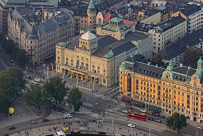
Nybrohamnen 2, Stockholm, Sweden
This station serves SL’s lines
Popular routes from Nybroplan station, Stockholm
- Nybroplan,
- Stockholm Nybroplan,
- Stureplan,
- Stockholm Kungsträdgården,
- Kungsträdgården,
- Stockholm Karl Xii:S Torg
Bus stops near Nybroplan stop
- Stockholm Nybrokajen
Ferry station near Nybroplan station
- Kungsträdgården T-Bana,
- Kungsträdgården
Metro stations near Nybroplan station
- Klippgatan,
- Gävle Skolgången,
- Stora Ekholmen,
- Gävle Gasklockorna,
- Strömkajen,
- Långgarn,
- Lidingövallen,
- Karlsborg,
- Karby Gård,
- Gunsta,
- Ramnäs,
- Stentorp,
- Folkesta Köpcentrum,
- Kämpetorpsskolan,
- Ambassaderna,
- Havdhem,
- Universitetet,
- Gröndal,
- Spånga Station,
- Uppsala Business Park Norra
Popular public transit stations in Stockholm
Get around Stockholm by public transit!
Traveling around Stockholm has never been so easy. See step by step directions as you travel to any attraction, street or major public transit station. View bus and train schedules, arrival times, service alerts and detailed routes on a map, so you know exactly how to get to anywhere in Stockholm.
When traveling to any destination around Stockholm use Moovit's Live Directions with Get Off Notifications to know exactly where and how far to walk, how long to wait for your line, and how many stops are left. Moovit will alert you when it's time to get off — no need to constantly re-check whether yours is the next stop.
Wondering how to use public transit in Stockholm or how to pay for public transit in Stockholm? Moovit public transit app can help you navigate your way with public transit easily, and at minimum cost. It includes public transit fees, ticket prices, and costs. Looking for a map of Stockholm public transit lines? Moovit public transit app shows all public transit maps in Stockholm with all Bus, Train, Metro, Light Rail, Ferry and Cable Car routes and stops on an interactive map.
Stockholm has 6 transit type(s), including: Bus, Train, Metro, Light Rail, Ferry and Cable Car, operated by several transit agencies, including SL, SL Rail, UL, Flygbussarna, Storstockholms Lokaltrafik AB, Sörmlandstrafiken, Region Gotland, VL, Vy Bus4You, SJ AB, Flixbus, Länstrafiken Örebro, Mälardalstrafik, X-trafik and Waxholmsbolaget Ångfartygs AB