How to get to Nyc Check Express by bus?
Click on the bus route to see step by step directions with maps, line arrival times and updated time schedules.
From 92nd Street Y, Manhattan
76 minFrom 68th Street-Hunter College, Manhattan
54 minFrom 300 E 66th street, Manhattan
51 minFrom The Jewish Museum, Manhattan
60 minFrom Grand Central Terminal, Manhattan
32 minFrom Apple Fifth Avenue, Manhattan
34 minFrom LaGuardia High School, Manhattan
54 minFrom Walmart Supercenter, Secaucus
89 minFrom Walmart, Secaucus
89 min
How to get to Nyc Check Express by train?
Click on the train route to see step by step directions with maps, line arrival times and updated time schedules.
How to get to Nyc Check Express by subway?
Click on the subway route to see step by step directions with maps, line arrival times and updated time schedules.
Bus stops near Nyc Check Express in Manhattan
- Broadway/Morris St, 2 min walk,VIEW
- The Battery, 3 min walk,VIEW
- State St/Battery Pl, 3 min walk,VIEW
- State St/Bridge St, 3 min walk,VIEW
- State St at Bridge St, 4 min walk,VIEW
- Broadway at Exchange Pl#, 5 min walk,VIEW
- New York - Broadway @ Exchange Pl (Northbound), 5 min walk,VIEW
- Broadway/Exchange Alley, 5 min walk,VIEW
- Broadway Between Exc. Place & Morris St, 5 min walk,VIEW
Subway stations near Nyc Check Express in Manhattan
Bus lines to Nyc Check Express in Manhattan
- BXM18, Downtown Wall St Via 5 Av Via Broadway,VIEW
- SIM1, Eltngvlle Trans Ctr Via Hylan Via Rich,VIEW
- SIM1C, Eltngvlle Trans Ctr Via Hylan Via Rich,VIEW
- SIM4, Annadale Via Richmond Av,VIEW
- SIM4C, Huguenot Via Richmond Av Via Arthur Kill,VIEW
- SIM3C, Pt Rchmnd Via Narrows Rd N Via Watchogue,VIEW
- SIM33C, Mariners Harbor Via N Gannon Av,VIEW
- M55, South Ferry,VIEW
- 120, New York Lower Manhattan,VIEW
- BM1, Mill Basin - Downtown/Midtown,VIEW
- BM2, Canarsie/Spring Creek - Downtown/Midtown,VIEW
- BM3, Sheepshead Bay - Downtown/Midtown,VIEW
- BM4, Gerritsen Beach - Downtown/Midtown,VIEW
- QM7, Fresh Meadows - Downtown Express,VIEW
- QM8, Glen Oaks - Downtown Express,VIEW
- QM11, Forest Hills - Downtown Express,VIEW
- QM25, Glendale - Downtown Express,VIEW
- QM65, Laurelton-Rochdale-Lower Manhattan,VIEW
- M20, Lincoln Center 66 St Via 8 Av,VIEW
- SIM5, Eltvlle Trans Ctr Via F Cap Bl Via Gfrds,VIEW
What are the closest stations to Nyc Check Express?
The closest stations to Nyc Check Express are:
- Broadway/Morris St is 71 yards away, 2 min walk.
- Broad St is 78 yards away, 2 min walk.
- Bowling Green is 103 yards away, 2 min walk.
- The Battery is 161 yards away, 3 min walk.
- State St/Battery Pl is 194 yards away, 3 min walk.
- State St/Bridge St is 219 yards away, 3 min walk.
- Whitehall St-South Ferry is 229 yards away, 3 min walk.
- State St at Bridge St is 322 yards away, 4 min walk.
- Broadway at Exchange Pl# is 325 yards away, 5 min walk.
- New York - Broadway @ Exchange Pl (Northbound) is 332 yards away, 5 min walk.
- Broadway/Exchange Alley is 348 yards away, 5 min walk.
- Broadway Between Exc. Place & Morris St is 372 yards away, 5 min walk.
Which bus lines stop near Nyc Check Express?
These bus lines stop near Nyc Check Express: BM2, BXM18, M15-SBS, M55.
Which train lines stop near Nyc Check Express?
These train lines stop near Nyc Check Express: GRE, YEL.
Which subway lines stop near Nyc Check Express?
These subway lines stop near Nyc Check Express: 1, 3, 4, 5.
What’s the nearest subway station to Nyc Check Express in Manhattan?
The nearest subway stations to Nyc Check Express in Manhattan are Broad St and Bowling Green. The closest one is a 2 min walk away.
What’s the nearest bus station to Nyc Check Express in Manhattan?
The nearest bus station to Nyc Check Express in Manhattan is Broadway/Morris St. It’s a 2 min walk away.
What time is the first subway to Nyc Check Express in Manhattan?
The 4 is the first subway that goes to Nyc Check Express in Manhattan. It stops nearby at 3:00 AM.
What time is the last subway to Nyc Check Express in Manhattan?
The 4 is the last subway that goes to Nyc Check Express in Manhattan. It stops nearby at 3:57 AM.
What time is the first bus to Nyc Check Express in Manhattan?
The SIM1C is the first bus that goes to Nyc Check Express in Manhattan. It stops nearby at 3:57 AM.
What time is the last bus to Nyc Check Express in Manhattan?
The SIM1C is the last bus that goes to Nyc Check Express in Manhattan. It stops nearby at 2:57 AM.
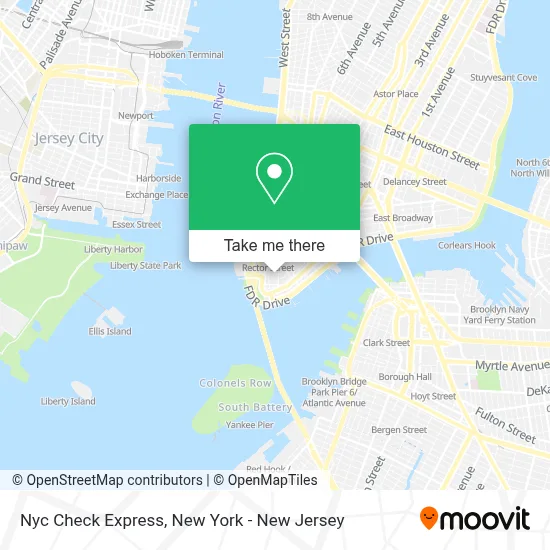
See Nyc Check Express, Manhattan, on the map
Public Transit to Nyc Check Express in Manhattan
Wondering how to get to Nyc Check Express in Manhattan? Moovit helps you find the best way to get to Nyc Check Express with step-by-step directions from the nearest public transit station.
Moovit provides free maps and live directions to help you navigate through your city. View schedules, routes, timetables, and find out how long does it take to get to Nyc Check Express in real time.
Looking for the nearest stop or station to Nyc Check Express? Check out this list of stops closest to your destination: Broadway/Morris St; Broad St; Bowling Green; The Battery; State St/Battery Pl; State St/Bridge St; Whitehall St-South Ferry; State St at Bridge St; Broadway at Exchange Pl#; New York - Broadway @ Exchange Pl (Northbound); Broadway/Exchange Alley; Broadway Between Exc. Place & Morris St.
Bus: BM2, BXM18, M15-SBS, M55, SIM1, SIM1C, SIM4, SIM4C, SIM3C, SIM33C.Train: GRE, YEL.Subway: 1, 3, 4, 5, J, M, Z, N, Q, R, W.
Want to see if there’s another route that gets you there at an earlier time? Moovit helps you find alternative routes or times. Get directions from and directions to Nyc Check Express easily from the Moovit App or Website.
We make riding to Nyc Check Express easy, which is why over 1.5 million users, including users in Manhattan, trust Moovit as the best app for public transit. You don’t need to download an individual bus app or train app, Moovit is your all-in-one transit app that helps you find the best bus time or train time available.
For information on prices of subway, bus and train, costs and ride fares to Nyc Check Express, please check the Moovit app.
Use the app to navigate to popular places including to the airport, hospital, stadium, grocery store, mall, coffee shop, school, college, and university.
Nyc Check Express Address: 24 Beaver St Frnt B street in Manhattan
- Hanki,
- Koutsomitis Architects Pc,
- Stavros S. Skenderis,
- Olan Mills Portrait Studio,
- Madame Koo (Qipao/Cheongsam),
- Beaver Street Pizza,
- NY Lottery Center,
- Donna Este-Green New York State Unified Court System,
- Daniel Patrick Greene Governor's Office Of Storm Recovery,
- Appointment Processing Unit,
- DHCR Executive Offices,
- Self Advocacy Association,
- John A. Maugham,
- New York Lottery,
- Dhcr New York State Homes and Community Renewal Lower Manhattan Borough Rent Office,
- Nyc Probation,
- Selfup Cooking Classes,
- 16 Beaver Studio,
- Selfup,
- Tim Petersen Studio
Places Near Nyc Check Express (Manhattan)
- 376 Hudson Street, Manhattan,
- Katz's Deli, Manhattan,
- San Gennaro Feast, Manhattan,
- 1 Police Plaza, Manhattan,
- 66 John Street, Manhattan,
- 26 Federal Plaza, Manhattan,
- qqqq, Manhattan,
- Rockefeller Center, Manhattan,
- Chinatown, Manhattan,
- 911 Memorial, Manhattan,
- Hudson Yards, Manhattan,
- 3 Stone St, Manhattan,
- SoHo, Manhattan,
- Times Square, Manhattan,
- Queens Center Mall, Queens,
- 111 Centre New York City Supreme Court, Manhattan,
- Pier 83, Manhattan,
- Bellevue Hospital, Manhattan,
- Mountainside Hospital, Glen Ridge,
- Wall Street, Manhattan
How to get to popular places in New York - New Jersey with public transit
Get around Manhattan by public transit!
Traveling around Manhattan has never been so easy. See step by step directions as you travel to any attraction, street or major public transit station. View bus and train schedules, arrival times, service alerts and detailed routes on a map, so you know exactly how to get to anywhere in Manhattan.
When traveling to any destination around Manhattan use Moovit's Live Directions with Get Off Notifications to know exactly where and how far to walk, how long to wait for your line, and how many stops are left. Moovit will alert you when it's time to get off — no need to constantly re-check whether yours is the next stop.
Wondering how to use public transit in Manhattan or how to pay for public transit in Manhattan? Moovit public transit app can help you navigate your way with public transit easily, and at minimum cost. It includes public transit fees, ticket prices, and costs. Looking for a map of Manhattan public transit lines? Moovit public transit app shows all public transit maps in Manhattan with all Bus, Train, Subway, Light Rail, Ferry and Cable Car routes and stops on an interactive map.
New York - New Jersey has 6 transit type(s), including: Bus, Train, Subway, Light Rail, Ferry and Cable Car, operated by several transit agencies, including MTA Subway, Metro-North Railroad, LIRR, PATH, MTA New York City Transit - Express routes, MTA Bus, NJ Transit, NYC Ferry, NICE bus, Bee-Line Bus, NJ Transit Rail, Norwalk Transit District, Hartford Line, River Valley Transit and HART