How to get to Nygot Reputation by bus?
Click on the bus route to see step by step directions with maps, line arrival times and updated time schedules.
From Upper West Side, Manhattan
95 minFrom 168-46 91st Ave, Queens
62 minFrom Bullpen Entrance Citi Field, Queens
75 minFrom DMV Jamaica Nys, Queens
62 minFrom DMV Jamaica Office, Queens
62 minFrom Ac Hotel Nyc Downtown, Manhattan
75 minFrom 23rd Street & 6th Ave., Manhattan
87 minFrom Mount Sinai West, Manhattan
81 minFrom Pier 79, W 39th St, Manhattan
84 minFrom kew gardens assembly room, 120-55 queens Blvd, Queens
54 min
How to get to Nygot Reputation by subway?
Click on the subway route to see step by step directions with maps, line arrival times and updated time schedules.
From Upper West Side, Manhattan
58 minFrom 168-46 91st Ave, Queens
83 minFrom Bullpen Entrance Citi Field, Queens
72 minFrom DMV Jamaica Nys, Queens
83 minFrom DMV Jamaica Office, Queens
83 minFrom Ac Hotel Nyc Downtown, Manhattan
50 minFrom 23rd Street & 6th Ave., Manhattan
62 minFrom Mount Sinai West, Manhattan
55 minFrom Pier 79, W 39th St, Manhattan
62 minFrom kew gardens assembly room, 120-55 queens Blvd, Queens
75 min
Bus stops near Nygot Reputation in Queens
Subway stations near Nygot Reputation in Queens
Bus lines to Nygot Reputation in Queens
What are the closest stations to Nygot Reputation?
The closest stations to Nygot Reputation are:
- Woodward Av/Stanhope St is 180 yards away, 3 min walk.
- Metropolitan Av/Amory Ct is 199 yards away, 3 min walk.
- Forest Av is 224 yards away, 3 min walk.
- Flushing Av/Metropolitan Av is 394 yards away, 5 min walk.
- Metropolitan Av/Forest Av is 540 yards away, 7 min walk.
- Dekalb Av is 949 yards away, 12 min walk.
Which bus lines stop near Nygot Reputation?
These bus lines stop near Nygot Reputation: Q14, Q39, Q54.
Which subway lines stop near Nygot Reputation?
These subway lines stop near Nygot Reputation: F, L.
What’s the nearest subway station to Nygot Reputation in Queens?
The nearest subway station to Nygot Reputation in Queens is Forest Av. It’s a 3 min walk away.
What’s the nearest bus station to Nygot Reputation in Queens?
The nearest bus stations to Nygot Reputation in Queens are Woodward Av/Stanhope St and Metropolitan Av/Amory Ct. The closest one is a 3 min walk away.
What time is the first subway to Nygot Reputation in Queens?
The L is the first subway that goes to Nygot Reputation in Queens. It stops nearby at 3:01 AM.
What time is the last subway to Nygot Reputation in Queens?
The L is the last subway that goes to Nygot Reputation in Queens. It stops nearby at 3:10 AM.
What time is the first bus to Nygot Reputation in Queens?
The Q39 is the first bus that goes to Nygot Reputation in Queens. It stops nearby at 3:07 AM.
What time is the last bus to Nygot Reputation in Queens?
The Q54 is the last bus that goes to Nygot Reputation in Queens. It stops nearby at 3:23 AM.
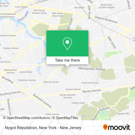
See Nygot Reputation, Queens, on the map
Public Transit to Nygot Reputation in Queens
Wondering how to get to Nygot Reputation in Queens? Moovit helps you find the best way to get to Nygot Reputation with step-by-step directions from the nearest public transit station.
Moovit provides free maps and live directions to help you navigate through your city. View schedules, routes, timetables, and find out how long does it take to get to Nygot Reputation in real time.
Looking for the nearest stop or station to Nygot Reputation? Check out this list of stops closest to your destination: Woodward Av/Stanhope St; Metropolitan Av/Amory Ct; Forest Av; Flushing Av/Metropolitan Av; Metropolitan Av/Forest Av; Dekalb Av.
Bus: Q14, Q39, Q54, B38, B57.Subway: F, L, M.
Want to see if there’s another route that gets you there at an earlier time? Moovit helps you find alternative routes or times. Get directions from and directions to Nygot Reputation easily from the Moovit App or Website.
We make riding to Nygot Reputation easy, which is why over 1.5 million users, including users in Queens, trust Moovit as the best app for public transit. You don’t need to download an individual bus app or train app, Moovit is your all-in-one transit app that helps you find the best bus time or train time available.
For information on prices of bus and subway, costs and ride fares to Nygot Reputation, please check the Moovit app.
Use the app to navigate to popular places including to the airport, hospital, stadium, grocery store, mall, coffee shop, school, college, and university.
Nygot Reputation Address: 53-46 Metropolitan Ave street in Queens
- Jaś I Małgosia Mali Odkrywcy,
- Blade Fencing Equipment,
- The Space Next Door,
- Fold New York,
- Digideo Llc,
- Brooklyn Sauce,
- Sapore Di La Italia,
- La Parrillada Colombiana,
- Ridgewood,
- Metropolitan Deli,
- Unux Clothing and Accessories & Home Decor Item's & Wirelesselectronics,
- MTA Q54/B38 Bus Stop,
- Grover Cleveland High School (Grover Cleveland Park),
- Grover Cleveland Park,
- Premium Dental Laboratory,
- Premium Dental Laboratory,
- 21-27 Himrod Street,
- Grover Cleveland High School,
- A & E Brothers Ltd.,
- P.S.290q A.C.E. Academy For Scholars at the Geraldine Ferraro Campus
Places Near Nygot Reputation (Queens)
- Bellevue Hospital, Manhattan,
- SoHo, Manhattan,
- 376 Hudson Street, Manhattan,
- Times Square, Manhattan,
- Wall Street, Manhattan,
- Rockefeller Center, Manhattan,
- 3 Stone St, Manhattan,
- Pier 83, Manhattan,
- Mountainside Hospital, Glen Ridge,
- Chinatown, Manhattan,
- 66 John Street, Manhattan,
- Queens Center Mall, Queens,
- 1 Police Plaza, Manhattan,
- 111 Centre New York City Supreme Court, Manhattan,
- qqqq, Manhattan,
- San Gennaro Feast, Manhattan,
- 911 Memorial, Manhattan,
- Hudson Yards, Manhattan,
- Katz's Deli, Manhattan,
- 26 Federal Plaza, Manhattan
How to get to popular places in New York - New Jersey with public transit
Get around Queens by public transit!
Traveling around Queens has never been so easy. See step by step directions as you travel to any attraction, street or major public transit station. View bus and train schedules, arrival times, service alerts and detailed routes on a map, so you know exactly how to get to anywhere in Queens.
When traveling to any destination around Queens use Moovit's Live Directions with Get Off Notifications to know exactly where and how far to walk, how long to wait for your line, and how many stops are left. Moovit will alert you when it's time to get off — no need to constantly re-check whether yours is the next stop.
Wondering how to use public transit in Queens or how to pay for public transit in Queens? Moovit public transit app can help you navigate your way with public transit easily, and at minimum cost. It includes public transit fees, ticket prices, and costs. Looking for a map of Queens public transit lines? Moovit public transit app shows all public transit maps in Queens with all Bus, Train, Subway, Light Rail, Ferry and Cable Car routes and stops on an interactive map.
New York - New Jersey has 6 transit type(s), including: Bus, Train, Subway, Light Rail, Ferry and Cable Car, operated by several transit agencies, including MTA Subway, Metro-North Railroad, LIRR, PATH, MTA New York City Transit - Express routes, MTA Bus, NJ Transit, NYC Ferry, NICE bus, Bee-Line Bus, NJ Transit Rail, Norwalk Transit District, Hartford Line, River Valley Transit and HART