Directions to Nymindegab (Varde) with public transportation
The following transit lines have routes that pass near Nymindegab
 Bus: 449.
Bus stop near Nymindegab in Varde
- Nymindegab (Nørre Nebel), 4 min walk,
Bus lines to Nymindegab in Varde
- 449, Nørre Nebel,
- Nymindegab Kro,
- Lønne,
- Seawest,
- Bjerregård,
- Nørre Nebel,
- Nr. Nebel Antik & Loppefund, Bredgade 28, 6830 Nr.Nebel,
- Borkhavn Efterskole,
- Hemmet Friluftskoncert,
- Hemmet,
- Hemmet,
- Henne Stationsby,
- Sønder Vium,
- Ph Events & Mobildiskotek Powerhouse,
- Henne,
- Jazz og Rock ved Ringkøbing Fjord - Vostrup Musikhus,
- Vostrup Efterskole,
- Renderne,
- EWII,
- Lyne,
- Hestholm Fugleskjul
Places Near Nymindegab (Varde)
- Refshaleøen, København,
- Aalborg Universitetshospital, Aalborg,
- Marmorkirken, København,
- Reffen, København,
- Fisketorvet, København,
- Operaen, København,
- Dr Koncerthuset, København,
- Royal Arena, København,
- Christiania, København,
- Dampfærgevej 30, København,
- Ikea, Århus,
- Grundtvigs Kirke, København,
- Valbyparken, København,
- Rigshospitalet, København,
- Bispebjerg Hospital, København,
- Eventyrpigerne, Sorø,
- Field's, København,
- Carlsberg Byen, København,
- Seduction Girls, Rødovre,
- Nyhavn, København
How to get to popular places in Denmark with public transit
What are the closest stations to Nymindegab?
The closest stations to Nymindegab are:
- Nymindegab (Nørre Nebel) stop is 239 meters away, 4 min walk.
Which bus line stops near Nymindegab?
449 (Nymindegab)
What’s the nearest bus station to Nymindegab in Varde?
The nearest bus station to Nymindegab in Varde is Nymindegab (Nørre Nebel). It’s a 4 min walk away.
See Nymindegab, Varde, on the map
Public Transit to Nymindegab in Varde
Wondering how to get to Nymindegab in Varde? Moovit helps you find the best way to get to Nymindegab with step-by-step directions from the nearest public transit station.
Moovit provides free maps and live directions to help you navigate through your city. View schedules, routes, timetables, and find out how long does it take to get to Nymindegab in real time.
Looking for the nearest stop or station to Nymindegab? Check out this list of stops closest to your destination: Nymindegab (Nørre Nebel).
Bus: 449.
Want to see if there’s another route that gets you there at an earlier time? Moovit helps you find alternative routes or times. Get directions from and directions to Nymindegab easily from the Moovit App or Website.
We make riding to Nymindegab easy, which is why over 1.7 billion users, including users in Varde, trust Moovit as the best app for public transit. You don’t need to download an individual bus app or train app, Moovit is your all-in-one transit app that helps you find the best bus time or train time available.
For information on prices of train and bus, costs and ride fares to Nymindegab, please check the Moovit app.
Use the app to navigate to popular places including to the airport, hospital, stadium, grocery store, mall, coffee shop, school, college, and university.
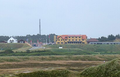
Nymindegab Address: Vesterhavsvej street in Varde
Get around Varde by public transit!
Traveling around Varde has never been so easy. See step by step directions as you travel to any attraction, street or major public transit station. View bus and train schedules, arrival times, service alerts and detailed routes on a map, so you know exactly how to get to anywhere in Varde.
When traveling to any destination around Varde use Moovit's Live Directions with Get Off Notifications to know exactly where and how far to walk, how long to wait for your line, and how many stops are left. Moovit will alert you when it's time to get off — no need to constantly re-check whether yours is the next stop.
Wondering how to use public transit in Varde or how to pay for public transit in Varde? Moovit public transit app can help you navigate your way with public transit easily, and at minimum cost. It includes public transit fees, ticket prices, and costs. Looking for a map of Varde public transit lines? Moovit public transit app shows all public transit maps in Varde with all Bus, Train, Metro, Light Rail and Ferry routes and stops on an interactive map.
Denmark has 5 transit type(s), including: Bus, Train, Metro, Light Rail and Ferry, operated by several transit agencies, including Metroselskabet, DSB S-tog, Lokaltog A/S, Midttrafik, Odense Letbane, DSB, NT, GoCollective, Skånetrafiken, Movia, FYNBUS, Sydtrafik, Bornholms Trafik, Samsø Bus and Citybus