How to get to O2 Brunoy by bus?
Click on the bus route to see step by step directions with maps, line arrival times and updated time schedules.
From Corbeil-Essonnes, Corbeil-Essonnes
92 minFrom Tigery, Tigery
121 minFrom Maison du Handball, Créteil
67 minFrom Athis-Mons, Athis-Mons
94 minFrom Centre Hospitalier Corbeil-Essonnes, Corbeil-Essonnes
130 minFrom Valenton, Valenton
81 minFrom Draveil, Draveil
78 minFrom Villeneuve-Saint-Georges, Villeneuve-Saint-Georges
94 minFrom Marques Avenue A6, Corbeil-Essonnes
115 minFrom Bonneuil-sur-Marne, Bonneuil-Sur-Marne
70 min
Bus stops near O2 Brunoy in Quincy-Sous-Senart
RER station near O2 Brunoy in Quincy-Sous-Senart
- Combs-La-Ville - Quincy, 17 min walk,VIEW
Bus lines to O2 Brunoy in Quincy-Sous-Senart
What are the closest stations to O2 Brunoy?
The closest stations to O2 Brunoy are:
- Gare de Boussy-Saint-Antoine is 108 meters away, 2 min walk.
- Bizet is 466 meters away, 7 min walk.
- Combs-La-Ville - Quincy is 1281 meters away, 17 min walk.
Which bus lines stop near O2 Brunoy?
These bus lines stop near O2 Brunoy: 3714, 4111, 4120.
Which RER line stops near O2 Brunoy?
D (Creil)
What’s the nearest bus station to O2 Brunoy in Quincy-Sous-Senart?
The nearest bus station to O2 Brunoy in Quincy-Sous-Senart is Gare de Boussy-Saint-Antoine. It’s a 2 min walk away.
What’s the nearest RER station to O2 Brunoy in Quincy-Sous-Senart?
The nearest RER station to O2 Brunoy in Quincy-Sous-Senart is Combs-La-Ville - Quincy. It’s a 17 min walk away.
What time is the first bus to O2 Brunoy in Quincy-Sous-Senart?
The N134 is the first bus that goes to O2 Brunoy in Quincy-Sous-Senart. It stops nearby at 3:07 AM.
What time is the last bus to O2 Brunoy in Quincy-Sous-Senart?
The N134 is the last bus that goes to O2 Brunoy in Quincy-Sous-Senart. It stops nearby at 3:07 AM.
What time is the first RER to O2 Brunoy in Quincy-Sous-Senart?
The D is the first RER that goes to O2 Brunoy in Quincy-Sous-Senart. It stops nearby at 4:59 AM.
What time is the last RER to O2 Brunoy in Quincy-Sous-Senart?
The D is the last RER that goes to O2 Brunoy in Quincy-Sous-Senart. It stops nearby at 1:14 AM.
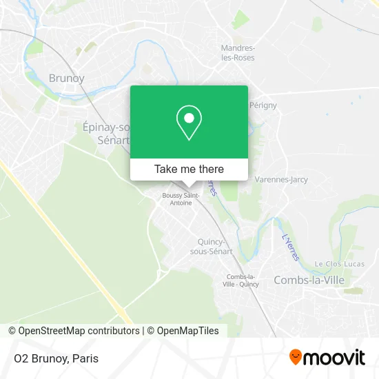
See O2 Brunoy, Quincy-Sous-Senart, on the map
Public Transit to O2 Brunoy in Quincy-Sous-Senart
Wondering how to get to O2 Brunoy in Quincy-Sous-Senart? Moovit helps you find the best way to get to O2 Brunoy with step-by-step directions from the nearest public transit station.
Moovit provides free maps and live directions to help you navigate through your city. View schedules, routes, timetables, and find out how long does it take to get to O2 Brunoy in real time.
Looking for the nearest stop or station to O2 Brunoy? Check out this list of stops closest to your destination: Gare de Boussy-Saint-Antoine; Bizet; Combs-La-Ville - Quincy.
Bus: 3714, 4111, 4120, 4133, SOIR, 4130, N134, 9101.RER: D.
Want to see if there’s another route that gets you there at an earlier time? Moovit helps you find alternative routes or times. Get directions from and directions to O2 Brunoy easily from the Moovit App or Website.
We make riding to O2 Brunoy easy, which is why over 1.5 million users, including users in Quincy-Sous-Senart, trust Moovit as the best app for public transit. You don’t need to download an individual bus app or train app, Moovit is your all-in-one transit app that helps you find the best bus time or train time available.
For information on prices of bus and RER, costs and ride fares to O2 Brunoy, please check the Moovit app.
Use the app to navigate to popular places including to the airport, hospital, stadium, grocery store, mall, coffee shop, school, college, and university.
O2 Brunoy Address: 6 Rue des 2 Communes 91480 Quincy-sous-Sénart street in Quincy-Sous-Senart
- Coallia,
- Institut Cardiovasculaire Paris,
- Orientaction,
- Akali 2M,
- Villa Val Sénart,
- Bioclinic,
- Alain Afflelou - Opticien Quincy-sous-Sénart,
- CORA P2,
- Chaussea Quincy-sous-Sénart,
- Alain Afflelou,
- CORA,
- RER Boussy-Saint-Antoine [D],
- Amazon Locker-Come,
- Rmb Europe,
- Voie 1,
- CORA Cafétéria Produits Frais,
- Centre Commercial Cora,
- Au Canard Laque,
- ALDI Nord,
- Carglass
Places Near O2 Brunoy (Quincy-Sous-Senart)
- Hôpital Necker, Paris,
- Institut Curie, Paris,
- Hôpital Beaujon, Clichy,
- Fondation Louis Vuitton, Paris,
- Créteil Soleil, Creteil,
- Atelier Des Lumieres, Paris,
- Hôpital de la Pitié-Salpêtrière, Paris,
- Hôpital Saint-Joseph, Paris,
- Théâtre Mogador, Paris,
- Hôpital Cochin, Paris,
- Centre Hospitalier des 15/20, Paris,
- Hôpital Henri Mondor, Creteil,
- Hopital Lariboisière, Paris,
- Gare Routière Flixbus, Paris,
- Galeries Lafayette, Paris,
- 29 Rue Manin, Paris,
- Marché Saint-Pierre, Paris,
- Hôpital Pitié Salpêtrière, Paris,
- Galeries Lafayette Haussmann, Paris,
- Hopital Foch, Suresnes
How to get to popular places in Paris with public transit
Get around Quincy-Sous-Senart by public transit!
Traveling around Quincy-Sous-Senart has never been so easy. See step by step directions as you travel to any attraction, street or major public transit station. View bus and train schedules, arrival times, service alerts and detailed routes on a map, so you know exactly how to get to anywhere in Quincy-Sous-Senart.
When traveling to any destination around Quincy-Sous-Senart use Moovit's Live Directions with Get Off Notifications to know exactly where and how far to walk, how long to wait for your line, and how many stops are left. Moovit will alert you when it's time to get off — no need to constantly re-check whether yours is the next stop.
Wondering how to use public transit in Quincy-Sous-Senart or how to pay for public transit in Quincy-Sous-Senart? Moovit public transit app can help you navigate your way with public transit easily, and at minimum cost. It includes public transit fees, ticket prices, and costs. Looking for a map of Quincy-Sous-Senart public transit lines? Moovit public transit app shows all public transit maps in Quincy-Sous-Senart with all Bus, Train, Metro, Light Rail, RER, Funicular and Gondola routes and stops on an interactive map.
Paris has 7 transit type(s), including: Bus, Train, Metro, Light Rail, RER, Funicular and Gondola, operated by several transit agencies, including RATP, RER, RER Bus de remplacement, Train, Train Bus de remplacement, Tramway Bus de remplacement, TER, ADP, Magical Shuttle, Argenteuil - Boucles de Seine, Autocars Dominique, Bièvre, Brie et 2 Morin, Le Bus - C.C. du Clermontois and Cœur d’Essonne