How to get to OMP by bus?
Click on the bus route to see step by step directions with maps, line arrival times and updated time schedules.
From Parque Lambramani Centro Comercial, Miraflores
24 minFrom Puente Santa Anita, Santa Anit
48 minFrom Larcomar, Miraflores
29 minFrom Av. Huaylas, Chorrillos
41 minFrom Morro Solar, Chorrillos
62 minFrom Barranco, Barranco
36 minFrom Santa Anita, Santa Anit
52 minFrom Instituto Nacioanal De Enfermedades Neoplásicas, Surquillo
32 minFrom Tecsup, Santa Anit
53 min
How to get to OMP by metro?
Click on the metro route to see step by step directions with maps, line arrival times and updated time schedules.
Bus stops near OMP in Lima
Metro station near OMP in Lima
- Nicolas Arriola, 41 min walk,VIEW
Bus lines to OMP in Lima
- 1044, Mangomarca (San Juan De Lurigancho) - Hospital Rebagliati (Jesús Maria),VIEW
- 1200, 28 De Julio (Lima) - San Gabriel (Villa María Del Triunfo),VIEW
- 1203, Portón (San Juan De Lurigancho) - Plaza Norte (San Martin De Porres) - Portón (San Juan De Lurigancho),VIEW
- 1223, Sarita Colonia (Callao) - Ceres (Ate),VIEW
- 1236, San Pedro (Carabayllo) - Pachacutec (Villa El Salvador),VIEW
- 1244, Las Palmas (Pachacamac) - Pan de Azúcar (San Martín De Porres),VIEW
- 1262, Pastor Sevilla (Villa El Salvador) - Pachacútec (Ventanilla),VIEW
- 1285, Callao - Ate ,VIEW
- 1290, Ate - San Martin De Porres,VIEW
- 1474, Hospital del Empleado (Jesús Maria) - Campoy (San Juan de Lurigancho),VIEW
- 336, 24 de Junio (Rimac) - Pardo (Miraflores),VIEW
- 1015, Carabayllo - Lince - Carabayllo,VIEW
- 1038, Petit Thouars (Lince),VIEW
- 1057, Bayóvar (San Juan De Lurigancho) - Hospital Del Empleado (Lince),VIEW
- 1099, 28 De Julio (Lima) - San Gabriel (Villa María Del Triunfo),VIEW
- 1214, Canta Callao (San Martin De Porres) - Las Gardenias (Ate),VIEW
- 301, El Sol (Barranco) - 24 de Junio (Rímac),VIEW
- 303, Angamos (Miraflores) - Caja De Agua (San Juan De Lurigancho),VIEW
- 305, Condominios (Rímac) - 2 De Mayo (Miraflores),VIEW
What are the closest stations to OMP?
The closest stations to OMP are:
- Miller is 48 meters away, 1 min walk.
- Manuel Del Pino is 120 meters away, 2 min walk.
- Manuel Segura is 270 meters away, 4 min walk.
- Nicolas Arriola is 3176 meters away, 41 min walk.
Which bus lines stop near OMP?
These bus lines stop near OMP: 1203, 1244, 1290, 301.
Which metro line stops near OMP?
LINEA 1 (Separadora Industrial (Villa El Salvador) - Bayóvar (San Juan De Lurigancho))
What’s the nearest bus station to OMP in Lima?
The nearest bus station to OMP in Lima is Miller. It’s a 1 min walk away.
What time is the first metro to OMP in Lima?
The LINEA 1 is the first metro that goes to OMP in Lima. It stops nearby at 5:19 AM.
What time is the last metro to OMP in Lima?
The LINEA 1 is the last metro that goes to OMP in Lima. It stops nearby at 10:29 PM.
What time is the first bus to OMP in Lima?
The 301 is the first bus that goes to OMP in Lima. It stops nearby at 4:48 AM.
What time is the last bus to OMP in Lima?
The 301 is the last bus that goes to OMP in Lima. It stops nearby at 12:18 AM.
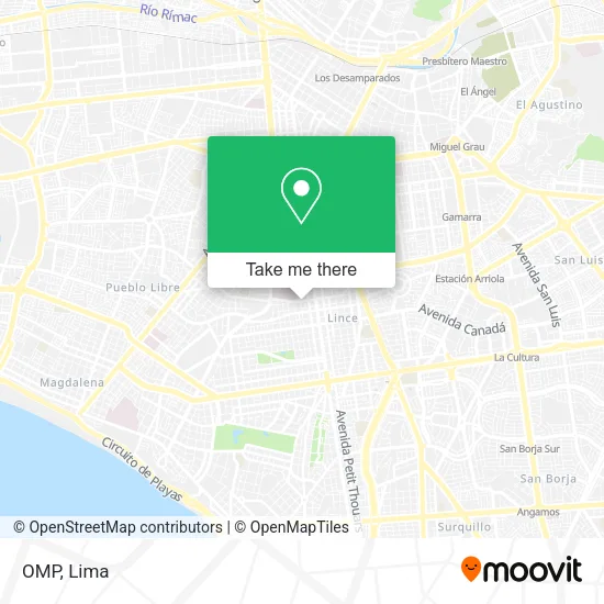
See OMP, Lima, on the map
Public Transit to OMP in Lima
Wondering how to get to OMP in Lima? Moovit helps you find the best way to get to OMP with step-by-step directions from the nearest public transit station.
Moovit provides free maps and live directions to help you navigate through your city. View schedules, routes, timetables, and find out how long does it take to get to OMP in real time.
Looking for the nearest stop or station to OMP? Check out this list of stops closest to your destination: Miller; Manuel Del Pino; Manuel Segura; Nicolas Arriola.
Bus: 1203, 1244, 1290, 301, 1044, 1200, 1223, 1236, 336, 1015, 1038, 1057, 1099, 303, 305.Metro: LINEA 1.
Want to see if there’s another route that gets you there at an earlier time? Moovit helps you find alternative routes or times. Get directions from and directions to OMP easily from the Moovit App or Website.
We make riding to OMP easy, which is why over 1.5 million users, including users in Lima, trust Moovit as the best app for public transit. You don’t need to download an individual bus app or train app, Moovit is your all-in-one transit app that helps you find the best bus time or train time available.
For information on prices of bus and metro, costs and ride fares to OMP, please check the Moovit app.
Use the app to navigate to popular places including to the airport, hospital, stadium, grocery store, mall, coffee shop, school, college, and university.
Location: Lima
- Centro Comercial Gamarra,
- Domingo Cueto 241 Dpto 805 Lince Frente al Hospital Rebagliati,
- Restaurante Cevicheria Buque 91,
- Omp Obras Misionales Pontificias,
- Seminario Teologico Evangelico Presbiteriano Del Peru,
- Endocrinólogo-Dr. Oscar Quintana Pinto,
- A una cuadra del Seguro Social espalda cuadra 15 de av arenales,
- Subgerencia de Gestión de la Incorporación de Essalud,
- JIRON MARISCAL MILLER 1562 LINCE,
- MARISCAL MILLER 1562,
- Essalud,
- Funeraria Acuña,
- Auditorio 9no Piso. Gerencia Central. Essalud,
- cuna jardin modelo de essalud,
- Av Domingo Cueto,
- La Merced - Chanchamayo,
- Farmacia PADOMI,
- Cooperativa San Jorge,
- Arenales con Domingo Cueto,
- Av Domingo Cueto 259 267 Lince
Places Near OMP (Lima)
- Aeropuerto Internacional Jorge Chávez, Ventanilla,
- Plaza San Miguel, San Miguel,
- Gamarra,
- Barranco, Barranco,
- Av. Salaverry, Jesus Mari,
- Miraflores, Miraflores,
- Av. Abancay, Lima,
- Pontificia Universidad Católica del Perú - PUCP, San Miguel,
- Jockey Plaza, Santiago D,
- Parque Kennedy, Miraflores,
- av arequipa, Lima,
- Circuito Mágico Del Agua, Lima,
- Av. La Marina, San Miguel,
- Paradero Av.Brasil,
- Larcomar, Miraflores,
- Mall Del Sur,
- Real Plaza Puruchuco, Ate,
- Centro Comercial Plaza Norte, Independen,
- Parque de las Leyendas, San Miguel,
- Hospital Edgardo Rebagliati Martins, Jesus Mari
How to get to popular places in Lima with public transit
Get around Lima by public transit!
Traveling around Lima has never been so easy. See step by step directions as you travel to any attraction, street or major public transit station. View bus and train schedules, arrival times, service alerts and detailed routes on a map, so you know exactly how to get to anywhere in Lima.
When traveling to any destination around Lima use Moovit's Live Directions with Get Off Notifications to know exactly where and how far to walk, how long to wait for your line, and how many stops are left. Moovit will alert you when it's time to get off — no need to constantly re-check whether yours is the next stop.
Wondering how to use public transit in Lima or how to pay for public transit in Lima? Moovit public transit app can help you navigate your way with public transit easily, and at minimum cost. It includes public transit fees, ticket prices, and costs. Looking for a map of Lima public transit lines? Moovit public transit app shows all public transit maps in Lima with all Bus, Metro and Ferry routes and stops on an interactive map.
Lima has 3 transit type(s), including: Bus, Metro and Ferry, operated by several transit agencies, including Metro de Lima Línea 2 , Metro de Lima, Corredor Rojo, Metropolitano, Metropolitano - Alimentadores, Corredor Morado, Corredor Azul, Rutas Tradicionales, Transportes y Servicios La Esperanza S.A., Las Flores S.A., Virgen de la Asunción S.A., Consorcio HAM, Transportes y Service Canadá S.A., ETUL4SA and ETUCHISA