Directions to O Construtor (Araucária) with public transportation
The following transit lines have routes that pass near O Construtor
How to get to O Construtor by bus?
Click on the bus route to see step by step directions with maps, line arrival times and updated time schedules.
From C.D. Condor Hipermercados, Umbará
79 minFrom BR-116, km 125 s/n, Fazenda Rio Grande
58 minFrom Rua Iluminada Família Moletta, Umbará
86 minFrom Rua João Lunardelli 2205, Cic
58 minFrom Deposito Do Condor, Umbará
78 minFrom hospital e maternidade nossa senhora Aparecida, Fazenda Rio Grande
74 minFrom Campo de Santana, Campo De Santana
50 minFrom Cidade Industrial de Curitiba, Cic
45 minFrom 11º Distrito Policial, Cic
58 minFrom Bairro Thomaz Coelho, Araucária
41 min
Bus stops near O Construtor in Araucária
Bus lines to O Construtor in Araucária
- 20 PLANALTO / MINAS GERAIS, Davi Carneiro (via Minas Gerais) → Terminal Central Araucária,VIEW
- 20 PLANALTO / GRALHA AZUL, Açougue Maranhão → Terminal Central Araucária,VIEW
- 27 HMA / UPA, Terminal Central Araucária → UPA Araucária (via Ortobom),VIEW
- 03 HORTÊNCIA / ANGÉLICA, R. Costa e Silva → Terminal Vila Angélica,VIEW
- 05 MANOEL RIBAS / ANGÉLICA, Terminal Vila Angélica → Manoel Ribas,VIEW
- I11 ARAUCÁRIA / FAZENDA, Terminal Araucária → Terminal Fazenda,VIEW
- 01 LINHÃO 01 (ANGÉLICA / TUPY), Tupy → Terminal Vila Angélica,VIEW
What are the closest stations to O Construtor?
The closest stations to O Construtor are:
- Rua Izidoro Ksiazkiewicz, 241 is 39 meters away, 1 min walk.
- Rua Izidoro Ksiazkiewicz, 261 is 73 meters away, 2 min walk.
- Rua Vicente Strugala, 29 is 211 meters away, 3 min walk.
- Rua Manoel Ribas, 3027 is 273 meters away, 4 min walk.
Which bus lines stop near O Construtor?
These bus lines stop near O Construtor: 03 HORTÊNCIA / ANGÉLICA, 20 PLANALTO / GRALHA AZUL, I11 ARAUCÁRIA / FAZENDA.
What’s the nearest bus station to O Construtor in Araucária?
The nearest bus station to O Construtor in Araucária is Rua Izidoro Ksiazkiewicz, 241. It’s a 1 min walk away.
What time is the first bus to O Construtor in Araucária?
The 27 HMA / UPA is the first bus that goes to O Construtor in Araucária. It stops nearby at 4:19 AM.
What time is the last bus to O Construtor in Araucária?
The 03 HORTÊNCIA / ANGÉLICA is the last bus that goes to O Construtor in Araucária. It stops nearby at 12:55 AM.
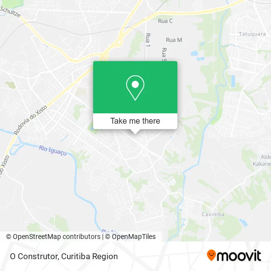
See O Construtor, Araucária, on the map
Public Transit to O Construtor in Araucária
Wondering how to get to O Construtor in Araucária? Moovit helps you find the best way to get to O Construtor with step-by-step directions from the nearest public transit station.
Moovit provides free maps and live directions to help you navigate through your city. View schedules, routes, timetables, and find out how long does it take to get to O Construtor in real time.
Looking for the nearest stop or station to O Construtor? Check out this list of stops closest to your destination: Rua Izidoro Ksiazkiewicz; Rua Izidoro Ksiazkiewicz; Rua Vicente Strugala; Rua Manoel Ribas.
Bus: 03 HORTÊNCIA / ANGÉLICA, 20 PLANALTO / GRALHA AZUL, I11 ARAUCÁRIA / FAZENDA, 20 PLANALTO / MINAS GERAIS, 27 HMA / UPA, 05 MANOEL RIBAS / ANGÉLICA, 01 LINHÃO 01 (ANGÉLICA / TUPY).
Want to see if there’s another route that gets you there at an earlier time? Moovit helps you find alternative routes or times. Get directions from and directions to O Construtor easily from the Moovit App or Website.
We make riding to O Construtor easy, which is why over 1.5 million users, including users in Araucária, trust Moovit as the best app for public transit. You don’t need to download an individual bus app or train app, Moovit is your all-in-one transit app that helps you find the best bus time or train time available.
For information on prices of bus, costs and ride fares to O Construtor, please check the Moovit app.
Use the app to navigate to popular places including to the airport, hospital, stadium, grocery store, mall, coffee shop, school, college, and university.
O Construtor Address: Rua Izidoro Ksiazkiewicz, 204 Costeira Araucária-PR 83708-750 street in Araucária
- Baraoutilidades.Araucaria,
- Elih Fashion Economia,
- Agtel Store,
- Monsatto Produtos Limpeza,
- Grupo Nova Uniao Seguranca,
- Priscila Valentin Makeup,
- Ella Charmosa,
- Studio Her Beauty,
- J a Pinheiro Araucaria,
- Brechó Valentina,
- Cris Favaro Beauty,
- Lily Store,
- Colegio Estadual Prof. Helena Wysocki,
- J. Wessling & E. Wessling,
- Hot Top Reparos Automotivos,
- Dcs Gestão Empresarial,
- D. V. Nascimento Serviços,
- Ivonete Adelaide Lassen,
- Magoo Sushi Delivery,
- Marquinhos Costela Gourmet
Places Near O Construtor (Araucária)
- Campo Largo, Campo,
- Hospital Nossa Senhora Das Graças, Mercês,
- Rua General Mário Tourinho, Campina Do Siqueira,
- Parque Barigui, Mercês,
- Hospital Erasto Gaertner, Jardim Das Américas,
- Hospital Madalena Sofia, Bairro Alto,
- Shopping Palladium, Portão,
- Hhhhh, Fazendinha,
- Shopping Estação, Rebouças,
- Hospital Angelina Caron, Campina Grande Do Sul,
- Jardim Botânico de Curitiba PR, Centro,
- Hospital do Rocio, Campo,
- Park Shopping Barigüi, Mossunguê,
- Jockey Plaza Shopping Center, Tarumã,
- Rua Martim Afonso 558, Mercês,
- Hospital de Clínicas (HC - UFPR), Centro,
- Hospital Universitário Evangélico de Curitiba, Bigorrilho,
- Pontifícia Universidade Católica do Paraná (PUCPR), Prado Velho,
- Arena Da Baixada - Curitiba,
- Hospital Da Cruz Vermelha, Batel
How to get to popular places in Curitiba Region with public transit
Get around Araucária by public transit!
Traveling around Araucária has never been so easy. See step by step directions as you travel to any attraction, street or major public transit station. View bus and train schedules, arrival times, service alerts and detailed routes on a map, so you know exactly how to get to anywhere in Araucária.
When traveling to any destination around Araucária use Moovit's Live Directions with Get Off Notifications to know exactly where and how far to walk, how long to wait for your line, and how many stops are left. Moovit will alert you when it's time to get off — no need to constantly re-check whether yours is the next stop.
Wondering how to use public transit in Araucária or how to pay for public transit in Araucária? Moovit public transit app can help you navigate your way with public transit easily, and at minimum cost. It includes public transit fees, ticket prices, and costs. Looking for a map of Araucária public transit lines? Moovit public transit app shows all public transit maps in Araucária with all Bus and Cable Car routes and stops on an interactive map.
Curitiba Region has 2 transit type(s), including: Bus and Cable Car, operated by several transit agencies, including Sistema Integrado de Mobilidade (URBS), Sistema Integrado de Mobilidade (AMEP), URBS (Cartões bancários e Dinheiro), URBS (Cartões bancários / Cartão URBS), AMEP (Cartões bancários / Cartão MetroCard), AMEP (Cartões bancários / Cartão MetroCard / Dinheiro), Viação Colombo (Dinheiro), TRIAR (Cartão TRIAR / Dinheiro), Empresa Curitiba Cerro Azul (Dinheiro), Expresso Nossa Senhora da Penha (Dinheiro), Empresa Campo Alto Tijucas (Dinheiro), Auto Viação São José (Cartão VEM / Dinheiro), BRT S/A (Cartão VEM / Dinheiro), TransPiedade (Cartão Cidadão / Dinheiro) and Oceânica Sul (Cartão Transporte / Dinheiro)