How to get to Oakton Life Insurance by bus?
Click on the bus route to see step by step directions with maps, line arrival times and updated time schedules.
From Liberty Crossing, Fairfax County
98 minFrom Defense Health Headquarters (DHHQ), Fairfax County
58 minFrom Falls Church, VA, Falls Church
80 minFrom Kaiser Permanente - Falls Church Medical Center, Falls Church
75 minFrom The Ritz-Carlton, Tysons Corner, Fairfax County
49 minFrom Falls Church Marriott Fairview Park, Fairfax County
65 minFrom Burke, VA, Fairfax County
126 minFrom Northern Virginia Community College - Annandale Campus, Fairfax County
58 minFrom [I-495] Exit 54 - Braddock Road, Fairfax County
93 minFrom Walmart, Fairfax County
61 min
How to get to Oakton Life Insurance by metro?
Click on the metro route to see step by step directions with maps, line arrival times and updated time schedules.
Bus stops near Oakton Life Insurance in Fairfax County
Metro station near Oakton Life Insurance in Fairfax County
- Vienna Metro Station, 61 min walk,VIEW
Bus lines to Oakton Life Insurance in Fairfax County
What are the closest stations to Oakton Life Insurance?
The closest stations to Oakton Life Insurance are:
- Chain Bridge Rd @ Oakton Manor Ct is 232 yards away, 3 min walk.
- Blake Ln+Bushman Dr is 801 yards away, 10 min walk.
- Vienna Metro Station is 5222 yards away, 61 min walk.
Which bus lines stop near Oakton Life Insurance?
These bus lines stop near Oakton Life Insurance: 461, 670, F61.
Which metro line stops near Oakton Life Insurance?
ORANGE (Vienna)
What’s the nearest bus station to Oakton Life Insurance in Fairfax County?
The nearest bus station to Oakton Life Insurance in Fairfax County is Chain Bridge Rd @ Oakton Manor Ct. It’s a 3 min walk away.
What time is the first metro to Oakton Life Insurance in Fairfax County?
The ORANGE is the first metro that goes to Oakton Life Insurance in Fairfax County. It stops nearby at 5:00 AM.
What time is the last metro to Oakton Life Insurance in Fairfax County?
The ORANGE is the last metro that goes to Oakton Life Insurance in Fairfax County. It stops nearby at 12:32 AM.
What time is the first bus to Oakton Life Insurance in Fairfax County?
The F61 is the first bus that goes to Oakton Life Insurance in Fairfax County. It stops nearby at 5:58 AM.
What time is the last bus to Oakton Life Insurance in Fairfax County?
The F61 is the last bus that goes to Oakton Life Insurance in Fairfax County. It stops nearby at 10:16 PM.
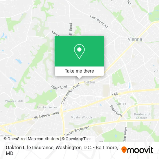
See Oakton Life Insurance, Fairfax County, on the map
Public Transit to Oakton Life Insurance in Fairfax County
Wondering how to get to Oakton Life Insurance in Fairfax County? Moovit helps you find the best way to get to Oakton Life Insurance with step-by-step directions from the nearest public transit station.
Moovit provides free maps and live directions to help you navigate through your city. View schedules, routes, timetables, and find out how long does it take to get to Oakton Life Insurance in real time.
Looking for the nearest stop or station to Oakton Life Insurance? Check out this list of stops closest to your destination: Chain Bridge Rd @ Oakton Manor Ct; Blake Ln+Bushman Dr; Vienna Metro Station.
Bus: 461, 670, F61.Metro: ORANGE.
Want to see if there’s another route that gets you there at an earlier time? Moovit helps you find alternative routes or times. Get directions from and directions to Oakton Life Insurance easily from the Moovit App or Website.
We make riding to Oakton Life Insurance easy, which is why over 1.5 million users, including users in Fairfax County, trust Moovit as the best app for public transit. You don’t need to download an individual bus app or train app, Moovit is your all-in-one transit app that helps you find the best bus time or train time available.
For information on prices of bus and metro, costs and ride fares to Oakton Life Insurance, please check the Moovit app.
Use the app to navigate to popular places including to the airport, hospital, stadium, grocery store, mall, coffee shop, school, college, and university.
Oakton Life Insurance Address: 2813 Oakton Manor Ct Oakton, VA 22124 street in Fairfax County
- Garcia Locksmiths,
- Mobil,
- I9 Sports,
- Looking Sharpe Landscapes,
- Pr Partners Oakton,
- R L & MH,
- STARBUCKS,
- Taco Rock,
- Food Agent,
- Reflexology and Beyond,
- Arsenal Security Group,
- Khalil & Giordano, DDS, PC,
- The Anderson Group,
- FedEx,
- Kar Consulting Group,
- Aesthetics Dentistry O,
- PP*C-Enterprise,
- Freshfarm Oakton Farmers Market,
- Gilbert Family Montessori Schools,
- Committee for Helping Others Simple
Places Near Oakton Life Insurance (Fairfax County)
- Rock Creek Tennis Center, Washington,
- Museum Of The Bible, Washington,
- National Museum of African American History and Culture, Washington,
- Georgetown, Washington,
- Warner Theatre, Washington,
- National Zoo, Washington,
- Camden Yards, Baltimore,
- Basilica of the National Shrine, Washington,
- The Anthem, Washington,
- Pennsylvania Ave NW (3rd st and pennsylvania), Washington,
- PG Mall, Prince George's County,
- National Mall, Washington,
- Westfield Montgomery Mall, Montgomery County,
- Sibley Memorial Hospital, Washington,
- Capital One Arena, Washington,
- M&T Bank Stadium, Baltimore,
- Washington National Cathedral, Washington,
- Amazon Hq2, Arlington County,
- Marriott Marquis Washington, DC, Washington,
- Washington DC VA Medical Center, Washington
How to get to popular places in Washington, D.C. - Baltimore, MD with public transit
Get around Fairfax County by public transit!
Traveling around Fairfax County has never been so easy. See step by step directions as you travel to any attraction, street or major public transit station. View bus and train schedules, arrival times, service alerts and detailed routes on a map, so you know exactly how to get to anywhere in Fairfax County.
When traveling to any destination around Fairfax County use Moovit's Live Directions with Get Off Notifications to know exactly where and how far to walk, how long to wait for your line, and how many stops are left. Moovit will alert you when it's time to get off — no need to constantly re-check whether yours is the next stop.
Wondering how to use public transit in Fairfax County or how to pay for public transit in Fairfax County? Moovit public transit app can help you navigate your way with public transit easily, and at minimum cost. It includes public transit fees, ticket prices, and costs. Looking for a map of Fairfax County public transit lines? Moovit public transit app shows all public transit maps in Fairfax County with all Bus, Train, Metro, Light Rail and Ferry routes and stops on an interactive map.
Washington, D.C. - Baltimore, MD has 5 transit type(s), including: Bus, Train, Metro, Light Rail and Ferry, operated by several transit agencies, including WMATA, Montgomery County Ride On, Fairfax Connector, TheBus, PRTC, DASH - Alexandria, Arlington Transit (ART), RTA of Central Maryland, MDOT MTA, MDOT MTA Light RailLink, MDOT MTA Commuter Bus, MDOT MTA Local Bus, FXBGO!, Virginia Railway Express (VRE) and MARC