How to get to Ob One by bus?
Click on the bus route to see step by step directions with maps, line arrival times and updated time schedules.
From SAP Campus, Walldorf
52 minFrom Friedhof Käfertal, Käfertal
132 minFrom GRN-Klinik Schwetzingen, Schwetzingen
47 minFrom Hauptfeuerwache, Berufsfeuerwehr Mannheim, Neckarau
97 minFrom SAP Walldorf P18, Walldorf
56 minFrom FH 1863, Neckarstadt-Ost/Wohlgelegen
125 minFrom MVV Energie Ladestation, Käfertal
130 minFrom SAP Headquarters, Walldorf
55 minFrom Möbel Höffner, Schwetzingen
65 min
How to get to Ob One by train?
Click on the train route to see step by step directions with maps, line arrival times and updated time schedules.
Bus stops near Ob One in Bahnstadt
Light Rail stations near Ob One in Bahnstadt
Bus lines to Ob One in Bahnstadt
- M2, Universitätsplatz - Wieblingen Mitte,VIEW
- M2, Bismarckplatz - S-Bahnhof Pfaffengrund/Wieblingen,VIEW
- M2, Bismarckplatz - Wieblingen Mitte,VIEW
- RNV MOONLINER 2, Heidelberg, Bismarckplatz,VIEW
- M3, Kolbenzeil,VIEW
- 721, Wiesloch-Walldorf, Bf,VIEW
- RNV 28, Neuenheim, Sportzentrum Nord,VIEW
- RNV 34, Heiligkreuzsteinach, Schule,VIEW
- RNV MOONLINER 3, Heidelberg, Bismarckplatz,VIEW
- 33, Universitätsplatz,VIEW
- 34, Hd Hauptbahnhof Süd,VIEW
- M3, Bismarckplatz,VIEW
- 35, Waldorfschule Hd,VIEW
- 35E, Waldorfschule Hd,VIEW
- 36, Pfaffengrund,VIEW
- RNV 35, Wieblingen, Nord,VIEW
- RNV 36, Pfaffengrund, Kranichweg/Stotz,VIEW
What are the closest stations to Ob One?
The closest stations to Ob One are:
- Agnesistraße is 411 meters away, 6 min walk.
- Bahnstadt, Gadamerplatz Bstg D is 433 meters away, 6 min walk.
- Gadamerplatz is 435 meters away, 6 min walk.
- Bahnstadt, Gadamerplatz Bstg B is 442 meters away, 6 min walk.
- Bahnstadt, Agnesistraße Bstg A is 462 meters away, 7 min walk.
- Hd Hauptbahnhof Süd is 709 meters away, 10 min walk.
- Bahnstadt, Schwetz. Terrasse is 720 meters away, 10 min walk.
- Schwetzinger Terrasse is 721 meters away, 10 min walk.
- Gneisenaustraße is 1146 meters away, 15 min walk.
- Heidelberg, Gneisenaustraße is 1148 meters away, 15 min walk.
Which train lines stop near Ob One?
These train lines stop near Ob One: RB68, S3.
Which light rail lines stop near Ob One?
These light rail lines stop near Ob One: 22, RNV 22, RNV 5, S1.
Which bus lines stop near Ob One?
These bus lines stop near Ob One: 717, 721.
What’s the nearest light rail station to Ob One in Bahnstadt?
The nearest light rail stations to Ob One in Bahnstadt are Bahnstadt, Gadamerplatz Bstg D, Gadamerplatz and Bahnstadt, Gadamerplatz Bstg B. The closest one is a 6 min walk away.
What’s the nearest bus station to Ob One in Bahnstadt?
The nearest bus station to Ob One in Bahnstadt is Agnesistraße. It’s a 6 min walk away.
What time is the first light rail to Ob One in Bahnstadt?
The RNV 22 is the first light rail that goes to Ob One in Bahnstadt. It stops nearby at 4:45 AM.
What time is the last light rail to Ob One in Bahnstadt?
The RNV 26 is the last light rail that goes to Ob One in Bahnstadt. It stops nearby at 12:35 AM.
What time is the first bus to Ob One in Bahnstadt?
The 35 is the first bus that goes to Ob One in Bahnstadt. It stops nearby at 4:51 AM.
What time is the last bus to Ob One in Bahnstadt?
The RNV MOONLINER 3 is the last bus that goes to Ob One in Bahnstadt. It stops nearby at 1:26 AM.
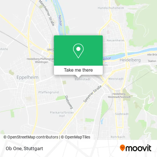
See Ob One, Bahnstadt, on the map
Public Transit to Ob One in Bahnstadt
Wondering how to get to Ob One in Bahnstadt? Moovit helps you find the best way to get to Ob One with step-by-step directions from the nearest public transit station.
Moovit provides free maps and live directions to help you navigate through your city. View schedules, routes, timetables, and find out how long does it take to get to Ob One in real time.
Looking for the nearest stop or station to Ob One? Check out this list of stops closest to your destination: Agnesistraße; Bahnstadt, Gadamerplatz Bstg D; Gadamerplatz; Bahnstadt, Gadamerplatz Bstg B; Bahnstadt, Agnesistraße Bstg A; Hd Hauptbahnhof Süd; Bahnstadt, Schwetz. Terrasse; Schwetzinger Terrasse; Gneisenaustraße; Heidelberg.
Train: RB68, S3.Light Rail: 22, RNV 22, RNV 5, S1.Bus: 717, 721, M2, M2, M2, RNV MOONLINER 2, M3, RNV 28, RNV 34, RNV MOONLINER 3, 33, 34, M3, 35, 35E, 36.
Want to see if there’s another route that gets you there at an earlier time? Moovit helps you find alternative routes or times. Get directions from and directions to Ob One easily from the Moovit App or Website.
We make riding to Ob One easy, which is why over 1.5 million users, including users in Bahnstadt, trust Moovit as the best app for public transit. You don’t need to download an individual bus app or train app, Moovit is your all-in-one transit app that helps you find the best bus time or train time available.
For information on prices of bus, light rail and train, costs and ride fares to Ob One, please check the Moovit app.
Use the app to navigate to popular places including to the airport, hospital, stadium, grocery store, mall, coffee shop, school, college, and university.
Ob One Address: Langer Anger 133 Bahnstadt, 69115 Heidelberg street in Bahnstadt
- Mein Brautkleid Heidelberg,
- Ludger Benighaus,
- Mein Brautkleid Cm Gmb,
- Bluewater Partners,
- Ukr-Dienste,
- Baugemeinschaft Heidelberg Bahnstadt,
- Bilfinger Digital next,
- Purzelzwerg,
- Helga Goetze,
- Kiku Lummerland,
- Studio Figura Heidelberg - Fitness und Wellness,
- Olga Guban Maßage Boutique,
- Vivants,
- E-Xplosion,
- Egh Projektgesellschaft Heidelberg,
- Constaff,
- Mitohne,
- Simonandbearns,
- Ernst²,
- Quartiere
Places Near Ob One (Bahnstadt)
- FlixBus Haltestelle, Stuttgart,
- Mercedes-Benz Museum (Mercedes Museum Stuttgart), Bad Cannstatt,
- Mettingen Eros-Center Puff Laufhaus, Esslingen Am Neckar,
- Porsche Museum, Zuffenhausen,
- Marmorsaal Im Weissenburgpark, Stuttgart-Süd,
- Hauptbahnhof Stuttgart, Stuttgart-Mitte,
- Porsche-Arena, Bad Cannstatt,
- Waldfriedhof, Degerloch,
- Hanns-Martin-Schleyer-Halle, Bad Cannstatt,
- Schleyerhalle, Bad Cannstatt,
- Im Wizemann (Halle), Bad Cannstatt,
- Mercedes-Benz Museum, Bad Cannstatt,
- Klinikum Stuttgart - Katharinenhospital, Stuttgart-Mitte,
- Gasometer Pforzheim, Pforzheim,
- Geilhaus Haus 33a, Reutlingen-Betzingen,
- Pariser Platz Stuttgart, Stuttgart-Mitte,
- SI-Centrum, Möhringen,
- Wilhelma (U-Bahn Wilhelma), Bad Cannstatt,
- Hanns-Martin-Schleyer-Halle (Stuttgart Hans-Martin-Schleyerhalle), Bad Cannstatt,
- Gleis 101/102 (tief), Stuttgart-Mitte
How to get to popular places in Stuttgart with public transit
Get around Bahnstadt by public transit!
Traveling around Bahnstadt has never been so easy. See step by step directions as you travel to any attraction, street or major public transit station. View bus and train schedules, arrival times, service alerts and detailed routes on a map, so you know exactly how to get to anywhere in Bahnstadt.
When traveling to any destination around Bahnstadt use Moovit's Live Directions with Get Off Notifications to know exactly where and how far to walk, how long to wait for your line, and how many stops are left. Moovit will alert you when it's time to get off — no need to constantly re-check whether yours is the next stop.
Wondering how to use public transit in Bahnstadt or how to pay for public transit in Bahnstadt? Moovit public transit app can help you navigate your way with public transit easily, and at minimum cost. It includes public transit fees, ticket prices, and costs. Looking for a map of Bahnstadt public transit lines? Moovit public transit app shows all public transit maps in Bahnstadt with all Bus, Train, Subway, Light Rail, Ferry, S-Bahn and Funicular routes and stops on an interactive map.
Stuttgart has 7 transit type(s), including: Bus, Train, Subway, Light Rail, Ferry, S-Bahn and Funicular, operated by several transit agencies, including SSB - Stadtbahn, SSB, SSB - Seilbahn / Zacke, S-Bahn Stuttgart, Rhein-Neckar-Verkehr GmbH (rnv), Karlsruher Verkehrsverbund, DB AG, DB Regiobus BW, Arverio Baden-Württemberg GmbH, DB RegioNetz Verkehrs GmbH Westfrankenbahn, DB Regio AG Baden-Württemberg, Südwestdeutsche Verkehrs-AG, DB Regio AG Mitte Region Hessen, DB and Bodensee-Oberschwaben-Bahn
Public transit lines with stations closest to Ob One in Bahnstadt
Bus lines with stations closest to Ob One in Bahnstadt
Schwetzinger Terrasse
 33Emmertsgrund - Mombertplatz - Rohrbach Süd - Kirchheim Rathaus - HD Hauptbahnhof - Bismarckplatz - S-Bf Altstadt - S-Bf Schlierbach/Ziegelhausen - Ziegelhausen Köpfel
- 34Kranichweg/Stotz - S-Bf Pfaffengrund/Wieblingen - Wieblingen Mitte - Betriebshof - HD Hauptbahnhof - Bismarckplatz - Alte Brücke Nord - Kreuzgrundweg - Heidebuckelweg - Heiligkreuzsteinach Schule
- M3Kolbenzeil - Bismarckplatz
Gneisenaustraße
- 35(HD Waldorfschule -) Wieblingen Nord - Betriebshof - Bismarckplatz - S-Bf Altstadt - S-Bf Schlierbach/Ziegelhausen - Neckargemünd Bf - Neckargemünd Bildungszentrum
- 35E(HD Waldorfschule -) Wieblingen Nord - Betriebshof - Bismarckplatz - S-Bf Altstadt - S-Bf Schlierbach/Ziegelhausen - Neckargemünd Bf - Neckargemünd Bildungszentrum
- 36S-Bf Orthopädie - S-Bf Schlierbach/Ziegelhausen - Ziegelhausen Kirche - Hirtenaue - Neckarschule - Bärenbach Süd