How to get to Obexcode by bus?
Click on the bus route to see step by step directions with maps, line arrival times and updated time schedules.
Bus stops near Obexcode in Tromsø
Ferry stations near Obexcode in Tromsø
Bus lines to Obexcode in Tromsø
What are the closest stations to Obexcode?
The closest stations to Obexcode are:
- Alfheimvegen Nord is 146 meters away, 3 min walk.
- Prost Schieldrups Gate is 210 meters away, 3 min walk.
- Sommerlyst Skole is 317 meters away, 5 min walk.
- Trollbakken is 465 meters away, 7 min walk.
- Tromsø Kystrutekai is 1310 meters away, 17 min walk.
- Tromsø Prostneset Hurtigbåtkai is 1408 meters away, 19 min walk.
Which bus lines stop near Obexcode?
These bus lines stop near Obexcode: 24, 26, 42.
What’s the nearest bus station to Obexcode in Tromsø?
The nearest bus stations to Obexcode in Tromsø are Alfheimvegen Nord and Prost Schieldrups Gate. The closest one is a 3 min walk away.
What’s the nearest ferry station to Obexcode in Tromsø?
The nearest ferry station to Obexcode in Tromsø is Tromsø Kystrutekai. It’s a 17 min walk away.
What time is the first bus to Obexcode in Tromsø?
The 26 is the first bus that goes to Obexcode in Tromsø. It stops nearby at 3:17 AM.
What time is the last bus to Obexcode in Tromsø?
The 26 is the last bus that goes to Obexcode in Tromsø. It stops nearby at 12:05 AM.
What time is the first ferry to Obexcode in Tromsø?
The 3 is the first ferry that goes to Obexcode in Tromsø. It stops nearby at 2:30 PM.
What time is the last ferry to Obexcode in Tromsø?
The HAV is the last ferry that goes to Obexcode in Tromsø. It stops nearby at 7:23 AM.
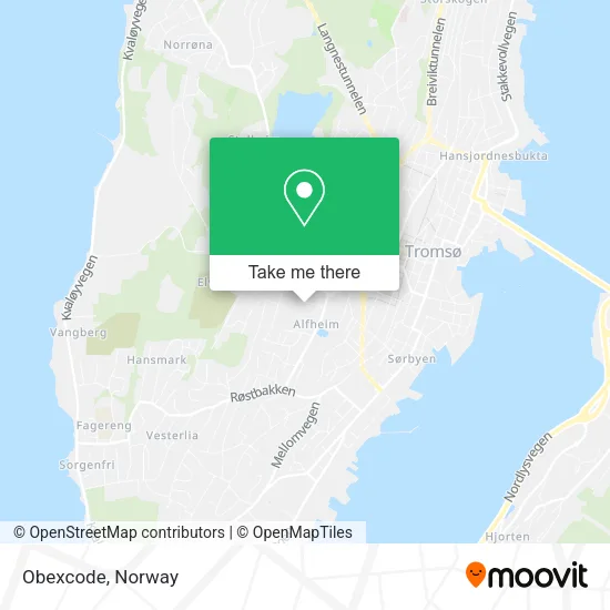
See Obexcode, Tromsø, on the map
Public Transit to Obexcode in Tromsø
Wondering how to get to Obexcode in Tromsø? Moovit helps you find the best way to get to Obexcode with step-by-step directions from the nearest public transit station.
Moovit provides free maps and live directions to help you navigate through your city. View schedules, routes, timetables, and find out how long does it take to get to Obexcode in real time.
Looking for the nearest stop or station to Obexcode? Check out this list of stops closest to your destination: Alfheimvegen Nord; Prost Schieldrups Gate; Sommerlyst Skole; Trollbakken; Tromsø Kystrutekai; Tromsø Prostneset Hurtigbåtkai.
Bus: 24, 26, 42, 40, 70, X36, 71.Ferry: HAV, HUR, 2, 3, 4.
Want to see if there’s another route that gets you there at an earlier time? Moovit helps you find alternative routes or times. Get directions from and directions to Obexcode easily from the Moovit App or Website.
We make riding to Obexcode easy, which is why over 1.5 million users, including users in Tromsø, trust Moovit as the best app for public transit. You don’t need to download an individual bus app or train app, Moovit is your all-in-one transit app that helps you find the best bus time or train time available.
For information on prices of bus, costs and ride fares to Obexcode, please check the Moovit app.
Use the app to navigate to popular places including to the airport, hospital, stadium, grocery store, mall, coffee shop, school, college, and university.
Obexcode Address: Stadionvegen 3 9007 Tromsø street in Tromsø
- Isberget Supporterklubb,
- Joker,
- Trine Lise The Lapp Olsen,
- Snow-Travels,
- Alfheim Svømmehall,
- Jan Trollvik,
- Eirik Håvard Hansen,
- Troms Parkinsonforening,
- Manuel Perez M,
- Polar Excursions,
- Oddgeir Kvello Olsen,
- Lyngen Wertshus Hotell og Camping AS,
- K24 Prestasjon AS,
- Ella Koren,
- Strikkhopp & Sånt,
- Tromsøya Speidergruppe,
- Storbandet 60+,
- Christiansen F,
- Ishavsbyen Kunstløpklubb,
- Meteorologisk institutt Værvarslinga for Nord-Norge
Places Near Obexcode (Tromsø)
- Color Line Terminal, Oslo,
- Vestby Outlet Store, Vestby,
- Haukeland Universitetssjukehus, Bergen,
- Drammen Sykehus, Drammen,
- Quality Hotel Edvard Grieg, Bergen,
- IKEA, Oslo,
- Voldsløkka, Oslo,
- Radiumhospitalet, Oslo,
- Jekta Storsenter, Tromsø,
- Ikea Leangen, Trondheim,
- Tyholttårnet, Trondheim,
- Ulriken, Bergen,
- IKEA, Bergen,
- Ullevål Stadion (T), Oslo,
- Bjerke Travbane, Oslo,
- Nylandsbrua, Oslo,
- Oslo S spor 19 (Trelastgata), Oslo,
- Rikshospitalet (trikk), Oslo,
- DFDS Seaways, Oslo,
- Lovisenberg Diakonale Sykehus, Oslo
How to get to popular places in Norway with public transit
Get around Tromsø by public transit!
Traveling around Tromsø has never been so easy. See step by step directions as you travel to any attraction, street or major public transit station. View bus and train schedules, arrival times, service alerts and detailed routes on a map, so you know exactly how to get to anywhere in Tromsø.
When traveling to any destination around Tromsø use Moovit's Live Directions with Get Off Notifications to know exactly where and how far to walk, how long to wait for your line, and how many stops are left. Moovit will alert you when it's time to get off — no need to constantly re-check whether yours is the next stop.
Wondering how to use public transit in Tromsø or how to pay for public transit in Tromsø? Moovit public transit app can help you navigate your way with public transit easily, and at minimum cost. It includes public transit fees, ticket prices, and costs. Looking for a map of Tromsø public transit lines? Moovit public transit app shows all public transit maps in Tromsø with all Bus, Train, Subway, Light Rail, Ferry and Cable Car routes and stops on an interactive map.
Norway has 6 transit type(s), including: Bus, Train, Subway, Light Rail, Ferry and Cable Car, operated by several transit agencies, including Ruter, Skyss, AtB, Flytoget, Vy Tåg, SJ, Go-Ahead Norge AS, SJ Nord, Vestfold Kollektivtrafikk as, Snelandia, Innlandstrafikk, FRAM, FlixBus, Kolumbus and Brakar