Ocean & Chestnut SE stop - Monday schedule
| Line | Direction | Time |
|---|---|---|
| 121 | 121 Belmont Shore to PCH at Clark via | 5:27 AM |
| 121 | 121 Belmont Shore to PCH at Clark via | 6:11 AM |
| 121 | 121 Belmont Shore to PCH at Clark via | 7:01 AM |
| 121 | 121 Belmont Shore to PCH at Clark via | 7:41 AM |
| 121 | 121 Belmont Shore to PCH at Clark via | 8:01 AM |
| 121 | 121 Belmont Shore to PCH at Clark via | 8:21 AM |
| 121 | 121 Belmont Shore to PCH at Clark via | 8:41 AM |
| 121 | 121 Belmont Shore to PCH at Clark via | 9:01 AM |
| 121 | 121 Belmont Shore to PCH at Clark via | 9:21 AM |
| 121 | 121 Belmont Shore to PCH at Clark via | 9:41 AM |
| 121 | 121 Belmont Shore to PCH at Clark via | 10:01 AM |
| 121 | 121 Belmont Shore to PCH at Clark via | 10:21 AM |
| 121 | 121 Belmont Shore to PCH at Clark via | 10:41 AM |
| 121 | 121 Belmont Shore to PCH at Clark via | 11:01 AM |
| 121 | 121 Belmont Shore to PCH at Clark via | 11:21 AM |
| 121 | 121 Belmont Shore to PCH at Clark via | 11:41 AM |
| 121 | 121 Belmont Shore to PCH at Clark via | 12:01 PM |
| 121 | 121 Belmont Shore to PCH at Clark via | 12:21 PM |
| 121 | 121 Belmont Shore to PCH at Clark via | 12:41 PM |
| 121 | 121 Belmont Shore to PCH at Clark via | 1:01 PM |
| 121 | 121 Belmont Shore to PCH at Clark via | 1:21 PM |
| 121 | 121 Belmont Shore to PCH at Clark via | 1:41 PM |
| 121 | 121 Belmont Shore to PCH at Clark via | 2:01 PM |
| 121 | 121 Belmont Shore to PCH at Clark via | 2:21 PM |
| 121 | 121 Belmont Shore to PCH at Clark via | 2:41 PM |
Directions to Ocean & Chestnut SE stop (Long Beach) with public transit
The following transit lines have routes that pass near Ocean & Chestnut SE
 Bus: 111, 121, 172, 93, CE142.
- Subway: A LINE.
- Ferry: CATALINA EXPRESS.
How to get to Ocean & Chestnut SE stop by bus?
Click on the bus route to see step by step directions with maps, line arrival times and updated time schedules.
Bus stops near Ocean & Chestnut SE stop in Long Beach
- Ocean & Chestnut NW, 1 min walk,
- Ocean Blvd & Magnolia Ave (Eastbound), 2 min walk,
- Pacific & Ocean NE, 4 min walk,
- Shoreline & Queensway SE, 5 min walk,
- Broadway & Magnolia SE, 5 min walk,
- Pacific Av + Broadway, 8 min walk,
- Pacific & Broadway NE, 8 min walk,
Subway stations near Ocean & Chestnut SE station in Long Beach
- Downtown Long Beach Station, 5 min walk,
Ferry stations near Ocean & Chestnut SE station in Long Beach
- Long Beach Port, 10 min walk,
Bus lines to Ocean & Chestnut SE stop in Long Beach
- 121, 121 Belmont Shore to PCH at Clark via,
- CE142, Westbound,
- 21, 21 Cherry to Downtown,
- 22, 22 Downey Ave to Downtown,
- 61, 61 Atlantic to Downtown,
- PASSPORT, Passport North to Downtown,
- 181, 181 Magnolia to Downtown,
- 191, 191 Santa Fe to Downtown,
- 192, 192 Santa Fe to Downtown,
- 3, Redondo Beach Pier,
- 182, 182 Pacific to Wardlow Station,
What are the closest stations to Ocean & Chestnut SE?
The closest stations to Ocean & Chestnut SE are:
- Ocean & Chestnut NW is 44 yards away, 1 min walk.
- Ocean Blvd & Magnolia Ave (Eastbound) is 152 yards away, 2 min walk.
- Pacific & Ocean NE is 317 yards away, 4 min walk.
- Shoreline & Queensway SE is 344 yards away, 5 min walk.
- Downtown Long Beach Station is 399 yards away, 5 min walk.
- Broadway & Magnolia SE is 404 yards away, 5 min walk.
- Pacific Av + Broadway is 598 yards away, 8 min walk.
- Pacific & Broadway NE is 610 yards away, 8 min walk.
- Long Beach Port is 787 yards away, 10 min walk.
Which bus lines stop near Ocean & Chestnut SE?
These bus lines stop near Ocean & Chestnut SE: 111, 121, 172, 93, CE142.
Which subway line stops near Ocean & Chestnut SE?
A LINE (Southbound to Long Beach)
What’s the nearest subway station to Ocean & Chestnut SE in Long Beach?
The nearest subway station to Ocean & Chestnut SE in Long Beach is Downtown Long Beach Station. It’s a 5 min walk away.
What’s the nearest bus station to Ocean & Chestnut SE in Long Beach?
The nearest bus station to Ocean & Chestnut SE in Long Beach is Ocean & Chestnut NW. It’s a 1 min walk away.
What’s the nearest ferry station to Ocean & Chestnut SE in Long Beach?
The nearest ferry station to Ocean & Chestnut SE in Long Beach is Long Beach Port. It’s a 10 min walk away.
What time is the first subway to Ocean & Chestnut SE in Long Beach?
The A LINE is the first subway that goes to Ocean & Chestnut SE in Long Beach. It stops nearby at 3:48 AM.
What time is the last subway to Ocean & Chestnut SE in Long Beach?
The A LINE is the last subway that goes to Ocean & Chestnut SE in Long Beach. It stops nearby at 1:48 AM.
What time is the first bus to Ocean & Chestnut SE in Long Beach?
The 121 is the first bus that goes to Ocean & Chestnut SE in Long Beach. It stops nearby at 5:11 AM.
What time is the last bus to Ocean & Chestnut SE in Long Beach?
The 61 is the last bus that goes to Ocean & Chestnut SE in Long Beach. It stops nearby at 12:23 AM.
What time is the first ferry to Ocean & Chestnut SE in Long Beach?
The CATALINA EXPRESS is the first ferry that goes to Ocean & Chestnut SE in Long Beach. It stops nearby at 6:00 AM.
What time is the last ferry to Ocean & Chestnut SE in Long Beach?
The CATALINA EXPRESS is the last ferry that goes to Ocean & Chestnut SE in Long Beach. It stops nearby at 9:06 PM.
Ocean & Chestnut SE station
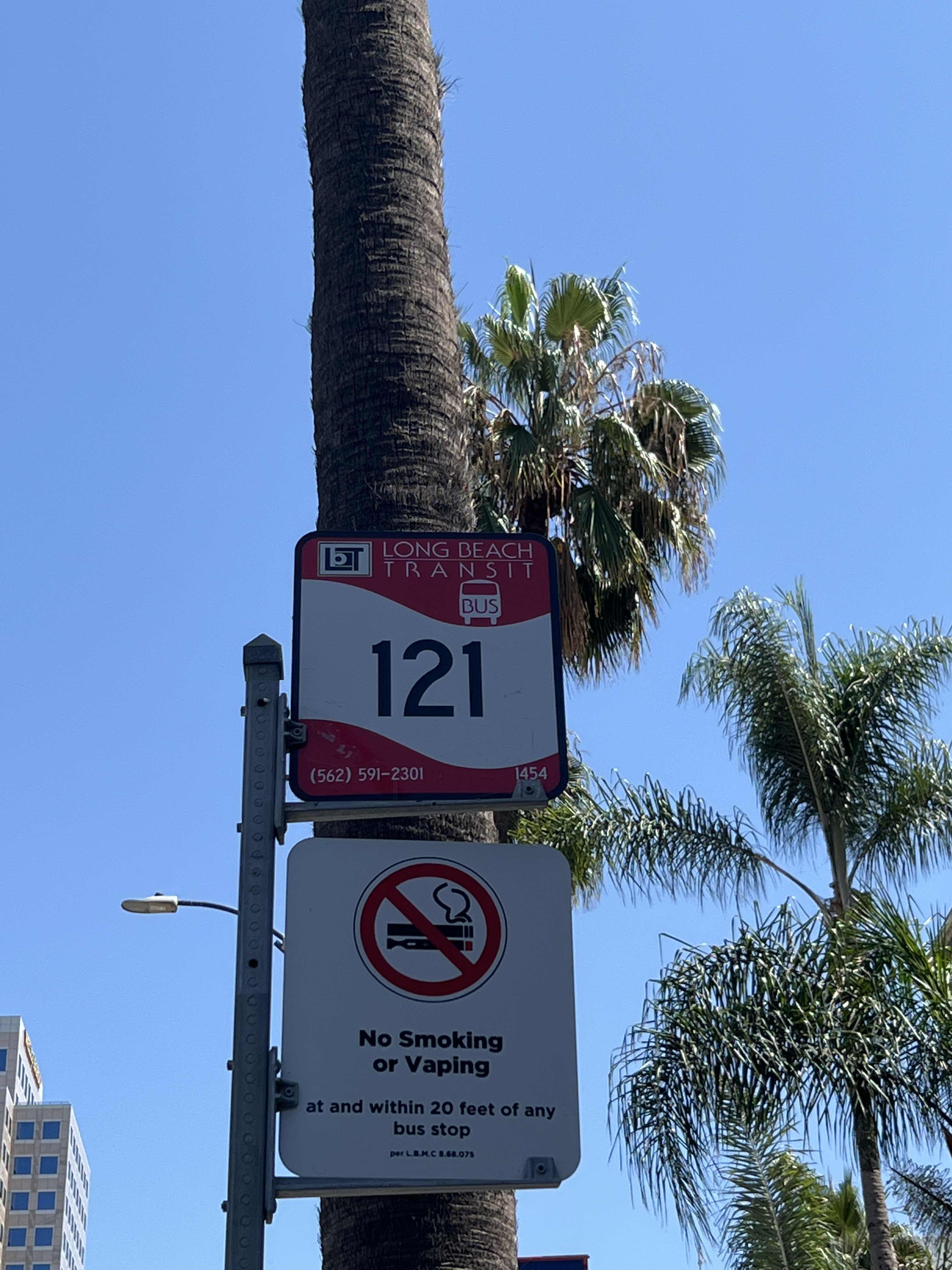 Taken by Anonymous
See Ocean & Chestnut SE stop, Long Beach, on the map
Public transit to Ocean & Chestnut SE stop (ID: 1454) in Long Beach
Looking for directions to Ocean & Chestnut SE in Long Beach, United States?
Download the Moovit App to find the current schedule and step-by-step directions for Bus or Subway routes that pass through Ocean & Chestnut SE.
Looking for the nearest stops closest to Ocean & Chestnut SE ? Check out this list of closest stops to your destination: Ocean & Chestnut NW; Ocean Blvd & Magnolia Ave (Eastbound); Pacific & Ocean NE; Shoreline & Queensway SE; Downtown Long Beach Station; Broadway & Magnolia SE; Pacific Av + Broadway; Pacific & Broadway NE; Long Beach Port.
Bus: 111, 121, 172, 93, CE142, 21, 22, 61, PASSPORT.Subway: A LINE.Ferry: CATALINA EXPRESS.
We make riding on public transit to Ocean & Chestnut SE easy, which is why over 1.5 million users, including users in Long Beach trust Moovit as the best app for public transit.
Use the app to navigate to popular places including to the airport, hospital, stadium, grocery store, mall, coffee shop, school, college, and university.
Ocean & Chestnut SE stop’s code is 1454
The first line to this stop is 121, at 5:27 AM, and the last line is 121 at 10:01 PM.
West Ocean Boulevard, Long Beach, CA, USA
This stop serves Long Beach Transit’s lines
- Ocean & Chestnut NW,
- Ocean Blvd & Magnolia Ave (Eastbound),
- Pacific & Ocean NE,
- Shoreline & Queensway SE,
- Broadway & Magnolia SE,
- Pacific Av + Broadway,
- Pacific & Broadway NE
Bus stops near Ocean & Chestnut SE stop
- Downtown Long Beach Station
Subway station near Ocean & Chestnut SE station
- Long Beach Port
Ferry station near Ocean & Chestnut SE station
- 101 Fwy & Vermont Ave (Westbound),
- Space Park Dr & Aviation Blvd,
- Arcadia Station (A Line),
- Compton Ave & 83rd St,
- Spring & Bellflower SE,
- University + Lemon,
- Katella-State College,
- Alondra Blvd/Studebaker Rd SB,
- Foothill / Sayre,
- San Gabriel / California,
- Indiana Station,
- Lakewood Blvd & Artesia Blvd,
- 4th/Los Angeles,
- Aviation Blvd/Imperial Hwy,
- Cesar E Chavez / Evergreen,
- Sawtelle Blvd & National Blvd,
- Tapo Canyon Road and 118 Freeway,
- Compton / Wilmington,
- Paramount / Whittier,
- San Fernando / Burbank
Popular public transit stations in Long Beach
Get around Long Beach by public transit!
Traveling around Long Beach has never been so easy. See step by step directions as you travel to any attraction, street or major public transit station. View bus and train schedules, arrival times, service alerts and detailed routes on a map, so you know exactly how to get to anywhere in Long Beach.
When traveling to any destination around Long Beach use Moovit's Live Directions with Get Off Notifications to know exactly where and how far to walk, how long to wait for your line, and how many stops are left. Moovit will alert you when it's time to get off — no need to constantly re-check whether yours is the next stop.
Wondering how to use public transit in Long Beach or how to pay for public transit in Long Beach? Moovit public transit app can help you navigate your way with public transit easily, and at minimum cost. It includes public transit fees, ticket prices, and costs. Looking for a map of Long Beach public transit lines? Moovit public transit app shows all public transit maps in Long Beach with all Bus, Train, Subway, Ferry and Funicular routes and stops on an interactive map.
Los Angeles has 5 transit type(s), including: Bus, Train, Subway, Ferry and Funicular, operated by several transit agencies, including Metro, Alhambra Community Transit, Arcadia Transit, Artesia Transit, AVTA, Baldwin Park Transit, Beach Cities Transit, Beaumont Transit, Bell Gardens Town Trolley, Bellflower Bus, Big Blue Bus, Burbank Bus, Calabasas Trolley, Camarillo Area Transit and Carson Circuit