How to get to Odricks Corner, Virginia by bus?
Click on the bus route to see step by step directions with maps, line arrival times and updated time schedules.
From George H.W. Bush Center For Intelligence (CIA Headquarters), Fairfax County
72 minFrom Eden Center, Falls Church
61 minFrom British Embassy, Washington
110 minFrom Falls Church Marriott Fairview Park, Fairfax County
73 minFrom Seven Corners Center (Seven Corners Shopping Center Falls Church VA), Fairfax County
65 minFrom Bullis School, Montgomery County
99 minFrom Sibley Memorial Hospital, Washington
121 minFrom Reston Town Center, Fairfax County
61 minFrom Inova Fairfax Hospital, Fairfax County
50 min
How to get to Odricks Corner, Virginia by metro?
Click on the metro route to see step by step directions with maps, line arrival times and updated time schedules.
Bus stops near Odricks Corner, Virginia in Fairfax County
Metro station near Odricks Corner, Virginia in Fairfax County
- Spring Hill, 21 min walk,VIEW
Bus lines to Odricks Corner, Virginia in Fairfax County
What are the closest stations to Odricks Corner, Virginia?
The closest stations to Odricks Corner, Virginia are:
- Spring Hill Rd @ Turning Leaf La is 280 yards away, 4 min walk.
- Tysons Westpark is 918 yards away, 11 min walk.
- Jones Branch Dr @ Lincoln Ctr is 1047 yards away, 13 min walk.
- Jones Branch Dr @ Lincoln Way is 1067 yards away, 13 min walk.
- Spring Hill is 1777 yards away, 21 min walk.
Which bus lines stop near Odricks Corner, Virginia?
These bus lines stop near Odricks Corner, Virginia: 401, 427, 432, 574, 798.
Which metro line stops near Odricks Corner, Virginia?
SILVER (Ashburn)
What’s the nearest metro station to Odricks Corner, Virginia in Fairfax County?
The nearest metro station to Odricks Corner, Virginia in Fairfax County is Spring Hill. It’s a 21 min walk away.
What’s the nearest bus station to Odricks Corner, Virginia in Fairfax County?
The nearest bus station to Odricks Corner, Virginia in Fairfax County is Spring Hill Rd @ Turning Leaf La. It’s a 4 min walk away.
What time is the first metro to Odricks Corner, Virginia in Fairfax County?
The SILVER is the first metro that goes to Odricks Corner, Virginia in Fairfax County. It stops nearby at 5:07 AM.
What time is the last metro to Odricks Corner, Virginia in Fairfax County?
The SILVER is the last metro that goes to Odricks Corner, Virginia in Fairfax County. It stops nearby at 12:43 AM.
What time is the first bus to Odricks Corner, Virginia in Fairfax County?
The 401 is the first bus that goes to Odricks Corner, Virginia in Fairfax County. It stops nearby at 4:38 AM.
What time is the last bus to Odricks Corner, Virginia in Fairfax County?
The 402 is the last bus that goes to Odricks Corner, Virginia in Fairfax County. It stops nearby at 11:20 PM.
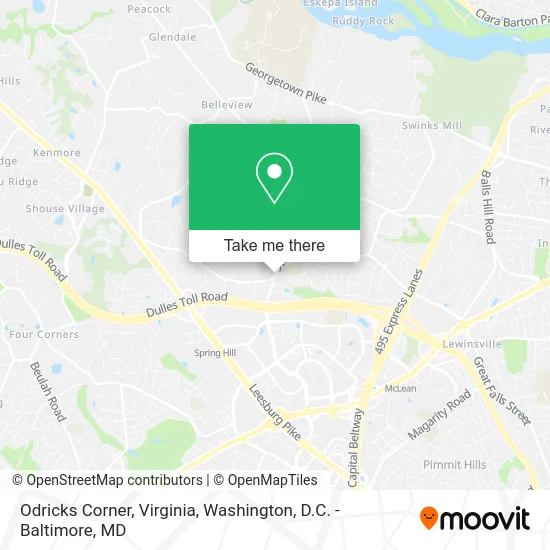
See Odricks Corner, Virginia, Fairfax County, on the map
Public Transit to Odricks Corner, Virginia in Fairfax County
Wondering how to get to Odricks Corner, Virginia in Fairfax County? Moovit helps you find the best way to get to Odricks Corner, Virginia with step-by-step directions from the nearest public transit station.
Moovit provides free maps and live directions to help you navigate through your city. View schedules, routes, timetables, and find out how long does it take to get to Odricks Corner, Virginia in real time.
Looking for the nearest stop or station to Odricks Corner, Virginia? Check out this list of stops closest to your destination: Spring Hill Rd @ Turning Leaf La; Tysons Westpark; Jones Branch Dr @ Lincoln Ctr; Jones Branch Dr @ Lincoln Way; Spring Hill.
Bus: 401, 427, 432, 574, 798, 402.Metro: SILVER.
Want to see if there’s another route that gets you there at an earlier time? Moovit helps you find alternative routes or times. Get directions from and directions to Odricks Corner, Virginia easily from the Moovit App or Website.
We make riding to Odricks Corner, Virginia easy, which is why over 1.5 million users, including users in Fairfax County, trust Moovit as the best app for public transit. You don’t need to download an individual bus app or train app, Moovit is your all-in-one transit app that helps you find the best bus time or train time available.
For information on prices of bus and metro, costs and ride fares to Odricks Corner, Virginia, please check the Moovit app.
Use the app to navigate to popular places including to the airport, hospital, stadium, grocery store, mall, coffee shop, school, college, and university.
Odricks Corner, Virginia Address: McLean, VA 22102 street in Fairfax County
- Springhill Elementary Playground,
- Domicile,
- McLean Hamlet Park,
- Tennis Central,
- District Renovations,
- Ortega's Tree Service,
- VA-267 W Exit 17 Centreville,
- Spring Hill Recreation Center (Spring Hill RECenter),
- Parks & Recreation Dept,
- Aikido McLean,
- TC Information,
- Spring Hill Recreation Center,
- VA-267 W Centreville,
- VA-267 E Entrance Centreville,
- VA-267 E Exit 17 Centreville,
- Tyson's Westpark TRANSIT Station,
- Freddie Mac,
- Leger Strategies,
- Freddie Mac CIRC,
- Jones Branch & Lincoln Way
Places Near Odricks Corner, Virginia (Fairfax County)
- Washington National Cathedral, Washington,
- Georgetown, Washington,
- Westfield Montgomery Mall, Montgomery County,
- National Theatre, Washington,
- Basilica of the National Shrine, Washington,
- PG Mall, Prince George's County,
- Amazon Hq2, Arlington County,
- The Anthem, Washington,
- M&T Bank Stadium, Baltimore,
- Capital One Arena, Washington,
- Warner Theatre, Washington,
- Marriott Marquis Washington, DC, Washington,
- National Museum of African American History and Culture, Washington,
- Sibley Memorial Hospital, Washington,
- Museum Of The Bible, Washington,
- National Zoo, Washington,
- Pennsylvania Ave NW (3rd st and pennsylvania), Washington,
- Washington DC VA Medical Center, Washington,
- Rock Creek Tennis Center, Washington,
- Camden Yards, Baltimore
How to get to popular places in Washington, D.C. - Baltimore, MD with public transit
Get around Fairfax County by public transit!
Traveling around Fairfax County has never been so easy. See step by step directions as you travel to any attraction, street or major public transit station. View bus and train schedules, arrival times, service alerts and detailed routes on a map, so you know exactly how to get to anywhere in Fairfax County.
When traveling to any destination around Fairfax County use Moovit's Live Directions with Get Off Notifications to know exactly where and how far to walk, how long to wait for your line, and how many stops are left. Moovit will alert you when it's time to get off — no need to constantly re-check whether yours is the next stop.
Wondering how to use public transit in Fairfax County or how to pay for public transit in Fairfax County? Moovit public transit app can help you navigate your way with public transit easily, and at minimum cost. It includes public transit fees, ticket prices, and costs. Looking for a map of Fairfax County public transit lines? Moovit public transit app shows all public transit maps in Fairfax County with all Bus, Train, Metro, Light Rail and Ferry routes and stops on an interactive map.
Washington, D.C. - Baltimore, MD has 5 transit type(s), including: Bus, Train, Metro, Light Rail and Ferry, operated by several transit agencies, including WMATA, Montgomery County Ride On, Fairfax Connector, TheBus, PRTC, DASH - Alexandria, Arlington Transit (ART), RTA of Central Maryland, MDOT MTA, MDOT MTA Light RailLink, MDOT MTA Commuter Bus, MDOT MTA Local Bus, FXBGO!, Virginia Railway Express (VRE) and MARC