How to get to Odyssey Charters by bus?
Click on the bus route to see step by step directions with maps, line arrival times and updated time schedules.
From Alligator Alley, Fort Lauderdale
59 minFrom Ross, Fort Lauderdale
38 minFrom Margate, FL, Coral Springs-Margate
59 minFrom Galleria at Fort Lauderdale (Galleria Mall At Fort Lauderdale), Fort Lauderdale
42 minFrom North Area Transportation Terminal, Pompano Beach
45 minFrom Cam Transfer, Coral Springs-Margate
53 minFrom Banco Davivienda sa Miami Internatl Branch, Fort Lauderdale
77 minFrom Galleria Mall, Fort Lauderdale
43 minFrom Xtreme Action Park, Fort Lauderdale
57 min
Bus stops near Odyssey Charters in Pompano Beach
Bus lines to Odyssey Charters in Pompano Beach
What are the closest stations to Odyssey Charters?
The closest stations to Odyssey Charters are:
- A1A/Atlantic Boulevard is 191 yards away, 3 min walk.
- Atlantic Boulevard/Hibiscus Avenue is 229 yards away, 3 min walk.
Which bus lines stop near Odyssey Charters?
These bus lines stop near Odyssey Charters: 10, 11, 42.
What’s the nearest bus station to Odyssey Charters in Pompano Beach?
The nearest bus stations to Odyssey Charters in Pompano Beach are A1A/Atlantic Boulevard and Atlantic Boulevard/Hibiscus Avenue. The closest one is a 3 min walk away.
What time is the first bus to Odyssey Charters in Pompano Beach?
The 11 is the first bus that goes to Odyssey Charters in Pompano Beach. It stops nearby at 4:39 AM.
What time is the last bus to Odyssey Charters in Pompano Beach?
The 11 is the last bus that goes to Odyssey Charters in Pompano Beach. It stops nearby at 12:34 AM.
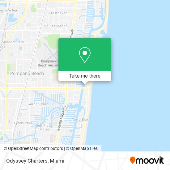
See Odyssey Charters, Pompano Beach, on the map
Public Transit to Odyssey Charters in Pompano Beach
Wondering how to get to Odyssey Charters in Pompano Beach? Moovit helps you find the best way to get to Odyssey Charters with step-by-step directions from the nearest public transit station.
Moovit provides free maps and live directions to help you navigate through your city. View schedules, routes, timetables, and find out how long does it take to get to Odyssey Charters in real time.
Looking for the nearest stop or station to Odyssey Charters? Check out this list of stops closest to your destination: A1A/Atlantic Boulevard; Atlantic Boulevard/Hibiscus Avenue.
Bus: 10, 11, 42.
Want to see if there’s another route that gets you there at an earlier time? Moovit helps you find alternative routes or times. Get directions from and directions to Odyssey Charters easily from the Moovit App or Website.
We make riding to Odyssey Charters easy, which is why over 1.5 million users, including users in Pompano Beach, trust Moovit as the best app for public transit. You don’t need to download an individual bus app or train app, Moovit is your all-in-one transit app that helps you find the best bus time or train time available.
For information on prices of bus, costs and ride fares to Odyssey Charters, please check the Moovit app.
Use the app to navigate to popular places including to the airport, hospital, stadium, grocery store, mall, coffee shop, school, college, and university.
Odyssey Charters Address: 101 N Riverside Dr Pompano Beach, FL 33062 street in Pompano Beach
- Ocean Supply,
- Global Expansion,
- Garzone Construction,
- Southern Airways Express,
- Lighthouse Dive Sands Harbor,
- J&J Luxury Charters,
- Wave Blast Water Sport,
- Underseas Sports,
- CITGO,
- Sands Resort and Marin,
- ATM,
- KC Jet Ski and Watersports Rental,
- High Life Parasail,
- Sands Waterfront Restaurant,
- Fire Station 11,
- Benny's Fishing Charters,
- Rma,
- My Yacht Sales,
- Freedom Boat Club,
- Ticket Max
Places Near Odyssey Charters (Pompano Beach)
- Miami Design District, Miami,
- Zoo Miami, Miami,
- Dolphin Mall, Miami,
- Little Havana, Miami,
- Wynwood, Miami,
- Hard Rock Stadium, Miami Gardens,
- Bayside Marketplace, Miami,
- Port of Miami Cruise Terminal, Miami,
- Sawgrass mall ( FL ), Miami Beach,
- Miami-Dade County Courthouse, Miami,
- Aventura Mall, Miami Beach,
- Miami VA Hospital, Miami,
- Sawgrass Mall, Miami,
- Keiser University Flagship Campus, West Palm Beach,
- Marlins Park, Miami,
- Dolphin Mall Bus, Miami,
- Richard E. Gerstein Justice Building, Miami,
- Brickell City Centre, Miami,
- Miami Freedom Park, Miami,
- Aventura Mall, Miami
How to get to popular places in Miami with public transit
Get around Pompano Beach by public transit!
Traveling around Pompano Beach has never been so easy. See step by step directions as you travel to any attraction, street or major public transit station. View bus and train schedules, arrival times, service alerts and detailed routes on a map, so you know exactly how to get to anywhere in Pompano Beach.
When traveling to any destination around Pompano Beach use Moovit's Live Directions with Get Off Notifications to know exactly where and how far to walk, how long to wait for your line, and how many stops are left. Moovit will alert you when it's time to get off — no need to constantly re-check whether yours is the next stop.
Wondering how to use public transit in Pompano Beach or how to pay for public transit in Pompano Beach? Moovit public transit app can help you navigate your way with public transit easily, and at minimum cost. It includes public transit fees, ticket prices, and costs. Looking for a map of Pompano Beach public transit lines? Moovit public transit app shows all public transit maps in Pompano Beach with all Bus, Train, Light Rail and Ferry routes and stops on an interactive map.
Miami has 4 transit type(s), including: Bus, Train, Light Rail and Ferry, operated by several transit agencies, including Broward County Transit, Miami-Dade Transit, Metrorail, Palm Tran, Tri-Rail, Brightline, MARTY, City of Homestead Trolley, Key West Transit, Treasure Coast Connector, GoLine IRT, Amtrak, Greyhound-us, FlixBus-us and Aventura Express Shuttle Bus