Directions to Off the Chain (Baltimore) with public transportation
The following transit lines have routes that pass near Off the Chain
 Bus: 40, 73, 80, 94, CITYLINK NAVY.
- Train: MARC.
- Metro: METRO.
- Light Rail: LIGHT RAILLINK.
How to get to Off the Chain by bus?
Click on the bus route to see step by step directions with maps, line arrival times and updated time schedules.
From Eastern Ave (eastern avenue and dundalk av), Baltimore
35 minFrom Reisterstown Road Plaza, Baltimore
58 minFrom Walmart, Baltimore County
47 minFrom I-695 @ Exit 17 (Security Blvd/MD 122), Baltimore County
36 minFrom Mva, Baltimore
53 minFrom NSA Friendship Annex (FANX), Anne Arundel County
74 minFrom Baltimore Poly Tech High School, Baltimore
37 minFrom Walmart Supercenter, Baltimore County
36 minFrom Guinness Open Gate Brewery & Barrel House, Baltimore County
55 minFrom MVA Glen Burnie, Anne Arundel County
52 min
How to get to Off the Chain by train?
Click on the train route to see step by step directions with maps, line arrival times and updated time schedules.
How to get to Off the Chain by metro?
Click on the metro route to see step by step directions with maps, line arrival times and updated time schedules.
Bus stops near Off the Chain in Baltimore
Metro station near Off the Chain in Baltimore
- Lexington Market Metro, 4 min walk,VIEW
Light Rail stations near Off the Chain in Baltimore
- Lexington Market, 5 min walk,VIEW
Bus lines to Off the Chain in Baltimore
- 210, 210/3 Annapolis/Baltimore,VIEW
- 215, 215/6 Baltimore,VIEW
- 310, 310/4 Johns Hopkins,VIEW
- CITYLINK ORANGE, Downtown,VIEW
- CITYLINK PURPLE, Catonsville,VIEW
- CITYLINK RED, Um Medical Center,VIEW
- 78, Cms,VIEW
- 150, Downtown/Harbor East,VIEW
- 69, Jumpers Hole,VIEW
- 70, Um Medical Center,VIEW
- 75, Arundel Mills Via Greyhound,VIEW
- 73, State Center,VIEW
- ORANGE ROUTE, B&O Railroad Museum,VIEW
- 71, Downtown,VIEW
What are the closest stations to Off the Chain?
The closest stations to Off the Chain are:
- Baltimore St & Paca St is 81 yards away, 2 min walk.
- Baltimore & Arch is 97 yards away, 2 min walk.
- Greene St & Fayette St Sb is 102 yards away, 2 min walk.
- Ummc - Baltimore St. & Greene St. (Eb) is 113 yards away, 2 min walk.
- Fayette St & Paca St is 126 yards away, 3 min walk.
- Lexington Market Metro is 269 yards away, 4 min walk.
- Lexington Market is 351 yards away, 5 min walk.
Which bus lines stop near Off the Chain?
These bus lines stop near Off the Chain: 40, 73, 80, 94, CITYLINK NAVY, CITYLINK ORANGE, CITYLINK PURPLE, CITYLINK YELLOW.
Which train line stops near Off the Chain?
MARC (Inbound - Penn)
Which metro line stops near Off the Chain?
METRO (Towards John Hopkins)
Which light rail line stops near Off the Chain?
LIGHT RAILLINK (Northbound)
What’s the nearest light rail station to Off the Chain in Baltimore?
The nearest light rail station to Off the Chain in Baltimore is Lexington Market. It’s a 5 min walk away.
What’s the nearest metro station to Off the Chain in Baltimore?
The nearest metro station to Off the Chain in Baltimore is Lexington Market Metro. It’s a 4 min walk away.
What’s the nearest bus station to Off the Chain in Baltimore?
The nearest bus stations to Off the Chain in Baltimore are Baltimore St & Paca St, Baltimore & Arch, Greene St & Fayette St Sb and Ummc - Baltimore St. & Greene St. (Eb). The closest one is a 2 min walk away.
What time is the first light rail to Off the Chain in Baltimore?
The LIGHT RAILLINK is the first light rail that goes to Off the Chain in Baltimore. It stops nearby at 3:56 AM.
What time is the last light rail to Off the Chain in Baltimore?
The LIGHT RAILLINK is the last light rail that goes to Off the Chain in Baltimore. It stops nearby at 1:20 AM.
What time is the first metro to Off the Chain in Baltimore?
The METRO is the first metro that goes to Off the Chain in Baltimore. It stops nearby at 5:08 AM.
What time is the last metro to Off the Chain in Baltimore?
The METRO is the last metro that goes to Off the Chain in Baltimore. It stops nearby at 12:25 AM.
What time is the first bus to Off the Chain in Baltimore?
The 75 is the first bus that goes to Off the Chain in Baltimore. It stops nearby at 3:08 AM.
What time is the last bus to Off the Chain in Baltimore?
The 73 is the last bus that goes to Off the Chain in Baltimore. It stops nearby at 3:14 AM.
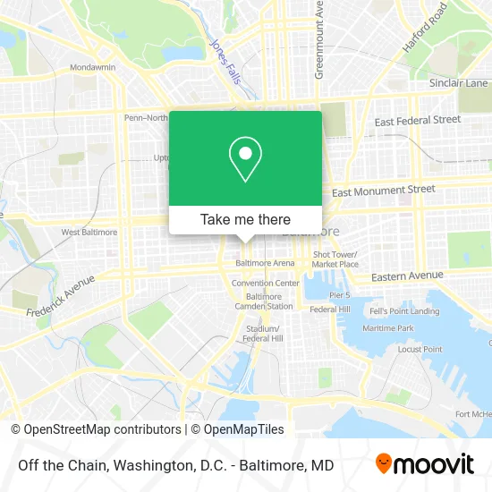
See Off the Chain, Baltimore, on the map
Public Transit to Off the Chain in Baltimore
Wondering how to get to Off the Chain in Baltimore? Moovit helps you find the best way to get to Off the Chain with step-by-step directions from the nearest public transit station.
Moovit provides free maps and live directions to help you navigate through your city. View schedules, routes, timetables, and find out how long does it take to get to Off the Chain in real time.
Looking for the nearest stop or station to Off the Chain? Check out this list of stops closest to your destination: Baltimore St & Paca St; Baltimore & Arch; Greene St & Fayette St Sb; Ummc - Baltimore St. & Greene St. (Eb); Fayette St & Paca St; Lexington Market Metro; Lexington Market.
Bus: 40, 73, 80, 94, CITYLINK NAVY, CITYLINK ORANGE, CITYLINK PURPLE, CITYLINK YELLOW, 210, 215, 310, CITYLINK RED, 78, 150, 69, 70, 75, ORANGE ROUTE.Train: MARC.Metro: METRO.Light Rail: LIGHT RAILLINK.
Want to see if there’s another route that gets you there at an earlier time? Moovit helps you find alternative routes or times. Get directions from and directions to Off the Chain easily from the Moovit App or Website.
We make riding to Off the Chain easy, which is why over 1.5 million users, including users in Baltimore, trust Moovit as the best app for public transit. You don’t need to download an individual bus app or train app, Moovit is your all-in-one transit app that helps you find the best bus time or train time available.
For information on prices of bus, metro, light rail and train, costs and ride fares to Off the Chain, please check the Moovit app.
Use the app to navigate to popular places including to the airport, hospital, stadium, grocery store, mall, coffee shop, school, college, and university.
Off the Chain Address: 538 W Baltimore St Baltimore, MD 21201 street in Baltimore
- Royal Sonesta Harbor Court Baltimore,
- Edgar Allan Poe's Grave Site and Memorial,
- Veteran Hospital,
- Grave of Edgar Allan Poe,
- Baltimore VA Medical Center,
- Baltimore Grand Garage,
- PNC Mortgage,
- STARBUCKS,
- Baltimore General Dispensary,
- Paca Street Firehouse,
- Swiss Steam Laundry Building of Cheese,
- Deddle's Donuts,
- Tasala Rufai,
- Dooley, Kevin P, DDS,
- Pyun, Lisa, DDS,
- Karopchinsky, Tifnie,
- PDS Optical,
- Melissa M. Wuechner, LSW,
- David M Pridmore, LCSW-C,
- Mai Phuong T. Tran, R.PH.
Places Near Off the Chain (Baltimore)
- Camden Yards, Baltimore,
- National Theatre, Washington,
- Pennsylvania Ave NW (3rd st and pennsylvania), Washington,
- Rock Creek Tennis Center, Washington,
- Warner Theatre, Washington,
- National Museum of African American History and Culture, Washington,
- Georgetown, Washington,
- Washington National Cathedral, Washington,
- Capital One Arena, Washington,
- PG Mall, Prince George's County,
- Westfield Montgomery Mall, Montgomery County,
- Washington DC VA Medical Center, Washington,
- M&T Bank Stadium, Baltimore,
- The Anthem, Washington,
- National Zoo, Washington,
- Sibley Memorial Hospital, Washington,
- Amazon Hq2, Arlington County,
- Basilica of the National Shrine, Washington,
- Museum Of The Bible, Washington,
- Marriott Marquis Washington, DC, Washington
How to get to popular places in Washington, D.C. - Baltimore, MD with public transit
Get around Baltimore by public transit!
Traveling around Baltimore has never been so easy. See step by step directions as you travel to any attraction, street or major public transit station. View bus and train schedules, arrival times, service alerts and detailed routes on a map, so you know exactly how to get to anywhere in Baltimore.
When traveling to any destination around Baltimore use Moovit's Live Directions with Get Off Notifications to know exactly where and how far to walk, how long to wait for your line, and how many stops are left. Moovit will alert you when it's time to get off — no need to constantly re-check whether yours is the next stop.
Wondering how to use public transit in Baltimore or how to pay for public transit in Baltimore? Moovit public transit app can help you navigate your way with public transit easily, and at minimum cost. It includes public transit fees, ticket prices, and costs. Looking for a map of Baltimore public transit lines? Moovit public transit app shows all public transit maps in Baltimore with all Bus, Train, Metro, Light Rail and Ferry routes and stops on an interactive map.
Washington, D.C. - Baltimore, MD has 5 transit type(s), including: Bus, Train, Metro, Light Rail and Ferry, operated by several transit agencies, including WMATA, Montgomery County Ride On, Fairfax Connector, TheBus, PRTC, DASH - Alexandria, Arlington Transit (ART), RTA of Central Maryland, MDOT MTA, MDOT MTA Light RailLink, MDOT MTA Commuter Bus, MDOT MTA Local Bus, FXBGO!, Virginia Railway Express (VRE) and MARC