Fare Zones Offline Map (PDF)
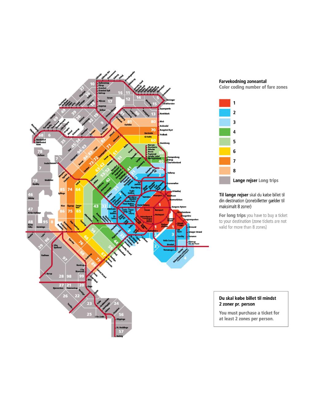
Moovit has an easy-to-download Fare Zones map, that serves as your offline Denmark light rail, ferry, bus, train or metro map while traveling. This map can be saved in your phone and it’s easy to share with friends. To view the downloaded map, no internet connection is required. It’s the offline light rail, ferry, bus, train or metro map in Denmark that will take you where you need to go.
Moovit has an easy-to-download Fare Zones map, that serves as your offline Denmark light rail, ferry, bus, train or metro map while traveling. This map can be saved in your phone and it’s easy to share with friends. To view the downloaded map, no internet connection is required. It’s the offline light rail, ferry, bus, train or metro map in Denmark that will take you where you need to go.
Find all light rail line schedules and routes in Denmark:
- Hundested St. - Hillerød St.

- Nærum St. - Jægersborg St.
- Tisvildeleje St. - Hillerød St.
- Roskilde St. - Rødvig St.
- Tølløse St. - Slagelse St.
- Nykøbing F St. - Nakskov St.
- Helsingør St. - Hillerød St.
- Helsingør St. - Gilleleje St.
- Faxe Ladeplads St. - Køge St.
- Holbæk St. - Nykøbing Sj St.
- 33
- 81
- 330
- 6
- 116
- 704
- 223
- 123
- 12
- 802
- 912X
- 515
- 237
- 1005
- 803
- 694
- 1002
- 561
- 100
- 570
- 2
- 560
- 314
- 211
- 34
- 230
- 335
- 3A
- 740
- 711
- 504
- 509
- 8
- 420
- 696
- 523
- 444
- 171
- 722
- 55
- 217
- 205
- 443
- 762
- 1003
- 62
- 64
- 235
- 2
- 403
- 2B
- 349
- 200
- 8300
- 3
- 122
- 231
- 6A
- 331
- 804
- 3
- 751
- 31
- 6
- 568
- 106
- 8301
- 716
- 1
- 4
- 202
- 238
- 513
- 402
- 28
- 190
- 189
- 191
- 101
- 40
- 596
- 5
- 105
- 404
- 1006
- 10
- 4A
- 306
- 150
- 1008