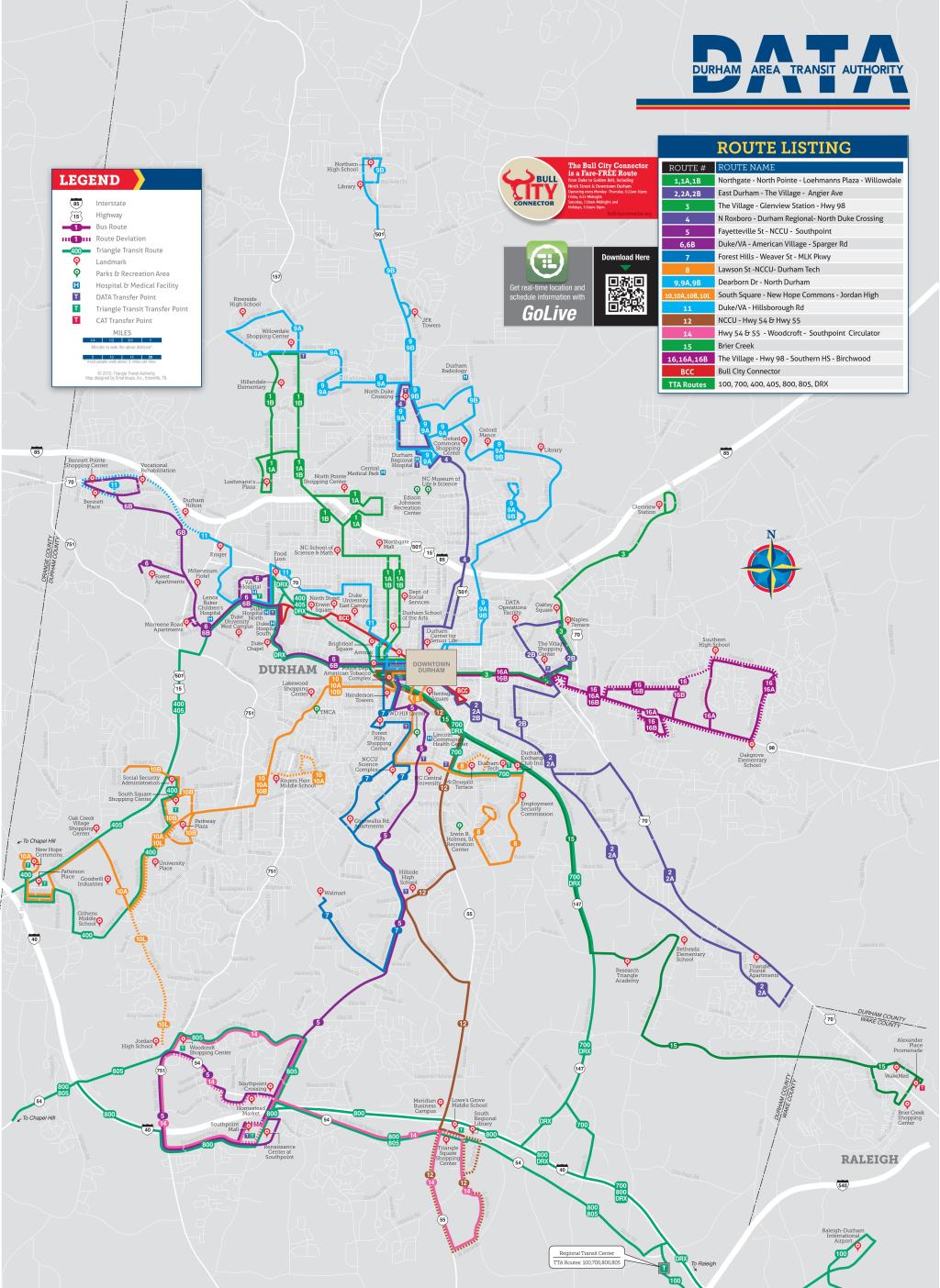
Raleigh DATA Offline Map (PDF)
Moovit has an easy-to-download Raleigh DATA Map, that serves as your offline Raleigh bus map while traveling. This map can be saved in your phone and it’s easy to share with friends. To view the downloaded map, no internet connection is required. It’s the offline bus map in Raleigh that will take you where you need to go.
Can't see the map? Click here to view it in a full page
Find all bus line schedules and routes in Raleigh:
- N. Roxboro Rd - Duke Regional - North Duke Crossing
4
- Holloway St - Village - Glenview Station
3
- 2: E. Main St – Angier Ave – Brier Creek
2
- Carrboro -> Durham Station
405
- Northgate - N. Pointe - Horton Rd/Guess Rd
1
- Duke Univ -> Durham Station -> Goraleigh Station
DRX
- Chapel Hill Rd - S. Square - Shannon Rd
10B
- 12: E. Main St – Nccu – Southpoint
12
- W. Main St - Duke/VA - Hillsborough Rd
11
- Chapel Hill Rd - S. Square - New Hope Commons
10
- Lawson St - NCCU - Durham Tech
8
- Forest Hills - Weaver St/S. Roxboro St - MLK Parkway
7
- 6: Chapel Hill St – Duke/Va – Crest St
6
- 5: Fayetteville St – Nccu – Southpoint
5
- Raleigh -> Rdu -> Regional Transit Center
100
- Nc 54 at Alston Ave -> Regional Transit Center
805
- Regional Transit Center -> Unc Hospitals
800
- Dearborn - Riverview - Northern HS
9B
- Durham Station -> Regional Transit Center
700
- Dearborn - Duke Regional - Riverside HS
9A
- Durham Station -> Unc Hospitals
400