How to get to Okbfaa by bus?
Click on the bus route to see step by step directions with maps, line arrival times and updated time schedules.
From Lodes Patricia Phy, Tulsa
42 minFrom E 41st St S&S Sheridan Rd, Tulsa
64 minFrom Autoworx, Tulsa
63 minFrom F's Hawaiian Food, Tulsa
42 minFrom Sarah Beth Flanders, Tulsa
72 minFrom Warren Clinic Plastic Surgery, Tulsa
71 minFrom St. John Medical Center, Tulsa
42 minFrom Derricks Lawn Care, Tulsa
45 minFrom KW Brews & Booze Shop, Tulsa
53 min
Bus stops near Okbfaa in Tulsa
What are the closest stations to Okbfaa?
The closest stations to Okbfaa are:
- (7988) Garnett Rd & 17th St Nb is 103 yards away, 2 min walk.
- (7000) 21st St. & Garnett Rd. Wb is 527 yards away, 7 min walk.
Which bus lines stop near Okbfaa?
These bus lines stop near Okbfaa: 150, 470.
What’s the nearest bus station to Okbfaa in Tulsa?
The nearest bus station to Okbfaa in Tulsa is (7988) Garnett Rd & 17th St Nb. It’s a 2 min walk away.
What time is the first bus to Okbfaa in Tulsa?
The 470 is the first bus that goes to Okbfaa in Tulsa. It stops nearby at 6:05 AM.
What time is the last bus to Okbfaa in Tulsa?
The 150 is the last bus that goes to Okbfaa in Tulsa. It stops nearby at 7:18 PM.
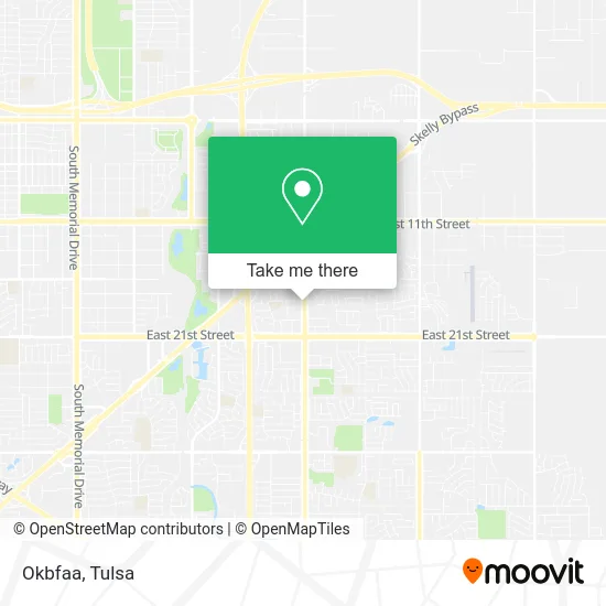
See Okbfaa, Tulsa, on the map
Public Transit to Okbfaa in Tulsa
Wondering how to get to Okbfaa in Tulsa? Moovit helps you find the best way to get to Okbfaa with step-by-step directions from the nearest public transit station.
Moovit provides free maps and live directions to help you navigate through your city. View schedules, routes, timetables, and find out how long does it take to get to Okbfaa in real time.
Looking for the nearest stop or station to Okbfaa? Check out this list of stops closest to your destination: (7988) Garnett Rd & 17th St Nb; (7000) 21st St. & Garnett Rd. Wb.
Bus: 150, 470.
Want to see if there’s another route that gets you there at an earlier time? Moovit helps you find alternative routes or times. Get directions from and directions to Okbfaa easily from the Moovit App or Website.
We make riding to Okbfaa easy, which is why over 1.5 million users, including users in Tulsa, trust Moovit as the best app for public transit. You don’t need to download an individual bus app or train app, Moovit is your all-in-one transit app that helps you find the best bus time or train time available.
For information on prices of bus, costs and ride fares to Okbfaa, please check the Moovit app.
Use the app to navigate to popular places including to the airport, hospital, stadium, grocery store, mall, coffee shop, school, college, and university.
Okbfaa Address: 11210 E 17th St S Tulsa, OK 74128 street in Tulsa
- Unidos Pharmacy,
- Smokin Joe's Hamburgers,
- TACO BELL,
- McDonald's,
- Tulsa Fabrics & Things,
- Oil Capital Electric,
- 99¢ & Up Discount Store,
- C J Enterprises,
- Crudoolandia,
- Crudoolandia Tulsa,
- Holy Ghost Ministry,
- Acts of Service Plumbing,
- Castro Auto Repair,
- Rams - Real Estate,
- Henrich Dental,
- Emergency Heating & Cooling Repair,
- La Tapatia,
- Altitude Bi Consulting,
- Metro Bell Investments,
- Venus Infinite Properties
Places Near Okbfaa (Tulsa)
- Bixby, OK, Bixby,
- Woodland Hills Mall, Tulsa,
- Hard Rock Casino, Tulsa,
- Broken Arrow, OK, Broken Arrow,
- Fallout Shelter, Tulsa,
- River Spirit Casino, Tulsa,
- Plaza Santa Cecilia, Tulsa,
- Osage Casino, Tulsa,
- St. Francis Hospital Outpatient Infusion, Tulsa,
- Tulsa State Fair, Tulsa,
- S Garnett Rd / E 21st St, Tulsa,
- Saint Francis Hospital, Tulsa,
- Tulsa Zoo, Tulsa,
- Tulsa Ok, Tulsa,
- Zavala Plus, Tulsa,
- 71st & Memorial, Tulsa,
- Walmart, Tulsa,
- 11th & Garnett, Tulsa,
- St Francis South Cardinal Building, Tulsa,
- Alagon Spa (Olympus Spa), Tulsa
How to get to popular places in Tulsa with public transit
Get around Tulsa by public transit!
Traveling around Tulsa has never been so easy. See step by step directions as you travel to any attraction, street or major public transit station. View bus and train schedules, arrival times, service alerts and detailed routes on a map, so you know exactly how to get to anywhere in Tulsa.
When traveling to any destination around Tulsa use Moovit's Live Directions with Get Off Notifications to know exactly where and how far to walk, how long to wait for your line, and how many stops are left. Moovit will alert you when it's time to get off — no need to constantly re-check whether yours is the next stop.
Wondering how to use public transit in Tulsa or how to pay for public transit in Tulsa? Moovit public transit app can help you navigate your way with public transit easily, and at minimum cost. It includes public transit fees, ticket prices, and costs. Looking for a map of Tulsa public transit lines? Moovit public transit app shows all public transit maps in Tulsa with all bus routes and stops on an interactive map.
Tulsa has 1 transit type(s), including: bus, operated by several transit agencies, including MetroLink Tulsa and Greyhound-us