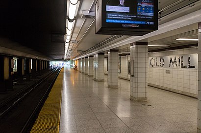
Old Mill Station stop - Monday schedule
| Line | Direction | Time |
|---|---|---|
| 66 | Old Mill Station | 5:35 AM |
| 66 | Old Mill Station | 5:55 AM |
| 66A | Humber Loop at the Queensway | 5:56 AM |
| 66 | Old Mill Station | 6:06 AM |
| 66 | Old Mill Station | 6:11 AM |
| 66A | Humber Loop at the Queensway | 6:12 AM |
| 66 | Old Mill Station | 6:22 AM |
| 66 | Old Mill Station | 6:27 AM |
| 66A | Humber Loop at the Queensway | 6:28 AM |
| 66 | Old Mill Station | 6:38 AM |
| 66 | Old Mill Station | 6:43 AM |
| 66A | Humber Loop at the Queensway | 6:44 AM |
| 66 | Old Mill Station | 6:54 AM |
| 66A | Humber Loop at the Queensway | 6:55 AM |
| 66 | Old Mill Station | 6:59 AM |
| 66 | Old Mill Station | 7:04 AM |
| 66A | Humber Loop at the Queensway | 7:08 AM |
| 66 | Old Mill Station | 7:14 AM |
| 66 | Old Mill Station | 7:17 AM |
| 66A | Humber Loop at the Queensway | 7:23 AM |
| 66 | Old Mill Station | 7:24 AM |
| 66 | Old Mill Station | 7:32 AM |
| 66 | Old Mill Station | 7:34 AM |
| 66A | Humber Loop at the Queensway | 7:38 AM |
| 66 | Old Mill Station | 7:44 AM |
Directions to Old Mill Station stop (Toronto) with public transit
The following transit lines have routes that pass near Old Mill Station
 Bus: 149, 26, 66, 935.
- Train: UP.
- Subway: 2.
How to get to Old Mill Station stop by bus?
Click on the bus route to see step by step directions with maps, line arrival times and updated time schedules.
How to get to Old Mill Station stop by train?
Click on the train route to see step by step directions with maps, line arrival times and updated time schedules.
How to get to Old Mill Station stop by subway?
Click on the subway route to see step by step directions with maps, line arrival times and updated time schedules.
Subway stations near Old Mill Station station in Toronto
- Jane, 14 min walk,
What are the closest stations to Old Mill Station?
The closest stations to Old Mill Station are:
- Jane is 1083 meters away, 14 min walk.
Which bus lines stop near Old Mill Station?
These bus lines stop near Old Mill Station: 149, 26, 66, 935.
Which train line stops near Old Mill Station?
UP (Up Express Union Station→Up Express Pearson Airport)
Which subway line stops near Old Mill Station?
2 (Towards Kipling)
What’s the nearest subway station to Old Mill Station in Toronto?
The nearest subway station to Old Mill Station in Toronto is Jane. It’s a 14 min walk away.
What time is the first subway to Old Mill Station in Toronto?
The 2 is the first subway that goes to Old Mill Station in Toronto. It stops nearby at 5:43 AM.
What time is the last subway to Old Mill Station in Toronto?
The 2 is the last subway that goes to Old Mill Station in Toronto. It stops nearby at 2:11 AM.
What time is the first bus to Old Mill Station in Toronto?
The 300B is the first bus that goes to Old Mill Station in Toronto. It stops nearby at 3:00 AM.
What time is the last bus to Old Mill Station in Toronto?
The 300B is the last bus that goes to Old Mill Station in Toronto. It stops nearby at 3:52 AM.
See Old Mill Station stop, Toronto, on the map
Public transit to Old Mill Station stop (ID: 15297) in Toronto
Looking for directions to Old Mill Station in Toronto, Canada?
Download the Moovit App to find the current schedule and step-by-step directions for Subway, Bus, Train or Streetcar routes that pass through Old Mill Station.
Looking for the nearest stops closest to Old Mill Station ? Check out this list of closest stops to your destination: Jane.
Bus: 149, 26, 66, 935.Train: UP.Subway: 2.
We make riding on public transit to Old Mill Station easy, which is why over 1.5 million users, including users in Toronto trust Moovit as the best app for public transit.
Use the app to navigate to popular places including to the airport, hospital, stadium, grocery store, mall, coffee shop, school, college, and university.
Old Mill Station stop’s code is 15297
The first line to this stop is 66, at 5:35 AM, and the last line is 66 at 1:12 AM.
Old Mill Bus Loop, Toronto, ON, Canada
This stop serves TTC’s lines
- Jane
Subway station near Old Mill Station station
- Kipling Ave at Rathburn Rd,
- Britannia Rd at Ninth Line,
- Dufferin St at Glencairn Ave,
- Kipling Ave at Belfield Rd - Etobicoke North Go Station,
- Grenoble Blvd N/Of Central Park Dr,
- Avenue Rd at Dupont St,
- Islington Ave at St Andrews Blvd,
- 85 Emmett Ave,
- Cambridge Smart Centre,
- 400 Danforth Rd,
- Dupont St at Ossington Ave,
- King St West at Blue Jays Way East Side,
- Derry Rd at Mavis Rd,
- High Park Ave at Dundas St West South Side,
- Humber College Blvd at Finch Ave West South Side,
- Lawson Rd at Kingston Rd - Highway 2a Overpass,
- Queen St West at Ossington Ave,
- Eglinton Go,
- Pioneer / Homer Watson,
- Eglinton Ave East at Laird Dr
Popular public transit stations in Toronto
Get around Toronto by public transit!
Traveling around Toronto has never been so easy. See step by step directions as you travel to any attraction, street or major public transit station. View bus and train schedules, arrival times, service alerts and detailed routes on a map, so you know exactly how to get to anywhere in Toronto.
When traveling to any destination around Toronto use Moovit's Live Directions with Get Off Notifications to know exactly where and how far to walk, how long to wait for your line, and how many stops are left. Moovit will alert you when it's time to get off — no need to constantly re-check whether yours is the next stop.
Wondering how to use public transit in Toronto or how to pay for public transit in Toronto? Moovit public transit app can help you navigate your way with public transit easily, and at minimum cost. It includes public transit fees, ticket prices, and costs. Looking for a map of Toronto public transit lines? Moovit public transit app shows all public transit maps in Toronto with all Bus, Train, Subway, Streetcar and Ferry routes and stops on an interactive map.
Toronto has 5 transit type(s), including: Bus, Train, Subway, Streetcar and Ferry, operated by several transit agencies, including Toronto Subway, Brampton Transit, MiWay, York Region Transit, GO Transit Bus, GO Transit, Durham Region Transit, UP Express, Grand River Transit, Guelph Transit, Hamilton Street Railway, Burlington Transit, Oakville Transit, Peterborough Transit and Barrie Transit