Directions to Old Post Office Building (Lynn) with public transportation
The following transit lines have routes that pass near Old Post Office Building
 Bus: 426, 429, 435, 436, 441.
- Train: NEWBURYPORT/ROCKPORT.
- Ferry: LYNN FERRY.
How to get to Old Post Office Building by bus?
Click on the bus route to see step by step directions with maps, line arrival times and updated time schedules.
From North Shore Mall, Peabody
43 minFrom Courtyard by Marriott Boston Logan Airport, Boston
36 minFrom Massachusetts Water Resource Authority (MWRA), Chelsea
53 minFrom Melrose Wakefield Hospital, Malden
63 minFrom Chelsea, MA, Chelsea
56 minFrom Revere Beach, Revere
26 minFrom Four Points by Sheraton Boston Logan Airport, Revere
40 minFrom Peabody, MA, Peabody
28 minFrom Kowloon Restaurant, Saugus
49 min
How to get to Old Post Office Building by train?
Click on the train route to see step by step directions with maps, line arrival times and updated time schedules.
Bus stops near Old Post Office Building in Lynn
Train station near Old Post Office Building in Lynn
- Lynn Interim, 6 min walk,VIEW
Ferry station near Old Post Office Building in Lynn
- Blossom Street Pier, 20 min walk,VIEW
Bus lines to Old Post Office Building in Lynn
- 436, Central Square via Malls & Lynnfield St - Liberty Tree via North Shore Mall & Lynnfield St,VIEW
- 439, Wonderland via Central Square - Nahant,VIEW
- 441, Wonderland via Paradise Rd & Central Square - Marblehead via Central Square & Paradise Rd,VIEW
- 442, Wonderland via Central Square & Humphrey St - Marblehead via Central Square & Humphrey St,VIEW
- 455, Wonderland via Central Square - Salem Depot via Central Square,VIEW
- 456, Central Square - Salem Depot,VIEW
- 441/442, Wonderland - Ocean St via Central Square,VIEW
- 435, Central Square Via Malls,VIEW
- 429, Kings Lynn,VIEW
- 426, Haymarket Via Cliftondale,VIEW
- NEWBURYPORT LINE SHUTTLE, Oak Grove (Local Shuttle),VIEW
- NEWBURYPORT/ROCKPORT LINE SHUTTLE, Swampscott (Shuttle),VIEW
- NEWBURYPORT/ROCKPORT LINE SHUTTLE, Beverly (Shuttle),VIEW
What are the closest stations to Old Post Office Building?
The closest stations to Old Post Office Building are:
- Union St @ Exchange St is 229 yards away, 3 min walk.
- Washington St @ Essex St is 267 yards away, 4 min walk.
- Tremont St Opp St Mary's High School is 300 yards away, 4 min walk.
- Market St @ Tremont St is 401 yards away, 6 min walk.
- Lynn Interim is 503 yards away, 6 min walk.
- Market Street @ Lynn Commuter Rail is 620 yards away, 8 min walk.
- Blossom Street Pier is 1673 yards away, 20 min walk.
Which bus lines stop near Old Post Office Building?
These bus lines stop near Old Post Office Building: 426, 429, 435, 436, 441, 455.
Which train line stops near Old Post Office Building?
NEWBURYPORT/ROCKPORT (#125 | Newburyport)
What’s the nearest train station to Old Post Office Building in Lynn?
The nearest train station to Old Post Office Building in Lynn is Lynn Interim. It’s a 6 min walk away.
What’s the nearest bus station to Old Post Office Building in Lynn?
The nearest bus station to Old Post Office Building in Lynn is Union St @ Exchange St. It’s a 3 min walk away.
What’s the nearest ferry station to Old Post Office Building in Lynn?
The nearest ferry station to Old Post Office Building in Lynn is Blossom Street Pier. It’s a 20 min walk away.
What time is the first train to Old Post Office Building in Lynn?
The NEWBURYPORT/ROCKPORT is the first train that goes to Old Post Office Building in Lynn. It stops nearby at 5:27 AM.
What time is the last train to Old Post Office Building in Lynn?
The NEWBURYPORT/ROCKPORT is the last train that goes to Old Post Office Building in Lynn. It stops nearby at 12:20 AM.
What time is the first bus to Old Post Office Building in Lynn?
The 455 is the first bus that goes to Old Post Office Building in Lynn. It stops nearby at 4:45 AM.
What time is the last bus to Old Post Office Building in Lynn?
The 426 is the last bus that goes to Old Post Office Building in Lynn. It stops nearby at 1:46 AM.
What time is the first ferry to Old Post Office Building in Lynn?
The LYNN FERRY is the first ferry that goes to Old Post Office Building in Lynn. It stops nearby at 6:00 AM.
What time is the last ferry to Old Post Office Building in Lynn?
The LYNN FERRY is the last ferry that goes to Old Post Office Building in Lynn. It stops nearby at 7:55 PM.
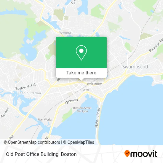
See Old Post Office Building, Lynn, on the map
Public Transit to Old Post Office Building in Lynn
Wondering how to get to Old Post Office Building in Lynn? Moovit helps you find the best way to get to Old Post Office Building with step-by-step directions from the nearest public transit station.
Moovit provides free maps and live directions to help you navigate through your city. View schedules, routes, timetables, and find out how long does it take to get to Old Post Office Building in real time.
Looking for the nearest stop or station to Old Post Office Building? Check out this list of stops closest to your destination: Union St @ Exchange St; Washington St @ Essex St; Tremont St Opp St Mary's High School; Market St @ Tremont St; Lynn Interim; Market Street @ Lynn Commuter Rail; Blossom Street Pier.
Bus: 426, 429, 435, 436, 441, 455, 439, 442.Train: NEWBURYPORT/ROCKPORT.Ferry: LYNN FERRY.
Want to see if there’s another route that gets you there at an earlier time? Moovit helps you find alternative routes or times. Get directions from and directions to Old Post Office Building easily from the Moovit App or Website.
We make riding to Old Post Office Building easy, which is why over 1.7 million users, including users in Lynn, trust Moovit as the best app for public transit. You don’t need to download an individual bus app or train app, Moovit is your all-in-one transit app that helps you find the best bus time or train time available.
For information on prices of bus, train and subway, costs and ride fares to Old Post Office Building, please check the Moovit app.
Use the app to navigate to popular places including to the airport, hospital, stadium, grocery store, mall, coffee shop, school, college, and university.
Old Post Office Building Address: 360 Washington St street in Lynn
- Los V Tires & Auto Services,
- Taqueria Doña Julia,
- Key Plus Locks Locksmith,
- Melchris Market,
- Prince Painting,
- Tequila's Bar and Grill,
- FedEx,
- Lynn Shelter Association,
- Garage Door Opener Repair,
- Lynn Police Station,
- Scarlett Hernandez - Total Mortgage, NMLS #1481186,
- Dayton Hotel,
- Insurance Fraud Bureau of Masschstts,
- High Grade Shade & Screen Co,
- D'Amici's Artistry in Banking,
- Josue Auto Detailing,
- Josue Auto Body & Mechanic Inc.,
- Lozan Landscape & Tree,
- District Attorney Office Salem,
- Lafountain & Wollman P.C.
Places Near Old Post Office Building (Lynn)
- House Of Blues, Boston,
- Boston Common, Boston,
- Quincy Market, Boston,
- Wilbur Theatre, Boston,
- Cheers, Boston,
- Boston Children's Hospital, Boston,
- Faneuil Hall, Boston,
- Prudential Center, Boston,
- Seaport District, Boston,
- Massachusetts General Hospital, Boston,
- North End, Boston,
- Castle Island, Boston,
- Isabella Stewart Gardner Museum, Boston,
- Mgm Music Hall, Boston,
- Leader Bank Pavilion (Leader Bank Pavillion), Boston,
- Boston Convention & Exhibition Center, Boston,
- Museum Of Science, Boston,
- Td Garden, Boston,
- Boston Medical Center, Boston,
- Wang Theater, Boston
How to get to popular places in Boston with public transit
Get around Lynn by public transit!
Traveling around Lynn has never been so easy. See step by step directions as you travel to any attraction, street or major public transit station. View bus and train schedules, arrival times, service alerts and detailed routes on a map, so you know exactly how to get to anywhere in Lynn.
When traveling to any destination around Lynn use Moovit's Live Directions with Get Off Notifications to know exactly where and how far to walk, how long to wait for your line, and how many stops are left. Moovit will alert you when it's time to get off — no need to constantly re-check whether yours is the next stop.
Wondering how to use public transit in Lynn or how to pay for public transit in Lynn? Moovit public transit app can help you navigate your way with public transit easily, and at minimum cost. It includes public transit fees, ticket prices, and costs. Looking for a map of Lynn public transit lines? Moovit public transit app shows all public transit maps in Lynn with all Bus, Train, Subway and Ferry routes and stops on an interactive map.
Boston has 4 transit type(s), including: Bus, Train, Subway and Ferry, operated by several transit agencies, including MBTA, Southeastern Regional Transit Authority, MetroWest Regional Transit Authority, Rhode Island Public Transit Authority, WRTA, Lowell Regional Transit Authority, Merrimack Valley Transit, Montachusett Regional Transit Authority, Cape Cod Regional Transit Authority, Brockton Area Transit Authority, Martha's Vineyard Transit Authority, the WAVE - Nantucket Regional Transit Authority, GATRA, Cape Ann Transportation Authority and Massport
Public transit lines with stations closest to Old Post Office Building in Lynn
Train lines with stations closest to Old Post Office Building in Lynn
Bus lines with stations closest to Old Post Office Building in Lynn
Union St @ Exchange St
- 436Central Square via Malls & Lynnfield St - Liberty Tree via North Shore Mall & Lynnfield St
- 439Wonderland via Central Square - Nahant
- 441Wonderland via Paradise Rd & Central Square - Marblehead via Central Square & Paradise Rd
- 442Wonderland via Central Square & Humphrey St - Marblehead via Central Square & Humphrey St
- 455Wonderland via Central Square - Salem Depot via Central Square