Directions to Olson Custom Designs (Indianapolis City (Balance)) with public transportation
The following transit lines have routes that pass near Olson Custom Designs
 Bus: 37.
How to get to Olson Custom Designs by bus?
Click on the bus route to see step by step directions with maps, line arrival times and updated time schedules.
From Butler University Jordan Hall, Indianapolis City (Balance)
74 minFrom Entrance I-65 N, Indianapolis City (Balance)
37 minFrom Heather McPherson Atty, Indianapolis City (Balance)
68 minFrom Turntable, Indianapolis City (Balance)
91 minFrom Westend Dental, Indianapolis City (Balance)
30 minFrom LR Advertising, Speedway
67 minFrom I-65 and Michigan, Indianapolis City (Balance)
66 minFrom 4600 Sunset Ave Parking, Indianapolis City (Balance)
78 minFrom Ross Hall Front Desk, Indianapolis City (Balance)
78 minFrom Broad Ripple Park Tennis Courts, Indianapolis City (Balance)
101 min
Bus stop near Olson Custom Designs in Indianapolis City (Balance)
- Georgetown Rd - 7520 N, 5 min walk,VIEW
Bus lines to Olson Custom Designs in Indianapolis City (Balance)
- 37, Transit Center,VIEW
What are the closest stations to Olson Custom Designs?
The closest stations to Olson Custom Designs are:
- Georgetown Rd - 7520 N is 378 yards away, 5 min walk.
Which bus line stops near Olson Custom Designs?
37 (Intech Park)
What’s the nearest bus station to Olson Custom Designs in Indianapolis City (Balance)?
The nearest bus station to Olson Custom Designs in Indianapolis City (Balance) is Georgetown Rd - 7520 N. It’s a 5 min walk away.
What time is the first bus to Olson Custom Designs in Indianapolis City (Balance)?
The 37 is the first bus that goes to Olson Custom Designs in Indianapolis City (Balance). It stops nearby at 4:47 AM.
What time is the last bus to Olson Custom Designs in Indianapolis City (Balance)?
The 37 is the last bus that goes to Olson Custom Designs in Indianapolis City (Balance). It stops nearby at 10:59 PM.
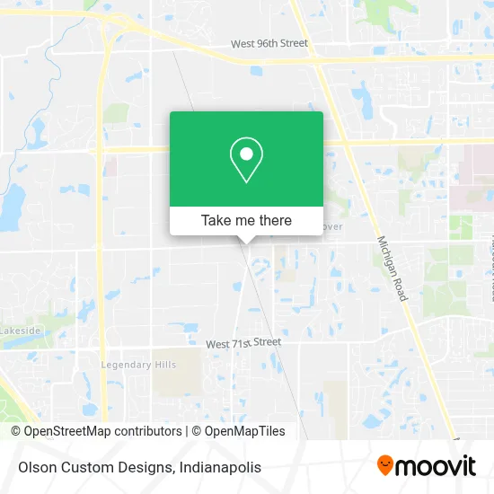
See Olson Custom Designs, Indianapolis City (Balance), on the map
Public Transit to Olson Custom Designs in Indianapolis City (Balance)
Wondering how to get to Olson Custom Designs in Indianapolis City (Balance)? Moovit helps you find the best way to get to Olson Custom Designs with step-by-step directions from the nearest public transit station.
Moovit provides free maps and live directions to help you navigate through your city. View schedules, routes, timetables, and find out how long does it take to get to Olson Custom Designs in real time.
Looking for the nearest stop or station to Olson Custom Designs? Check out this list of stops closest to your destination: Georgetown Rd - 7520 N.
Bus: 37.
Want to see if there’s another route that gets you there at an earlier time? Moovit helps you find alternative routes or times. Get directions from and directions to Olson Custom Designs easily from the Moovit App or Website.
We make riding to Olson Custom Designs easy, which is why over 1.5 million users, including users in Indianapolis City (Balance), trust Moovit as the best app for public transit. You don’t need to download an individual bus app or train app, Moovit is your all-in-one transit app that helps you find the best bus time or train time available.
For information on prices of bus, costs and ride fares to Olson Custom Designs, please check the Moovit app.
Use the app to navigate to popular places including to the airport, hospital, stadium, grocery store, mall, coffee shop, school, college, and university.
Olson Custom Designs Address: 4825 W 79th St street in Indianapolis City (Balance)
- Cardinal Health,
- Indy Tours,
- Food & Fun Express,
- Emt,
- Fischer Process Industries,
- R.S. Hughes Co. Inc,
- Bittersweet Woodworks,
- The Closet Factory,
- Veho,
- Mount Pleasant Missnry Chu,
- Metal Supermarkets,
- Prime Source,
- Novipax,
- Ferguson,
- McAfee Distribution,
- smart Garage Doors & Gates,
- Indy Partners,
- Wisheks,
- L. Phoenix Decor Flooring & Cabinets,
- Endangered Species Chocolate
Places Near Olson Custom Designs (Indianapolis City (Balance))
- I U Health Methodist Hospital, Indianapolis City (Balance),
- Cotter's Massage Parlor With Happy Endings, Indianapolis City (Balance),
- St. Vincent Hospital - Indianapolis, Indianapolis City (Balance),
- Indianapolis Airport Zone 2, Indianapolis City (Balance),
- Lucas Oil Stadium, Indianapolis City (Balance),
- Eskenazi Hospital, Indianapolis City (Balance),
- St. Vincent entrance #1, Indianapolis City (Balance),
- I-465 / I-65 Interchange, Indianapolis City (Balance),
- Indianapolis Motor Speedway, Speedway,
- Methodist Hospital of Indianapolis, Indianapolis City (Balance),
- Gainbridge Fieldhouse, Indianapolis City (Balance),
- THE BALT, Indianapolis City (Balance),
- Plainfield, IN, Plainfield,
- Castleton Square Mall, Indianapolis,
- Indiana, Indianapolis City (Balance),
- Indiana Convention Center, Indianapolis City (Balance),
- Train Ride At Castleton Mall, Indianapolis City (Balance),
- 119 W 19th St Parking, Indianapolis City (Balance),
- Lilly Corporate Center (Eli Lilly & Co), Indianapolis City (Balance),
- Jersey Barn, Indianapolis City (Balance)
How to get to popular places in Indianapolis with public transit
Get around Indianapolis City (Balance) by public transit!
Traveling around Indianapolis City (Balance) has never been so easy. See step by step directions as you travel to any attraction, street or major public transit station. View bus and train schedules, arrival times, service alerts and detailed routes on a map, so you know exactly how to get to anywhere in Indianapolis City (Balance).
When traveling to any destination around Indianapolis City (Balance) use Moovit's Live Directions with Get Off Notifications to know exactly where and how far to walk, how long to wait for your line, and how many stops are left. Moovit will alert you when it's time to get off — no need to constantly re-check whether yours is the next stop.
Wondering how to use public transit in Indianapolis City (Balance) or how to pay for public transit in Indianapolis City (Balance)? Moovit public transit app can help you navigate your way with public transit easily, and at minimum cost. It includes public transit fees, ticket prices, and costs. Looking for a map of Indianapolis City (Balance) public transit lines? Moovit public transit app shows all public transit maps in Indianapolis City (Balance) with all bus routes and stops on an interactive map.
Indianapolis has 1 transit type(s), including: bus, operated by several transit agencies, including IndyGo, FlixBus-us and Greyhound-us