How to get to Omega Watches by bus?
Click on the bus route to see step by step directions with maps, line arrival times and updated time schedules.
From I-83 Exit 16 (Timonium Road), Baltimore County
102 minFrom Mva, Baltimore
22 minFrom Western High School, Baltimore
55 minFrom I-695 @ Exit 17 (Security Blvd/MD 122), Baltimore County
53 minFrom Light Rail-Timonium Fairgrounds, Baltimore County
155 minFrom Mondawmin Mall, Baltimore
42 minFrom The Maryland Zoo In Baltimore, Baltimore
43 minFrom Sinai Hospital, Baltimore
55 minFrom Social Security Administration (Robert M. Ball Building), Baltimore County
73 minFrom Coppin State University, Baltimore
73 min
How to get to Omega Watches by metro?
Click on the metro route to see step by step directions with maps, line arrival times and updated time schedules.
Bus stops near Omega Watches in Baltimore County
Metro station near Omega Watches in Baltimore County
- Old Court Metro, 33 min walk,VIEW
What are the closest stations to Omega Watches?
The closest stations to Omega Watches are:
- Reisterstown Rd & Hooks Ln Nb is 110 yards away, 2 min walk.
- Reisterstown Rd & Woodholme Ln FS Sb is 202 yards away, 3 min walk.
- Old Court Metro is 2759 yards away, 33 min walk.
Which bus lines stop near Omega Watches?
These bus lines stop near Omega Watches: 85, 89.
Which metro line stops near Omega Watches?
METRO (Towards Owing Mills)
What’s the nearest bus station to Omega Watches in Baltimore County?
The nearest bus station to Omega Watches in Baltimore County is Reisterstown Rd & Hooks Ln Nb. It’s a 2 min walk away.
What time is the first metro to Omega Watches in Baltimore County?
The METRO is the first metro that goes to Omega Watches in Baltimore County. It stops nearby at 4:56 AM.
What time is the last metro to Omega Watches in Baltimore County?
The METRO is the last metro that goes to Omega Watches in Baltimore County. It stops nearby at 12:26 AM.
What time is the first bus to Omega Watches in Baltimore County?
The 89 is the first bus that goes to Omega Watches in Baltimore County. It stops nearby at 5:12 AM.
What time is the last bus to Omega Watches in Baltimore County?
The 89 is the last bus that goes to Omega Watches in Baltimore County. It stops nearby at 12:52 AM.
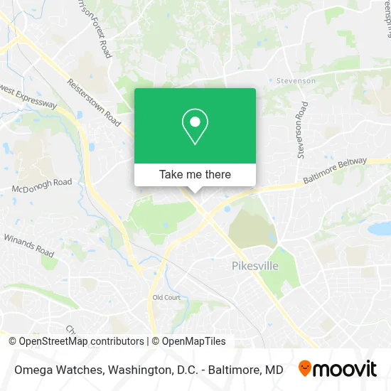
See Omega Watches, Baltimore County, on the map
Public Transit to Omega Watches in Baltimore County
Wondering how to get to Omega Watches in Baltimore County? Moovit helps you find the best way to get to Omega Watches with step-by-step directions from the nearest public transit station.
Moovit provides free maps and live directions to help you navigate through your city. View schedules, routes, timetables, and find out how long does it take to get to Omega Watches in real time.
Looking for the nearest stop or station to Omega Watches? Check out this list of stops closest to your destination: Reisterstown Rd & Hooks Ln Nb; Reisterstown Rd & Woodholme Ln FS Sb; Old Court Metro.
Bus: 85, 89, 92.Metro: METRO.
Want to see if there’s another route that gets you there at an earlier time? Moovit helps you find alternative routes or times. Get directions from and directions to Omega Watches easily from the Moovit App or Website.
We make riding to Omega Watches easy, which is why over 1.7 million users, including users in Baltimore County, trust Moovit as the best app for public transit. You don’t need to download an individual bus app or train app, Moovit is your all-in-one transit app that helps you find the best bus time or train time available.
For information on prices of bus, metro and light rail, costs and ride fares to Omega Watches, please check the Moovit app.
Use the app to navigate to popular places including to the airport, hospital, stadium, grocery store, mall, coffee shop, school, college, and university.
Omega Watches Address: 1819 Reisterstown Road street in Baltimore County
- Woodholme Center,
- Trader Joe's-Pikesville,MD,
- Andrea Howard Real Estate Consultant,
- I-695 @ Exit 20 (Reisterstown Rd / MD 140),
- Target,
- DoubleTree by Hilton Baltimore North - Pikesville,
- Bpes,
- Ramada Hotel Baltimore West,
- Pomona Square,
- I-695 (Baltimore Beltway),
- 400 Mt Wilson Ln,
- Blessed Soles Podiatry,
- Ashley Ramtahal Real Estate Services (Odessa Moseley Real Estate),
- Ner Israel Rabbinical College,
- Club,
- Oasis Ministries of MD,
- Paisley Experience,
- Bruce H Sindler MD,
- Post Office,
- Uscis Application Support Center
Places Near Omega Watches (Baltimore County)
- Westfield Montgomery Mall, Montgomery County,
- Amazon Hq2, Arlington County,
- Marriott Marquis Washington, DC, Washington,
- Georgetown, Washington,
- Museum Of The Bible, Washington,
- M&T Bank Stadium, Baltimore,
- National Zoo, Washington,
- Warner Theatre, Washington,
- National Theatre, Washington,
- Sibley Memorial Hospital, Washington,
- Camden Yards, Baltimore,
- Rock Creek Tennis Center, Washington,
- National Museum of African American History and Culture, Washington,
- Washington DC VA Medical Center, Washington,
- Basilica of the National Shrine, Washington,
- PG Mall, Prince George's County,
- The Anthem, Washington,
- Washington National Cathedral, Washington,
- Pennsylvania Ave NW (3rd st and pennsylvania), Washington,
- Capital One Arena, Washington
How to get to popular places in Washington, D.C. - Baltimore, MD with public transit
Get around Baltimore County by public transit!
Traveling around Baltimore County has never been so easy. See step by step directions as you travel to any attraction, street or major public transit station. View bus and train schedules, arrival times, service alerts and detailed routes on a map, so you know exactly how to get to anywhere in Baltimore County.
When traveling to any destination around Baltimore County use Moovit's Live Directions with Get Off Notifications to know exactly where and how far to walk, how long to wait for your line, and how many stops are left. Moovit will alert you when it's time to get off — no need to constantly re-check whether yours is the next stop.
Wondering how to use public transit in Baltimore County or how to pay for public transit in Baltimore County? Moovit public transit app can help you navigate your way with public transit easily, and at minimum cost. It includes public transit fees, ticket prices, and costs. Looking for a map of Baltimore County public transit lines? Moovit public transit app shows all public transit maps in Baltimore County with all Bus, Train, Metro, Light Rail and Ferry routes and stops on an interactive map.
Washington, D.C. - Baltimore, MD has 5 transit type(s), including: Bus, Train, Metro, Light Rail and Ferry, operated by several transit agencies, including WMATA, Montgomery County Ride On, Fairfax Connector, TheBus, PRTC, DASH - Alexandria, Arlington Transit (ART), RTA of Central Maryland, MDOT MTA, MDOT MTA Light RailLink, MDOT MTA Commuter Bus, MDOT MTA Local Bus, FXBGO!, Virginia Railway Express (VRE) and MARC