How to get to One Auto Solution by bus?
Click on the bus route to see step by step directions with maps, line arrival times and updated time schedules.
From Costco Wholesale, Miami
43 minFrom NW 183rd St / NW 7th Ave, Miami Gardens
46 minFrom Casino Miami, Miami
57 minFrom Cape Coral Insure, Hialeah
100 minFrom La Quinta Inn & Suites Miami Airport East, Miami
40 minFrom NW 17th Ave / NW 36th St, Miami
70 minFrom Little Haiti, Miami
71 minFrom Westland Hialeah Senior High School, Hialeah
73 minFrom Embassy Suites by Hilton Miami International Airport, Miami
61 minFrom Comfort Inn & Suites Miami International Airport, Miami
71 min
How to get to One Auto Solution by train?
Click on the train route to see step by step directions with maps, line arrival times and updated time schedules.
Bus stops near One Auto Solution in Miami
Train station near One Auto Solution in Miami
- Opa-Locka Station, 8 min walk,VIEW
Bus lines to One Auto Solution in Miami
What are the closest stations to One Auto Solution?
The closest stations to One Auto Solution are:
- Opa Locka Bd & West Dr is 128 yards away, 2 min walk.
- Sinbad Av & Superior St is 366 yards away, 5 min walk.
- Opa-Locka Tri-Rail Station is 658 yards away, 9 min walk.
- Opa-Locka Station is 658 yards away, 8 min walk.
Which bus lines stop near One Auto Solution?
These bus lines stop near One Auto Solution: 135, 32.
Which train line stops near One Auto Solution?
TRIRAIL (Northbound To Mangonia Park)
What’s the nearest train station to One Auto Solution in Miami?
The nearest train station to One Auto Solution in Miami is Opa-Locka Station. It’s a 8 min walk away.
What’s the nearest bus station to One Auto Solution in Miami?
The nearest bus station to One Auto Solution in Miami is Opa Locka Bd & West Dr. It’s a 2 min walk away.
What time is the first train to One Auto Solution in Miami?
The TRIRAIL is the first train that goes to One Auto Solution in Miami. It stops nearby at 4:02 AM.
What time is the last train to One Auto Solution in Miami?
The TRIRAIL is the last train that goes to One Auto Solution in Miami. It stops nearby at 10:29 PM.
What time is the first bus to One Auto Solution in Miami?
The 135 is the first bus that goes to One Auto Solution in Miami. It stops nearby at 5:00 AM.
What time is the last bus to One Auto Solution in Miami?
The 32 is the last bus that goes to One Auto Solution in Miami. It stops nearby at 11:54 PM.
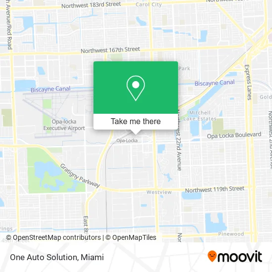
See One Auto Solution, Miami, on the map
Public Transit to One Auto Solution in Miami
Wondering how to get to One Auto Solution in Miami? Moovit helps you find the best way to get to One Auto Solution with step-by-step directions from the nearest public transit station.
Moovit provides free maps and live directions to help you navigate through your city. View schedules, routes, timetables, and find out how long does it take to get to One Auto Solution in real time.
Looking for the nearest stop or station to One Auto Solution? Check out this list of stops closest to your destination: Opa Locka Bd & West Dr; Sinbad Av & Superior St; Opa-Locka Tri-Rail Station; Opa-Locka Station.
Bus: 135, 32, OPALCKA, OPALKAN, 42.Train: TRIRAIL.
Want to see if there’s another route that gets you there at an earlier time? Moovit helps you find alternative routes or times. Get directions from and directions to One Auto Solution easily from the Moovit App or Website.
We make riding to One Auto Solution easy, which is why over 1.5 million users, including users in Miami, trust Moovit as the best app for public transit. You don’t need to download an individual bus app or train app, Moovit is your all-in-one transit app that helps you find the best bus time or train time available.
For information on prices of bus and train, costs and ride fares to One Auto Solution, please check the Moovit app.
Use the app to navigate to popular places including to the airport, hospital, stadium, grocery store, mall, coffee shop, school, college, and university.
One Auto Solution Address: West Dr Opa-Locka, FL 33054 street in Miami
- Steel Homes Modular,
- Tabernacle of Bethlehem,
- Los Amigos del Sol Cafe I,
- Teen Upward Bound,
- Janay Family Food Market,
- Boulevard Cleaners,
- Marina's Bar & Restaurant,
- BC Print Shop,
- Uptown Uptown,
- El Forito Hookah and Lounge,
- Opa-Locka Thematic Resource Area,
- B&V Restaurant Bar-Grill,
- City of Opa-Locka, Florida,
- Water Utility Services,
- Opa Locka Police Department,
- Opa locka,
- Metrorail - Opa-locka Station,
- Post Office,
- 550 Fisherman St Parking,
- Kenmore Appliance Repair
Places Near One Auto Solution (Miami)
- Brickell City Centre, Miami,
- Richard E. Gerstein Justice Building, Miami,
- Zoo Miami, Miami,
- Wynwood, Miami,
- Dolphin Mall, Miami,
- Little Havana, Miami,
- Port of Miami Cruise Terminal, Miami,
- Marlins Park, Miami,
- Miami Freedom Park, Miami,
- Keiser University Flagship Campus, West Palm Beach,
- Dolphin Mall Bus, Miami,
- Aventura Mall, Miami Beach,
- Bayside Marketplace, Miami,
- Sawgrass mall ( FL ), Miami Beach,
- Miami Design District, Miami,
- Miami-Dade County Courthouse, Miami,
- Hard Rock Stadium, Miami Gardens,
- Miami VA Hospital, Miami,
- Aventura Mall, Miami,
- Sawgrass Mall, Miami
How to get to popular places in Miami with public transit
Get around Miami by public transit!
Traveling around Miami has never been so easy. See step by step directions as you travel to any attraction, street or major public transit station. View bus and train schedules, arrival times, service alerts and detailed routes on a map, so you know exactly how to get to anywhere in Miami.
When traveling to any destination around Miami use Moovit's Live Directions with Get Off Notifications to know exactly where and how far to walk, how long to wait for your line, and how many stops are left. Moovit will alert you when it's time to get off — no need to constantly re-check whether yours is the next stop.
Wondering how to use public transit in Miami or how to pay for public transit in Miami? Moovit public transit app can help you navigate your way with public transit easily, and at minimum cost. It includes public transit fees, ticket prices, and costs. Looking for a map of Miami public transit lines? Moovit public transit app shows all public transit maps in Miami with all Bus, Train, Light Rail and Ferry routes and stops on an interactive map.
Miami has 4 transit type(s), including: Bus, Train, Light Rail and Ferry, operated by several transit agencies, including Broward County Transit, Miami-Dade Transit, Metrorail, Palm Tran, Tri-Rail, Brightline, MARTY, City of Homestead Trolley, Key West Transit, Treasure Coast Connector, GoLine IRT, Amtrak, Greyhound-us, FlixBus-us and Aventura Express Shuttle Bus