Directions to Operating Room (Baltimore) with public transportation
The following transit lines have routes that pass near Operating Room
 Bus: 22, CITYLINK RED, CITYLINK SILVER, PURPLE ROUTE, 51.
- Train: NORTHEAST REGIONAL, ACELA, CARDINAL, CAROLINIAN, CRESCENT.
- Metro: METRO.
How to get to Operating Room by bus?
Click on the bus route to see step by step directions with maps, line arrival times and updated time schedules.
From M&T Bank Stadium, Baltimore
44 minFrom Walmart Supercenter, Baltimore County
65 minFrom Reisterstown Road Plaza, Baltimore
43 minFrom Social Security Administration (Robert M. Ball Building), Baltimore County
72 minFrom Hanover, Baltimore
33 minFrom Walmart, Baltimore County
64 minFrom I-70 at Security Blvd Baltimore City Lot Park & Ride, Baltimore
61 minFrom Walmart, Baltimore County
55 minFrom Johns Hopkins Medicine at Green Spring Station, Baltimore County
54 minFrom Maryland, Baltimore
46 min
How to get to Operating Room by train?
Click on the train route to see step by step directions with maps, line arrival times and updated time schedules.
How to get to Operating Room by metro?
Click on the metro route to see step by step directions with maps, line arrival times and updated time schedules.
Bus stops near Operating Room in Baltimore
Light Rail stations near Operating Room in Baltimore
- Penn Station, 40 min walk,VIEW
Train station near Operating Room in Baltimore
- Baltimore Penn Station, 40 min walk,VIEW
Bus lines to Operating Room in Baltimore
What are the closest stations to Operating Room?
The closest stations to Operating Room are:
- 33rd St & Guilford Ave is 159 yards away, 3 min walk.
- University Pwky & Charles St Wb is 210 yards away, 3 min walk.
- Charles St & University Pkwy Nb is 240 yards away, 4 min walk.
- 33rd St. - Medstar Union Memorial Hospital (Sb) is 270 yards away, 4 min walk.
- University Pkwy & Saint Paul St Sb is 357 yards away, 5 min walk.
- Penn Station is 3311 yards away, 40 min walk.
- Baltimore Penn Station is 3311 yards away, 40 min walk.
Which bus lines stop near Operating Room?
These bus lines stop near Operating Room: 22, CITYLINK RED, CITYLINK SILVER, PURPLE ROUTE.
Which train line stops near Operating Room?
NORTHEAST REGIONAL (Springfield)
Which metro line stops near Operating Room?
METRO (Towards John Hopkins)
What’s the nearest bus station to Operating Room in Baltimore?
The nearest bus stations to Operating Room in Baltimore are 33rd St & Guilford Ave and University Pwky & Charles St Wb. The closest one is a 3 min walk away.
What time is the first light rail to Operating Room in Baltimore?
The LIGHT RAILLINK is the first light rail that goes to Operating Room in Baltimore. It stops nearby at 3:42 AM.
What time is the last light rail to Operating Room in Baltimore?
The LIGHT RAILLINK is the last light rail that goes to Operating Room in Baltimore. It stops nearby at 1:30 AM.
What time is the first train to Operating Room in Baltimore?
The ACELA is the first train that goes to Operating Room in Baltimore. It stops nearby at 5:34 AM.
What time is the last train to Operating Room in Baltimore?
The SILVER METEOR is the last train that goes to Operating Room in Baltimore. It stops nearby at 7:57 AM.
What time is the first bus to Operating Room in Baltimore?
The CITYLINK SILVER is the first bus that goes to Operating Room in Baltimore. It stops nearby at 3:05 AM.
What time is the last bus to Operating Room in Baltimore?
The CITYLINK SILVER is the last bus that goes to Operating Room in Baltimore. It stops nearby at 3:07 AM.
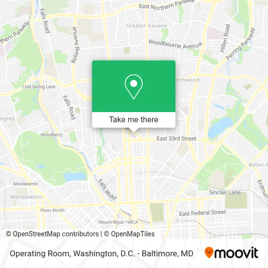
See Operating Room, Baltimore, on the map
Public Transit to Operating Room in Baltimore
Wondering how to get to Operating Room in Baltimore? Moovit helps you find the best way to get to Operating Room with step-by-step directions from the nearest public transit station.
Moovit provides free maps and live directions to help you navigate through your city. View schedules, routes, timetables, and find out how long does it take to get to Operating Room in real time.
Looking for the nearest stop or station to Operating Room? Check out this list of stops closest to your destination: 33rd St & Guilford Ave; University Pwky & Charles St Wb; Charles St & University Pkwy Nb; 33rd St. - Medstar Union Memorial Hospital (Sb); University Pkwy & Saint Paul St Sb; Penn Station; Baltimore Penn Station.
Bus: 22, CITYLINK RED, CITYLINK SILVER, PURPLE ROUTE, 51, 95.Train: NORTHEAST REGIONAL, ACELA, CARDINAL, CAROLINIAN, CRESCENT.Metro: METRO.
Want to see if there’s another route that gets you there at an earlier time? Moovit helps you find alternative routes or times. Get directions from and directions to Operating Room easily from the Moovit App or Website.
We make riding to Operating Room easy, which is why over 1.7 million users, including users in Baltimore, trust Moovit as the best app for public transit. You don’t need to download an individual bus app or train app, Moovit is your all-in-one transit app that helps you find the best bus time or train time available.
For information on prices of bus, train, light rail and metro, costs and ride fares to Operating Room, please check the Moovit app.
Use the app to navigate to popular places including to the airport, hospital, stadium, grocery store, mall, coffee shop, school, college, and university.
Operating Room Address: 201 E University Pkwy street in Baltimore
- Union Memorial Hospital,
- Medstar Union Memorial Hospital,
- Abel Wolman House,
- Amazon Locker-Zane,
- 33rd and Greenmount Ave,
- East 33rd Street & Greenmount Avenue,
- MTA Bus Stop - Greenmount & 33rd (#8),
- Johns Hopkins University,
- Neuroplasticity And Development Laboratory, Jhu,
- Lab For Child Development at Johns Hopkins University,
- Giant Food Stores,
- Center For Systems Science And Engineering,
- Engineering Innovation at Johns Hopkins University,
- Baltimore Museum Of Art,
- Newton White Athletic Center,
- Department Of Electrical And Computer Engineering,
- Johns Hopkins University Writing Program,
- Inn at The Colonnade Baltimore - A DoubleTree by Hilton Hotel,
- Jhu Rec,
- Johns Hopkins University Glass Pavilion
Places Near Operating Room (Baltimore)
- Washington National Cathedral, Washington,
- Pennsylvania Ave NW (3rd st and pennsylvania), Washington,
- Westfield Montgomery Mall, Montgomery County,
- National Museum of African American History and Culture, Washington,
- Amazon Hq2, Arlington County,
- Sibley Memorial Hospital, Washington,
- National Zoo, Washington,
- The Anthem, Washington,
- Warner Theatre, Washington,
- Rock Creek Tennis Center, Washington,
- PG Mall, Prince George's County,
- National Theatre, Washington,
- Marriott Marquis Washington, DC, Washington,
- Georgetown, Washington,
- M&T Bank Stadium, Baltimore,
- Camden Yards, Baltimore,
- Capital One Arena, Washington,
- Museum Of The Bible, Washington,
- Basilica of the National Shrine, Washington,
- Washington DC VA Medical Center, Washington
How to get to popular places in Washington, D.C. - Baltimore, MD with public transit
Get around Baltimore by public transit!
Traveling around Baltimore has never been so easy. See step by step directions as you travel to any attraction, street or major public transit station. View bus and train schedules, arrival times, service alerts and detailed routes on a map, so you know exactly how to get to anywhere in Baltimore.
When traveling to any destination around Baltimore use Moovit's Live Directions with Get Off Notifications to know exactly where and how far to walk, how long to wait for your line, and how many stops are left. Moovit will alert you when it's time to get off — no need to constantly re-check whether yours is the next stop.
Wondering how to use public transit in Baltimore or how to pay for public transit in Baltimore? Moovit public transit app can help you navigate your way with public transit easily, and at minimum cost. It includes public transit fees, ticket prices, and costs. Looking for a map of Baltimore public transit lines? Moovit public transit app shows all public transit maps in Baltimore with all Bus, Train, Metro, Light Rail and Ferry routes and stops on an interactive map.
Washington, D.C. - Baltimore, MD has 5 transit type(s), including: Bus, Train, Metro, Light Rail and Ferry, operated by several transit agencies, including WMATA, Montgomery County Ride On, Fairfax Connector, TheBus, PRTC, DASH - Alexandria, Arlington Transit (ART), RTA of Central Maryland, MDOT MTA, MDOT MTA Light RailLink, MDOT MTA Commuter Bus, MDOT MTA Local Bus, FXBGO!, Virginia Railway Express (VRE) and MARC