Directions to Optical Choice (Queens) with public transportation
The following transit lines have routes that pass near Optical Choice
 Bus: Q10, Q60, QM68, QM18, QM11.
- Train: BABYLON BRANCH, LONG BEACH BRANCH, CITY TERMINAL ZONE, FAR ROCKAWAY BRANCH, HEMPSTEAD BRANCH.
- Subway: F, FX, E, M, R.
How to get to Optical Choice by bus?
Click on the bus route to see step by step directions with maps, line arrival times and updated time schedules.
How to get to Optical Choice by train?
Click on the train route to see step by step directions with maps, line arrival times and updated time schedules.
How to get to Optical Choice by subway?
Click on the subway route to see step by step directions with maps, line arrival times and updated time schedules.
Subway stations near Optical Choice in Queens
Bus stops near Optical Choice in Queens
Train station near Optical Choice in Queens
- Forest Hills, 10 min walk,VIEW
Bus lines to Optical Choice in Queens
- Q60, Jamaica LIRR Via Queens Bl,VIEW
- QM18, S. Ozone Pk 130 St Via Lefferts Bl,VIEW
- QM11, Forest Hills,VIEW
- QM63, Rosedale,VIEW
- QM64, Elmont,VIEW
- QM68, Floral Park,VIEW
- QM65, Laurelton,VIEW
- Q45, Kew Gardens Via Union Tpke,VIEW
- Q46, Rush Lij Hospital Via Union Tpke,VIEW
- Q48, Rush Glen Oaks Via Union Tpke,VIEW
- Q23, Forest Hills Union Tpke Via 108 St,VIEW
- Q64, Forest Hills Via Jewel Av Via 69 Rd,VIEW
What are the closest stations to Optical Choice?
The closest stations to Optical Choice are:
- 75 Av is 130 yards away, 2 min walk.
- Queens Blvd/76 Av is 243 yards away, 4 min walk.
- Queens Blvd/Ascan Av is 255 yards away, 4 min walk.
- Queens Blvd/72 Dr is 396 yards away, 5 min walk.
- Queens Blvd/78 Av is 666 yards away, 9 min walk.
- Forest Hills-71 Av is 741 yards away, 9 min walk.
- 108 St/Queens Blvd is 793 yards away, 10 min walk.
- Forest Hills is 802 yards away, 10 min walk.
- 108 St/Queens Bl is 810 yards away, 10 min walk.
Which bus lines stop near Optical Choice?
These bus lines stop near Optical Choice: Q10, Q60, QM68.
Which train lines stop near Optical Choice?
These train lines stop near Optical Choice: BABYLON BRANCH, LONG BEACH BRANCH.
Which subway lines stop near Optical Choice?
These subway lines stop near Optical Choice: F, FX.
What’s the nearest subway station to Optical Choice in Queens?
The nearest subway station to Optical Choice in Queens is 75 Av. It’s a 2 min walk away.
What’s the nearest train station to Optical Choice in Queens?
The nearest train station to Optical Choice in Queens is Forest Hills. It’s a 10 min walk away.
What’s the nearest bus station to Optical Choice in Queens?
The nearest bus stations to Optical Choice in Queens are Queens Blvd/76 Av and Queens Blvd/Ascan Av. The closest one is a 4 min walk away.
What time is the first subway to Optical Choice in Queens?
The E is the first subway that goes to Optical Choice in Queens. It stops nearby at 3:00 AM.
What time is the last subway to Optical Choice in Queens?
The F is the last subway that goes to Optical Choice in Queens. It stops nearby at 4:06 AM.
What time is the first train to Optical Choice in Queens?
The BABYLON BRANCH is the first train that goes to Optical Choice in Queens. It stops nearby at 3:00 AM.
What time is the last train to Optical Choice in Queens?
The BABYLON BRANCH is the last train that goes to Optical Choice in Queens. It stops nearby at 3:02 AM.
What time is the first bus to Optical Choice in Queens?
The Q45 is the first bus that goes to Optical Choice in Queens. It stops nearby at 3:00 AM.
What time is the last bus to Optical Choice in Queens?
The Q46 is the last bus that goes to Optical Choice in Queens. It stops nearby at 3:11 AM.
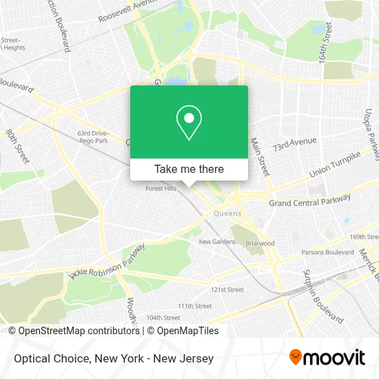
See Optical Choice, Queens, on the map
Public Transit to Optical Choice in Queens
Wondering how to get to Optical Choice in Queens? Moovit helps you find the best way to get to Optical Choice with step-by-step directions from the nearest public transit station.
Moovit provides free maps and live directions to help you navigate through your city. View schedules, routes, timetables, and find out how long does it take to get to Optical Choice in real time.
Looking for the nearest stop or station to Optical Choice? Check out this list of stops closest to your destination: 75 Av; Queens Blvd/76 Av; Queens Blvd/Ascan Av; Queens Blvd/72 Dr; Queens Blvd/78 Av; Forest Hills-71 Av; 108 St/Queens Blvd; Forest Hills; 108 St/Queens Bl.
Bus: Q10, Q60, QM68, QM18, QM11.Train: BABYLON BRANCH, LONG BEACH BRANCH, CITY TERMINAL ZONE, FAR ROCKAWAY BRANCH, HEMPSTEAD BRANCH.Subway: F, FX, E, M, R.
Want to see if there’s another route that gets you there at an earlier time? Moovit helps you find alternative routes or times. Get directions from and directions to Optical Choice easily from the Moovit App or Website.
We make riding to Optical Choice easy, which is why over 1.5 million users, including users in Queens, trust Moovit as the best app for public transit. You don’t need to download an individual bus app or train app, Moovit is your all-in-one transit app that helps you find the best bus time or train time available.
For information on prices of subway, bus, train and light rail, costs and ride fares to Optical Choice, please check the Moovit app.
Use the app to navigate to popular places including to the airport, hospital, stadium, grocery store, mall, coffee shop, school, college, and university.
Optical Choice Address: 11811 Queens Blvd street in Queens
- Q60,
- Affordable Home Program Llc,
- Rego Park Dentist,
- Fdny Engine 305 & Ladder 151,
- Jimmy Sales Chevy,
- Forest Hills Sleep Center,
- 25 Nước Mắm Cốt Cá Cơm Bếp Xưa,
- Tokyo Market,
- New York Times,
- Art Of Grill,
- Western Union,
- Habachi & Sushi Bar,
- Walgreens,
- Take Me To the Water Swim School,
- Advanced Dentistry Of New York,
- Walgreens Pharmacy,
- Queens Blvd (75th ave queens),
- New Age Medical,
- Walgreens #19694,
- Western Union
Places Near Optical Choice (Queens)
- Chinatown, Manhattan,
- Rockefeller Center, Manhattan,
- 911 Memorial, Manhattan,
- San Gennaro Feast, Manhattan,
- Queens Center Mall, Queens,
- Bellevue Hospital, Manhattan,
- 26 Federal Plaza, Manhattan,
- Wall Street, Manhattan,
- 111 Centre New York City Supreme Court, Manhattan,
- Mountainside Hospital, Glen Ridge,
- Times Square, Manhattan,
- 1 Police Plaza, Manhattan,
- 3 Stone St, Manhattan,
- Pier 83, Manhattan,
- Hudson Yards, Manhattan,
- SoHo, Manhattan,
- qqqq, Manhattan,
- 376 Hudson Street, Manhattan,
- Katz's Deli, Manhattan,
- 66 John Street, Manhattan
How to get to popular places in New York - New Jersey with public transit
Get around Queens by public transit!
Traveling around Queens has never been so easy. See step by step directions as you travel to any attraction, street or major public transit station. View bus and train schedules, arrival times, service alerts and detailed routes on a map, so you know exactly how to get to anywhere in Queens.
When traveling to any destination around Queens use Moovit's Live Directions with Get Off Notifications to know exactly where and how far to walk, how long to wait for your line, and how many stops are left. Moovit will alert you when it's time to get off — no need to constantly re-check whether yours is the next stop.
Wondering how to use public transit in Queens or how to pay for public transit in Queens? Moovit public transit app can help you navigate your way with public transit easily, and at minimum cost. It includes public transit fees, ticket prices, and costs. Looking for a map of Queens public transit lines? Moovit public transit app shows all public transit maps in Queens with all Bus, Train, Subway, Light Rail, Ferry and Cable Car routes and stops on an interactive map.
New York - New Jersey has 6 transit type(s), including: Bus, Train, Subway, Light Rail, Ferry and Cable Car, operated by several transit agencies, including MTA Subway, Metro-North Railroad, LIRR, PATH, MTA New York City Transit - Express routes, MTA Bus, NJ Transit, NYC Ferry, NICE bus, Bee-Line Bus, NJ Transit Rail, Norwalk Transit District, Hartford Line, River Valley Transit and HART