Directions to Optileaf (Wichita) with public transportation
The following transit lines have routes that pass near Optileaf
How to get to Optileaf by bus?
Click on the bus route to see step by step directions with maps, line arrival times and updated time schedules.
From 2nd Chance Home Decor, Wichita
22 minFrom Auto Glass Now, Wichita
29 minFrom Allstar, Wichita
53 minFrom Governors Cigar Lounge, Wichita
61 minFrom Show Submenu for Addiction Treatment, Wichita
42 minFrom Coleman Middle School, Wichita
38 minFrom Oaklawn Activity Center, Oaklawn-Sunview
39 minFrom 2019 W 29th St S, Wichita
35 min
Bus stops near Optileaf in Wichita
Bus lines to Optileaf in Wichita
- Q-LINE CLIFTON T, Q Westbound,VIEW
- ROUTE15: DOUGLAS, 15ibtic1hr Detou,VIEW
- ROUTE12: DOUGLAS, Route 12 Inbound,VIEW
- ROUTE14: DOUGLAS, Route 14 Outboun,VIEW
- ROUTE13: N BDWY-, Route 13 Inbound,VIEW
- ROUTE27: N BDWY-, Route 27 Outboun,VIEW
- EAST HIGH SCHOOL, East High Schoo,VIEW
- MEAD MIDDLE, Mead Going Home,VIEW
- NORTH HIGH SCHOO, North High To Sc,VIEW
- SOUTH HIGH, South High Rt. 1,VIEW
- SOUTHEAST HIGH, Southeast High R,VIEW
- ROUTE11: MAPLE-R, Bwsf Inbound,VIEW
- ROUTE16: S BDWY-, Route 16 Inbound,VIEW
- ROUTE17: RIVERSI, Route 17 Inbound,VIEW
- ROUTE21: DOUGLAS, Route 21 Inbound,VIEW
- ROUTE22: S BDWY-, Route 22 Inbound,VIEW
- ROUTE23: PWNEPLA, Route23 Outbound,VIEW
- ROUTE25: E CENTR, Route 25 Outboun,VIEW
- ROUTE26: PWNEPLA, Route26 Outbound,VIEW
- ROUTE28: KU MED-, 28 Inbound,VIEW
What are the closest stations to Optileaf?
The closest stations to Optileaf are:
- Douglas And Market Ob is 86 yards away, 2 min walk.
- Douglas And Market Ib is 125 yards away, 2 min walk.
- 2nd St And Broadway is 322 yards away, 4 min walk.
- Douglas And Topeka NW is 339 yards away, 5 min walk.
- Transit Center is 546 yards away, 7 min walk.
- Wichita Bus Stop is 554 yards away, 7 min walk.
Which bus lines stop near Optileaf?
These bus lines stop near Optileaf: Q-LINE CLIFTON T, ROUTE11: MAPLE-R, ROUTE14: DOUGLAS, ROUTE16: S BDWY-, ROUTE22: S BDWY-, ROUTE27: N BDWY-, ROUTE29: HYDRAUL.
What’s the nearest bus station to Optileaf in Wichita?
The nearest bus stations to Optileaf in Wichita are Douglas And Market Ob and Douglas And Market Ib. The closest one is a 2 min walk away.
What time is the first bus to Optileaf in Wichita?
The GREYHOUND US1142 is the first bus that goes to Optileaf in Wichita. It stops nearby at 4:35 AM.
What time is the last bus to Optileaf in Wichita?
The GREYHOUND US0136 is the last bus that goes to Optileaf in Wichita. It stops nearby at 12:05 PM.
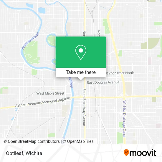
See Optileaf, Wichita, on the map
Public Transit to Optileaf in Wichita
Wondering how to get to Optileaf in Wichita? Moovit helps you find the best way to get to Optileaf with step-by-step directions from the nearest public transit station.
Moovit provides free maps and live directions to help you navigate through your city. View schedules, routes, timetables, and find out how long does it take to get to Optileaf in real time.
Looking for the nearest stop or station to Optileaf? Check out this list of stops closest to your destination: Douglas And Market Ob; Douglas And Market Ib; 2nd St And Broadway; Douglas And Topeka NW; Transit Center; Wichita Bus Stop.
Bus: Q-LINE CLIFTON T, ROUTE11: MAPLE-R, ROUTE14: DOUGLAS, ROUTE16: S BDWY-, ROUTE22: S BDWY-, ROUTE27: N BDWY-, ROUTE29: HYDRAUL, ROUTE15: DOUGLAS, ROUTE12: DOUGLAS, ROUTE13: N BDWY-, EAST HIGH SCHOOL, MEAD MIDDLE, NORTH HIGH SCHOO, SOUTH HIGH, SOUTHEAST HIGH, GREYHOUND US0136, GREYHOUND US1142, FLIXBUS 2241.
Want to see if there’s another route that gets you there at an earlier time? Moovit helps you find alternative routes or times. Get directions from and directions to Optileaf easily from the Moovit App or Website.
We make riding to Optileaf easy, which is why over 1.5 million users, including users in Wichita, trust Moovit as the best app for public transit. You don’t need to download an individual bus app or train app, Moovit is your all-in-one transit app that helps you find the best bus time or train time available.
For information on prices of bus, costs and ride fares to Optileaf, please check the Moovit app.
Use the app to navigate to popular places including to the airport, hospital, stadium, grocery store, mall, coffee shop, school, college, and university.
Optileaf Address: 100 N Main St Wichita, KS 67202 street in Wichita
- 316 Health Insurance,
- Law Offices of Rassman & Niekamp,
- RJN,
- Hexcode Marketing,
- MAC,
- Law Offices of Julie Ariagno,
- Intrust Cafe,
- Big B's Beef Truck,
- Wichita Magazine,
- Wichita Data Center,
- Brown Edward L Jr Attorney,
- Budget Mobile Storage,
- 125 N. Market Building,
- Larry Cook Heating and Cooling,
- Encompass Pediatrics,
- Jenny Dawn Cellars,
- Ionex Telecommunications,
- HRN Performance Solutions,
- Wichita Technology,
- Parrish Oil Company
Places Near Optileaf (Wichita)
- East 21st Street North and Webb Road, Wichita,
- Lopez Services, Wichita,
- Ratcliff Auto and Truck Repair, Wichita,
- Ascencion Via Christi Hospital St Francis, Wichita,
- 21st & Maize, Wichita,
- Afghan Halal Market, Wichita,
- Four Corners Cafe @ Wesley Medical Center, Wichita,
- Sena African Hair Braiding LLC, Wichita,
- McConnell Air Force Base, Mcconnell Afb,
- Spirit Aerosystems,
- Paige Place Apartments, Wichita,
- Towne East Mall, Wichita,
- Hubb's glory hole, Wichita,
- Westside Athletic Field (Friends University Baseball Field), Wichita,
- Wichita Dwight D. Eisenhower National Airport (ICT) (Wichita Eisenhower National Airport), Wichita,
- Total Card Solutions, Wichita,
- Bmer Tech Automotive, Wichita,
- Spirit Aerosystems Inc, Building 1-198D,
- North High School, Wichita,
- Spirit AeroSystems, Bldg 2-280J (Section 9)
How to get to popular places in Wichita with public transit
Get around Wichita by public transit!
Traveling around Wichita has never been so easy. See step by step directions as you travel to any attraction, street or major public transit station. View bus and train schedules, arrival times, service alerts and detailed routes on a map, so you know exactly how to get to anywhere in Wichita.
When traveling to any destination around Wichita use Moovit's Live Directions with Get Off Notifications to know exactly where and how far to walk, how long to wait for your line, and how many stops are left. Moovit will alert you when it's time to get off — no need to constantly re-check whether yours is the next stop.
Wondering how to use public transit in Wichita or how to pay for public transit in Wichita? Moovit public transit app can help you navigate your way with public transit easily, and at minimum cost. It includes public transit fees, ticket prices, and costs. Looking for a map of Wichita public transit lines? Moovit public transit app shows all public transit maps in Wichita with all bus routes and stops on an interactive map.
Wichita has 1 transit type(s), including: bus, operated by several transit agencies, including Wichita Transit, Greyhound-us and FlixBus-us