How to get to Options Care Center by bus?
Click on the bus route to see step by step directions with maps, line arrival times and updated time schedules.
From Wilson Blvd, Arlington County
43 minFrom The Watermark Hotel, Fairfax County
66 minFrom Kreeger Museum, Washington
96 minFrom Quarterdeck, Arlington County
66 minFrom [I-495] Exit 54 - Braddock Road, Fairfax County
90 minFrom Leesburg VA-684, Fairfax County
60 minFrom Sheraton-Pentagon City Hotel (Sheraton Arlington), Arlington County
57 minFrom Days Inn by Wyndham Arlington Pentagon, Arlington County
67 minFrom Quarterdeck Restaurant, Arlington County
66 min
How to get to Options Care Center by metro?
Click on the metro route to see step by step directions with maps, line arrival times and updated time schedules.
Bus stop near Options Care Center in Fairfax County
- S Washington St+Rosemary Ln, 3 min walk,VIEW
Metro stations near Options Care Center in Fairfax County
Bus lines to Options Care Center in Fairfax County
- F50, West To Vienna,VIEW
What are the closest stations to Options Care Center?
The closest stations to Options Care Center are:
- S Washington St+Rosemary Ln is 244 yards away, 3 min walk.
- West Falls Church-Vt is 3258 yards away, 38 min walk.
- East Falls Church is 4902 yards away, 58 min walk.
Which bus line stops near Options Care Center?
F50 (West To George Mason)
Which metro lines stop near Options Care Center?
These metro lines stop near Options Care Center: ORANGE, SILVER.
What’s the nearest bus station to Options Care Center in Fairfax County?
The nearest bus station to Options Care Center in Fairfax County is S Washington St+Rosemary Ln. It’s a 3 min walk away.
What time is the first metro to Options Care Center in Fairfax County?
The ORANGE is the first metro that goes to Options Care Center in Fairfax County. It stops nearby at 5:04 AM.
What time is the last metro to Options Care Center in Fairfax County?
The SILVER is the last metro that goes to Options Care Center in Fairfax County. It stops nearby at 12:31 AM.
What time is the first bus to Options Care Center in Fairfax County?
The F50 is the first bus that goes to Options Care Center in Fairfax County. It stops nearby at 6:01 AM.
What time is the last bus to Options Care Center in Fairfax County?
The F50 is the last bus that goes to Options Care Center in Fairfax County. It stops nearby at 12:00 AM.
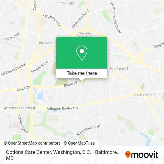
See Options Care Center, Fairfax County, on the map
Public Transit to Options Care Center in Fairfax County
Wondering how to get to Options Care Center in Fairfax County? Moovit helps you find the best way to get to Options Care Center with step-by-step directions from the nearest public transit station.
Moovit provides free maps and live directions to help you navigate through your city. View schedules, routes, timetables, and find out how long does it take to get to Options Care Center in real time.
Looking for the nearest stop or station to Options Care Center? Check out this list of stops closest to your destination: S Washington St+Rosemary Ln; West Falls Church-Vt; East Falls Church.
Bus: F50.Metro: ORANGE, SILVER.
Want to see if there’s another route that gets you there at an earlier time? Moovit helps you find alternative routes or times. Get directions from and directions to Options Care Center easily from the Moovit App or Website.
We make riding to Options Care Center easy, which is why over 1.7 million users, including users in Fairfax County, trust Moovit as the best app for public transit. You don’t need to download an individual bus app or train app, Moovit is your all-in-one transit app that helps you find the best bus time or train time available.
For information on prices of bus and metro, costs and ride fares to Options Care Center, please check the Moovit app.
Use the app to navigate to popular places including to the airport, hospital, stadium, grocery store, mall, coffee shop, school, college, and university.
Options Care Center Address: 7297 Lee Hwy Ste L street in Fairfax County
- Amazon Locker-Mantaray,
- Blink Charging,
- Fairfax County Fire Station Company 18,
- Dolley Madison Apartments,
- Coleman Powersports Falls Church,
- Winston Mews Condominiums,
- Mosaic District Fountains,
- La Fitness,
- Spacebar (Space Bar),
- Loehmann's Plaza Barber Shop,
- Subway,
- Falls Church, VA,
- La Granja De Oro,
- Hilton Garden Inn Falls Church,
- Crown,
- Prometric Testing Center,
- Bowl America,
- James Lee Community Center,
- Kyuramen,
- King David Memorial Gardens
Places Near Options Care Center (Fairfax County)
- Basilica of the National Shrine, Washington,
- PG Mall, Prince George's County,
- Pennsylvania Ave NW (3rd st and pennsylvania), Washington,
- Amazon Hq2, Arlington County,
- National Theatre, Washington,
- Washington DC VA Medical Center, Washington,
- Marriott Marquis Washington, DC, Washington,
- National Museum of African American History and Culture, Washington,
- Washington National Cathedral, Washington,
- National Zoo, Washington,
- Museum Of The Bible, Washington,
- The Anthem, Washington,
- Rock Creek Tennis Center, Washington,
- Sibley Memorial Hospital, Washington,
- Capital One Arena, Washington,
- Camden Yards, Baltimore,
- Warner Theatre, Washington,
- Westfield Montgomery Mall, Montgomery County,
- Georgetown, Washington,
- M&T Bank Stadium, Baltimore
How to get to popular places in Washington, D.C. - Baltimore, MD with public transit
Get around Fairfax County by public transit!
Traveling around Fairfax County has never been so easy. See step by step directions as you travel to any attraction, street or major public transit station. View bus and train schedules, arrival times, service alerts and detailed routes on a map, so you know exactly how to get to anywhere in Fairfax County.
When traveling to any destination around Fairfax County use Moovit's Live Directions with Get Off Notifications to know exactly where and how far to walk, how long to wait for your line, and how many stops are left. Moovit will alert you when it's time to get off — no need to constantly re-check whether yours is the next stop.
Wondering how to use public transit in Fairfax County or how to pay for public transit in Fairfax County? Moovit public transit app can help you navigate your way with public transit easily, and at minimum cost. It includes public transit fees, ticket prices, and costs. Looking for a map of Fairfax County public transit lines? Moovit public transit app shows all public transit maps in Fairfax County with all Bus, Train, Metro, Light Rail and Ferry routes and stops on an interactive map.
Washington, D.C. - Baltimore, MD has 5 transit type(s), including: Bus, Train, Metro, Light Rail and Ferry, operated by several transit agencies, including WMATA, Montgomery County Ride On, Fairfax Connector, TheBus, PRTC, DASH - Alexandria, Arlington Transit (ART), RTA of Central Maryland, MDOT MTA, MDOT MTA Light RailLink, MDOT MTA Commuter Bus, MDOT MTA Local Bus, FXBGO!, Virginia Railway Express (VRE) and MARC