Orange & Carson SW stop - Tuesday schedule
| Line | Direction | Time |
|---|---|---|
| 71 | 71 Orange to Downtown Long Beach | 6:25 AM |
| 71 | 71 Orange to Downtown Long Beach | 6:54 AM |
| 71 | 71 Orange to Downtown Long Beach | 7:24 AM |
| 71 | 71 Orange to Downtown Long Beach | 7:54 AM |
| 71 | 71 Orange to Downtown Long Beach | 8:24 AM |
| 71 | 71 Orange to Downtown Long Beach | 8:54 AM |
| 71 | 71 Orange to Downtown Long Beach | 9:24 AM |
| 71 | 71 Orange to Downtown Long Beach | 9:54 AM |
| 71 | 71 Orange to Downtown Long Beach | 10:24 AM |
| 71 | 71 Orange to Downtown Long Beach | 10:54 AM |
| 71 | 71 Orange to Downtown Long Beach | 11:24 AM |
| 71 | 71 Orange to Downtown Long Beach | 11:54 AM |
| 71 | 71 Orange to Downtown Long Beach | 12:24 PM |
| 71 | 71 Orange to Downtown Long Beach | 12:54 PM |
| 71 | 71 Orange to Downtown Long Beach | 1:24 PM |
| 71 | 71 Orange to Downtown Long Beach | 1:54 PM |
| 71 | 71 Orange to Downtown Long Beach | 2:24 PM |
| 71 | 71 Orange to Downtown Long Beach | 2:52 PM |
| 71 | 71 Orange to Downtown Long Beach | 3:22 PM |
| 71 | 71 Orange to Downtown Long Beach | 3:52 PM |
| 71 | 71 Orange to Downtown Long Beach | 4:22 PM |
| 71 | 71 Orange to Downtown Long Beach | 4:52 PM |
| 71 | 71 Orange to Downtown Long Beach | 5:24 PM |
| 71 | 71 Orange to Downtown Long Beach | 5:54 PM |
| 71 | 71 Orange to Downtown Long Beach | 6:24 PM |
Directions to Orange & Carson SW stop (Long Beach) with public transit
The following transit lines have routes that pass near Orange & Carson SW
 Bus: 101, 103, 61, 71.
- Subway: A LINE.
How to get to Orange & Carson SW stop by bus?
Click on the bus route to see step by step directions with maps, line arrival times and updated time schedules.
How to get to Orange & Carson SW stop by subway?
Click on the subway route to see step by step directions with maps, line arrival times and updated time schedules.
Bus stops near Orange & Carson SW stop in Long Beach
- Carson & Orange SE, 2 min walk,
- Orange & Carson NE, 2 min walk,
Subway stations near Orange & Carson SW station in Long Beach
- Wardlow Station, 14 min walk,
Bus lines to Orange & Carson SW stop in Long Beach
- 101, 101 Carson to Hawaiian Gardens,
- 103, 103 Carson St to Santa Fe Ave via Willow,
- 71, 71 Orange to Rosecrans at Lakewood,
What are the closest stations to Orange & Carson SW?
The closest stations to Orange & Carson SW are:
- Carson & Orange SE stop is 78 yards away, 2 min walk.
- Orange & Carson NE stop is 81 yards away, 2 min walk.
- Wardlow Station is 1121 yards away, 14 min walk.
Which bus lines stop near Orange & Carson SW?
These bus lines stop near Orange & Carson SW: 101, 103, 61, 71.
Which subway line stops near Orange & Carson SW?
A LINE (Southbound to Long Beach)
What’s the nearest subway station to Orange & Carson SW in Long Beach?
The nearest subway station to Orange & Carson SW in Long Beach is Wardlow Station. It’s a 14 min walk away.
What’s the nearest bus station to Orange & Carson SW in Long Beach?
The nearest bus stations to Orange & Carson SW in Long Beach are Carson & Orange SE and Orange & Carson NE. The closest one is a 2 min walk away.
What time is the first subway to Orange & Carson SW in Long Beach?
The A LINE is the first subway that goes to Orange & Carson SW in Long Beach. It stops nearby at 3:36 AM.
What time is the last subway to Orange & Carson SW in Long Beach?
The A LINE is the last subway that goes to Orange & Carson SW in Long Beach. It stops nearby at 1:28 AM.
What time is the first bus to Orange & Carson SW in Long Beach?
The 101 is the first bus that goes to Orange & Carson SW in Long Beach. It stops nearby at 5:31 AM.
What time is the last bus to Orange & Carson SW in Long Beach?
The 101 is the last bus that goes to Orange & Carson SW in Long Beach. It stops nearby at 10:33 PM.
Orange & Carson SW station
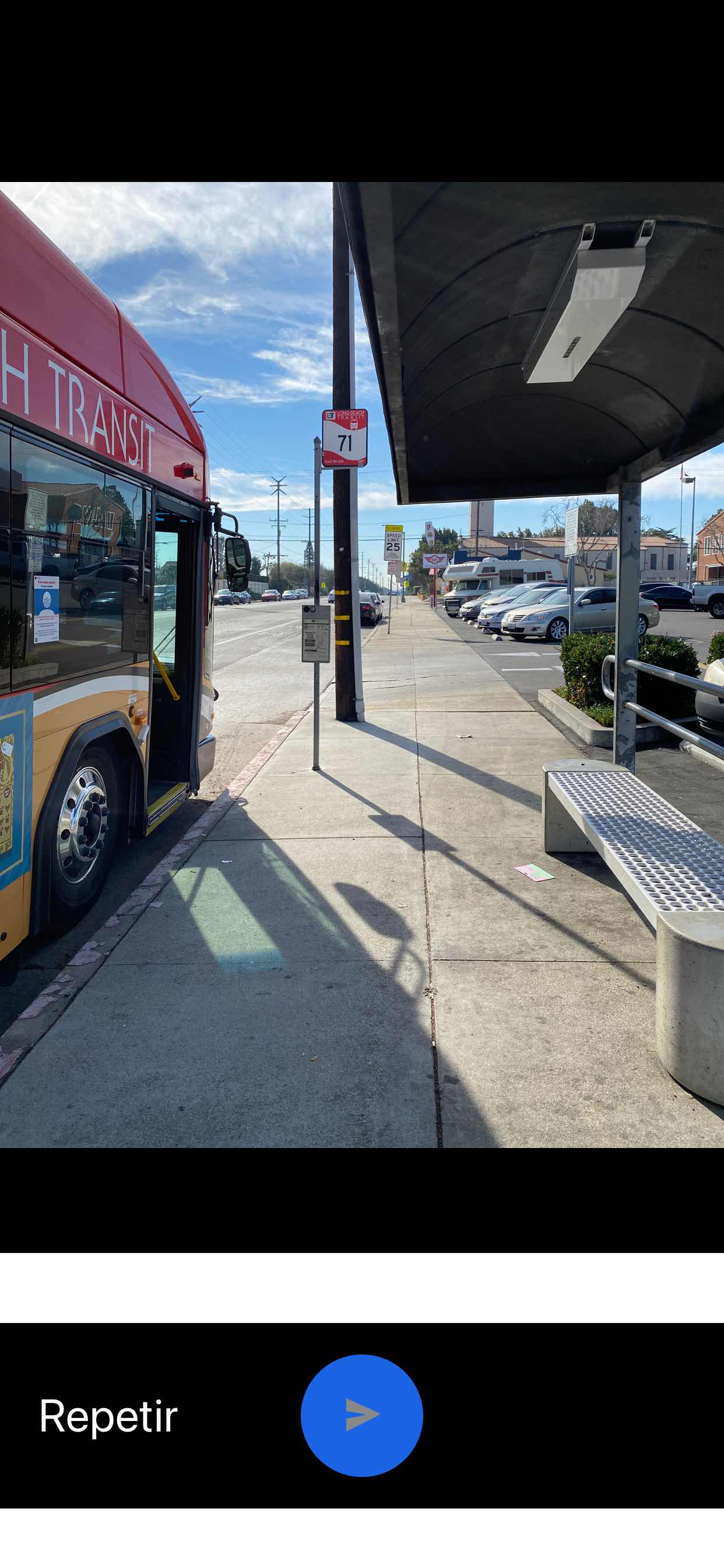 Taken by Anonymous
See Orange & Carson SW stop, Long Beach, on the map
Public transit to Orange & Carson SW stop (ID: 0887) in Long Beach
Looking for directions to Orange & Carson SW in Long Beach, United States?
Download the Moovit App to find the current schedule and step-by-step directions for Bus or Subway routes that pass through Orange & Carson SW.
Looking for the nearest stops closest to Orange & Carson SW ? Check out this list of closest stops to your destination: Carson & Orange SE; Orange & Carson NE; Wardlow Station.
Bus: 101, 103, 61, 71.Subway: A LINE.
We make riding on public transit to Orange & Carson SW easy, which is why over 1.7 billion users, including users in Long Beach trust Moovit as the best app for public transit.
Use the app to navigate to popular places including to the airport, hospital, stadium, grocery store, mall, coffee shop, school, college, and university.
Orange & Carson SW stop’s code is 0887
The first line to this stop is 71, at 6:25 AM, and the last line is 71 at 7:41 PM.
1200 Carson St, Long Beach, CA, USA
This stop serves Long Beach Transit’s lines
- Carson & Orange SE,
- Orange & Carson NE
Bus stops near Orange & Carson SW stop
- Wardlow Station
Subway station near Orange & Carson SW station
- Pacific Coast Highway / Torrance,
- Florence / Miramonte,
- Vernon & Broadway (CCW),
- Riverside / Coldwater Canyon,
- Pacific / Florence,
- Florence Ave & Santa Fe Ave,
- Columbus Ave & Parthenia St Eastbound,
- Canoga / Ventura Freeway Off Ramp,
- Roscoe / Topanga Canyon,
- Vineland / Victory,
- Crenshaw Bl at El Camino College,
- Sepulveda / Brand,
- Soledad Canyon Rd & Canyon Country Prk,
- 103rd Street / Watts Towers Station,
- Van Nuys / Foothill,
- Wilshire / Western,
- Santa Monica / Las Palmas,
- Main & Daly St.,
- 7th & Orange SE,
- Lankershim / Magnolia
Popular public transit stations in Long Beach
Get around Long Beach by public transit!
Traveling around Long Beach has never been so easy. See step by step directions as you travel to any attraction, street or major public transit station. View bus and train schedules, arrival times, service alerts and detailed routes on a map, so you know exactly how to get to anywhere in Long Beach.
When traveling to any destination around Long Beach use Moovit's Live Directions with Get Off Notifications to know exactly where and how far to walk, how long to wait for your line, and how many stops are left. Moovit will alert you when it's time to get off — no need to constantly re-check whether yours is the next stop.
Wondering how to use public transit in Long Beach or how to pay for public transit in Long Beach? Moovit public transit app can help you navigate your way with public transit easily, and at minimum cost. It includes public transit fees, ticket prices, and costs. Looking for a map of Long Beach public transit lines? Moovit public transit app shows all public transit maps in Long Beach with all Bus, Train, Subway, Ferry and Funicular routes and stops on an interactive map.
Los Angeles has 5 transit type(s), including: Bus, Train, Subway, Ferry and Funicular, operated by several transit agencies, including Metro, Metro Event Service, Alhambra Community Transit (ACT), Arcadia Transit, Artesia Transit, AVTA, Baldwin Park Transit, Beach Cities Transit, Beaumont Transit, Bell Gardens Town Trolley, Bellflower Bus, Big Blue Bus, Burbank Bus, Calabasas Trolley and Camarillo Area Transit