How to get to Orgelfabrik by bus?
Click on the bus route to see step by step directions with maps, line arrival times and updated time schedules.
From Epplesee, Rheinstetten
71 minFrom Arcus Klinik, Pforzheim
103 minFrom POCO Einrichtungsmärkte, Pforzheim
121 minFrom 75217, Birkenfeld
155 minFrom Waldbronn Eistreff, Waldbronn
41 minFrom Karlsruher Straße, Pforzheim
120 minFrom Rkh Kliniken, Verwaltungsgemeinschaft Bretten
199 minFrom Media Markt, Pforzheim
107 minFrom Kaufland Pforzheim Wilhelm-Becker-Str., Pforzheim
107 min
How to get to Orgelfabrik by train?
Click on the train route to see step by step directions with maps, line arrival times and updated time schedules.
From Epplesee, Rheinstetten
54 minFrom Arcus Klinik, Pforzheim
76 minFrom POCO Einrichtungsmärkte, Pforzheim
79 minFrom Waldbronn Eistreff, Waldbronn
74 minFrom Karlsruher Straße, Pforzheim
78 minFrom Rkh Kliniken, Verwaltungsgemeinschaft Bretten
42 minFrom Media Markt, Pforzheim
73 minFrom Kaufland Pforzheim Wilhelm-Becker-Str., Pforzheim
73 min
Light Rail stations near Orgelfabrik in Durlach
Bus stops near Orgelfabrik in Durlach
- Durlach Schlossplatz Bstg A, 5 min walk,VIEW
- Durlach Schlossplatz, 5 min walk,VIEW
- Durlach Parkschlössle, 7 min walk,VIEW
- Durlach Parkschlössle Bstg B, 7 min walk,VIEW
- Durlach Ochsentorstraße Bstg B, 7 min walk,VIEW
- Durlach Ochsentorstraße, 7 min walk,VIEW
- Durlach Karl-Weysser-Straße Bstg A, 8 min walk,VIEW
- Durlach Karl-Weysser-Straße, 8 min walk,VIEW
Bus lines to Orgelfabrik in Durlach
- 21, Grötzingen Nord Bstg C - Durlach Turmberg Bstg A,VIEW
- 23, Durlach Turmberg Bstg A - Stupferich Rathaus Bstg A,VIEW
- 24, Durlach Turmberg Bstg C - Bergwald Fridtjof-Nansen-Str. Bstg A,VIEW
- 26, Durlach Geigersberg Bstg A - Durlach Turmberg Bstg B,VIEW
- NL3, Stupferich Rathaus Bstg A - Durlach Turmberg Bstg A,VIEW
- 21, Grötzingen Nord - Durlach Turmberg,VIEW
- 23, Durlach Turmberg - Stupferich Rathaus,VIEW
- 24, Bergwald Fridtjof-Nansen-Str. - Durlach Turmberg,VIEW
- 26, Durlach Geigersberg - Durlach Turmberg,VIEW
- NL3, Durlach Turmberg - Stupferich Rathaus,VIEW
- 27, Palmbach Rudolf-Link-Straße - Durlach Bahnhof,VIEW
- NL11, Bergwald Mitte - Durlach Turmberg,VIEW
- 27, Palmbach Auf Der Römerstraße,VIEW
- NL11, Bergwald Mitte,VIEW
- 31, Durlach Bahnhof,VIEW
- 31, Waldstadt Zentrum,VIEW
- NL12, Durlach Turmberg,VIEW
What are the closest stations to Orgelfabrik?
The closest stations to Orgelfabrik are:
- Durlach Schlossplatz is 286 meters away, 4 min walk.
- Durlach Schlossplatz Gleis 1 is 303 meters away, 5 min walk.
- Durlach Friedrichschule is 356 meters away, 5 min walk.
- Durlach Schlossplatz Bstg A is 368 meters away, 5 min walk.
- Durlach Parkschlössle is 479 meters away, 7 min walk.
- Durlach Parkschlössle Bstg B is 479 meters away, 7 min walk.
- Durlach Ochsentorstraße Bstg B is 501 meters away, 7 min walk.
- Durlach Ochsentorstraße is 505 meters away, 7 min walk.
- Durlach Karl-Weysser-Straße Bstg A is 539 meters away, 8 min walk.
- Durlach Karl-Weysser-Straße is 539 meters away, 8 min walk.
Which train lines stop near Orgelfabrik?
These train lines stop near Orgelfabrik: MEX17, RE 45, RE1, S5.
Which light rail line stops near Orgelfabrik?
1 (Durlach Turmberg)
Which bus lines stop near Orgelfabrik?
These bus lines stop near Orgelfabrik: 107, 158, 23, 24.
What’s the nearest light rail station to Orgelfabrik in Durlach?
The nearest light rail station to Orgelfabrik in Durlach is Durlach Schlossplatz. It’s a 4 min walk away.
What’s the nearest bus station to Orgelfabrik in Durlach?
The nearest bus stations to Orgelfabrik in Durlach are Durlach Schlossplatz Bstg A and Durlach Schlossplatz. The closest one is a 5 min walk away.
What time is the first light rail to Orgelfabrik in Durlach?
The E is the first light rail that goes to Orgelfabrik in Durlach. It stops nearby at 4:03 AM.
What time is the last light rail to Orgelfabrik in Durlach?
The E is the last light rail that goes to Orgelfabrik in Durlach. It stops nearby at 1:25 AM.
What time is the first bus to Orgelfabrik in Durlach?
The 24 is the first bus that goes to Orgelfabrik in Durlach. It stops nearby at 5:05 AM.
What time is the last bus to Orgelfabrik in Durlach?
The 23 is the last bus that goes to Orgelfabrik in Durlach. It stops nearby at 1:10 AM.
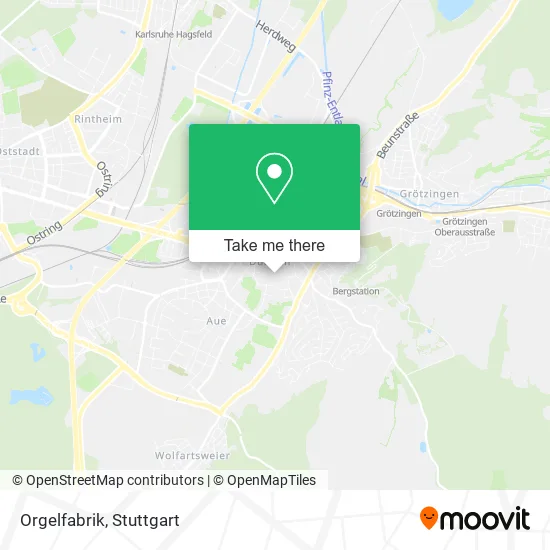
See Orgelfabrik, Durlach, on the map
Public Transit to Orgelfabrik in Durlach
Wondering how to get to Orgelfabrik in Durlach? Moovit helps you find the best way to get to Orgelfabrik with step-by-step directions from the nearest public transit station.
Moovit provides free maps and live directions to help you navigate through your city. View schedules, routes, timetables, and find out how long does it take to get to Orgelfabrik in real time.
Looking for the nearest stop or station to Orgelfabrik? Check out this list of stops closest to your destination: Durlach Schlossplatz; Durlach Schlossplatz Gleis 1; Durlach Friedrichschule; Durlach Schlossplatz Bstg A; Durlach Parkschlössle; Durlach Parkschlössle Bstg B; Durlach Ochsentorstraße Bstg B; Durlach Ochsentorstraße; Durlach Karl-Weysser-Straße Bstg A; Durlach Karl-Weysser-Straße.
Train: MEX17, RE 45, RE1, S5.Light Rail: 1.Bus: 107, 158, 23, 24, 21, 26, NL3, 21, 26, NL3, 27, NL11, 27, NL11, 31, 31.
Want to see if there’s another route that gets you there at an earlier time? Moovit helps you find alternative routes or times. Get directions from and directions to Orgelfabrik easily from the Moovit App or Website.
We make riding to Orgelfabrik easy, which is why over 1.5 million users, including users in Durlach, trust Moovit as the best app for public transit. You don’t need to download an individual bus app or train app, Moovit is your all-in-one transit app that helps you find the best bus time or train time available.
For information on prices of bus, train and light rail, costs and ride fares to Orgelfabrik, please check the Moovit app.
Use the app to navigate to popular places including to the airport, hospital, stadium, grocery store, mall, coffee shop, school, college, and university.
Orgelfabrik Address: Amthausstraße 19 Durlach, 76227 Karlsruhe street in Durlach
- Kindergarten Städt. Schülerhort,
- Siri Thaimaßagen,
- Praxis für Geistiges Heilen,
- Spörle Hannes Dr.Med.Vet. Kleintierpraxis,
- Unauffälligkeiten,
- Kabarett in der Orgelfabrik,
- Filteq,
- Die Orgelfabrik,
- Drk Ov Durlach E.V.,
- DRK Bereitschaft Durlach,
- T.Radtke,
- Evangelisches Gemeindezentrum,
- Home Of Blues,
- Polizeirevier Durlach,
- Stadtkirche Durlach,
- Spreitzer & Köhler Partnerschaft Mbb Steuerberater,
- Sprachschule Durlach,
- Ecco,
- Pizzataxi,
- Trompeter von Säckingen
Places Near Orgelfabrik (Durlach)
- FlixBus Haltestelle, Stuttgart,
- Pariser Platz Stuttgart, Stuttgart-Mitte,
- Hanns-Martin-Schleyer-Halle (Stuttgart Hans-Martin-Schleyerhalle), Bad Cannstatt,
- Mercedes-Benz Museum, Bad Cannstatt,
- Hanns-Martin-Schleyer-Halle, Bad Cannstatt,
- Hauptbahnhof Stuttgart, Stuttgart-Mitte,
- Geilhaus Haus 33a, Reutlingen-Betzingen,
- Marmorsaal Im Weissenburgpark, Stuttgart-Süd,
- Porsche Museum, Zuffenhausen,
- SI-Centrum, Möhringen,
- Porsche-Arena, Bad Cannstatt,
- Im Wizemann (Halle), Bad Cannstatt,
- Wilhelma (U-Bahn Wilhelma), Bad Cannstatt,
- Klinikum Stuttgart - Katharinenhospital, Stuttgart-Mitte,
- Gasometer Pforzheim, Pforzheim,
- Mettingen Eros-Center Puff Laufhaus, Esslingen Am Neckar,
- Waldfriedhof, Degerloch,
- Schleyerhalle, Bad Cannstatt,
- Mercedes-Benz Museum (Mercedes Museum Stuttgart), Bad Cannstatt,
- Gleis 101/102 (tief), Stuttgart-Mitte
How to get to popular places in Stuttgart with public transit
Get around Durlach by public transit!
Traveling around Durlach has never been so easy. See step by step directions as you travel to any attraction, street or major public transit station. View bus and train schedules, arrival times, service alerts and detailed routes on a map, so you know exactly how to get to anywhere in Durlach.
When traveling to any destination around Durlach use Moovit's Live Directions with Get Off Notifications to know exactly where and how far to walk, how long to wait for your line, and how many stops are left. Moovit will alert you when it's time to get off — no need to constantly re-check whether yours is the next stop.
Wondering how to use public transit in Durlach or how to pay for public transit in Durlach? Moovit public transit app can help you navigate your way with public transit easily, and at minimum cost. It includes public transit fees, ticket prices, and costs. Looking for a map of Durlach public transit lines? Moovit public transit app shows all public transit maps in Durlach with all Bus, Train, Subway, Light Rail, Ferry, S-Bahn and Funicular routes and stops on an interactive map.
Stuttgart has 7 transit type(s), including: Bus, Train, Subway, Light Rail, Ferry, S-Bahn and Funicular, operated by several transit agencies, including SSB - Stadtbahn, SSB, SSB - Seilbahn / Zacke, S-Bahn Stuttgart, Rhein-Neckar-Verkehr GmbH (rnv), Karlsruher Verkehrsverbund, DB AG, DB Regiobus BW, Arverio Baden-Württemberg GmbH, DB RegioNetz Verkehrs GmbH Westfrankenbahn, DB Regio AG Baden-Württemberg, Südwestdeutsche Verkehrs-AG, DB Regio AG Mitte Region Hessen, DB and Bodensee-Oberschwaben-Bahn