How to get to Oriel Stat-A-Matrix by bus?
Click on the bus route to see step by step directions with maps, line arrival times and updated time schedules.
From East Orange, NJ, East Orange
55 minFrom Bayonne, NJ, Bayonne
138 minFrom Bayonne, NJ, Bayonne
141 minFrom Ikea, Elizabeth
54 minFrom Prudential Center, Newark
52 minFrom New Jersey Motor Vehicle Commission, Newark
40 minFrom Walmart Supercenter, Bayonne
139 minFrom Union County College - Cranford Campus, Cranford
58 minFrom Community Coach Bus 77, West Orange
71 minFrom Saint Barnabas Medical Center, Livingston
83 min
How to get to Oriel Stat-A-Matrix by train?
Click on the train route to see step by step directions with maps, line arrival times and updated time schedules.
Bus stops near Oriel Stat-A-Matrix in New York - New Jersey
Train stations near Oriel Stat-A-Matrix in New York - New Jersey
Bus lines to Oriel Stat-A-Matrix in New York - New Jersey
What are the closest stations to Oriel Stat-A-Matrix?
The closest stations to Oriel Stat-A-Matrix are:
- Morris Ave at Kean Dr is 266 yards away, 4 min walk.
- North Ave 152' N Of Lynmar Way is 849 yards away, 11 min walk.
- Union is 2715 yards away, 33 min walk.
- North Elizabeth is 3989 yards away, 47 min walk.
Which bus lines stop near Oriel Stat-A-Matrix?
These bus lines stop near Oriel Stat-A-Matrix: 26, 52, 66.
Which train lines stop near Oriel Stat-A-Matrix?
These train lines stop near Oriel Stat-A-Matrix: NC, RVL.
What’s the nearest bus station to Oriel Stat-A-Matrix in New York - New Jersey?
The nearest bus station to Oriel Stat-A-Matrix in New York - New Jersey is Morris Ave at Kean Dr. It’s a 4 min walk away.
What time is the first train to Oriel Stat-A-Matrix in New York - New Jersey?
The NC is the first train that goes to Oriel Stat-A-Matrix in New York - New Jersey. It stops nearby at 4:43 AM.
What time is the last train to Oriel Stat-A-Matrix in New York - New Jersey?
The NC is the last train that goes to Oriel Stat-A-Matrix in New York - New Jersey. It stops nearby at 1:52 AM.
What time is the first bus to Oriel Stat-A-Matrix in New York - New Jersey?
The 26 is the first bus that goes to Oriel Stat-A-Matrix in New York - New Jersey. It stops nearby at 5:36 AM.
What time is the last bus to Oriel Stat-A-Matrix in New York - New Jersey?
The 113 is the last bus that goes to Oriel Stat-A-Matrix in New York - New Jersey. It stops nearby at 11:41 PM.
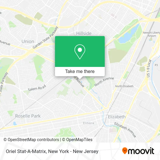
See Oriel Stat-A-Matrix, New York - New Jersey, on the map
Public Transit to Oriel Stat-A-Matrix in New York - New Jersey
Wondering how to get to Oriel Stat-A-Matrix in New York - New Jersey? Moovit helps you find the best way to get to Oriel Stat-A-Matrix with step-by-step directions from the nearest public transit station.
Moovit provides free maps and live directions to help you navigate through your city. View schedules, routes, timetables, and find out how long does it take to get to Oriel Stat-A-Matrix in real time.
Looking for the nearest stop or station to Oriel Stat-A-Matrix? Check out this list of stops closest to your destination: Morris Ave at Kean Dr; North Ave 152' N Of Lynmar Way; Union; North Elizabeth.
Bus: 26, 52, 66, 113.Train: NC, RVL, NJCL.
Want to see if there’s another route that gets you there at an earlier time? Moovit helps you find alternative routes or times. Get directions from and directions to Oriel Stat-A-Matrix easily from the Moovit App or Website.
We make riding to Oriel Stat-A-Matrix easy, which is why over 1.5 million users, including users in New York - New Jersey, trust Moovit as the best app for public transit. You don’t need to download an individual bus app or train app, Moovit is your all-in-one transit app that helps you find the best bus time or train time available.
For information on prices of bus, train and light rail, costs and ride fares to Oriel Stat-A-Matrix, please check the Moovit app.
Use the app to navigate to popular places including to the airport, hospital, stadium, grocery store, mall, coffee shop, school, college, and university.
Oriel Stat-A-Matrix Address: 1095 Morris Ave Union, NJ 07083 street in New York - New Jersey
- Transcore,
- Eye Clinic,
- Paul Marzarella - Mortgage and Refinance,
- SS&C Fund Services North America,
- The Eye Clinic NJ,
- Michael Santos,
- Eye Clinic Dr. Alan Goldfeder Dr Racier,
- Thibaut Corporate Headquarters,
- Union County Economic Development,
- American Chimney Cleaning,
- Straightforward Chimney Services,
- At&T Store,
- Starbucks Coffee,
- Chipotle Mexican Grill,
- At&T,
- Union,
- The Cougar's Byte,
- Miron Student Center,
- James Howe Gallery,
- New Jersey Academy Of Science
Places Near Oriel Stat-A-Matrix (New York - New Jersey)
- 911 Memorial, Manhattan,
- San Gennaro Feast, Manhattan,
- Queens Center Mall, Queens,
- Bellevue Hospital, Manhattan,
- Katz's Deli, Manhattan,
- 376 Hudson Street, Manhattan,
- 3 Stone St, Manhattan,
- Chinatown, Manhattan,
- 1 Police Plaza, Manhattan,
- Rockefeller Center, Manhattan,
- SoHo, Manhattan,
- qqqq, Manhattan,
- Pier 83, Manhattan,
- 66 John Street, Manhattan,
- Mountainside Hospital, Glen Ridge,
- Hudson Yards, Manhattan,
- 111 Centre New York City Supreme Court, Manhattan,
- Wall Street, Manhattan,
- 26 Federal Plaza, Manhattan,
- Times Square, Manhattan
How to get to popular places in New York - New Jersey with public transit
Get around New York - New Jersey by public transit!
Traveling around New York - New Jersey has never been so easy. See step by step directions as you travel to any attraction, street or major public transit station. View bus and train schedules, arrival times, service alerts and detailed routes on a map, so you know exactly how to get to anywhere in New York - New Jersey.
When traveling to any destination around New York - New Jersey use Moovit's Live Directions with Get Off Notifications to know exactly where and how far to walk, how long to wait for your line, and how many stops are left. Moovit will alert you when it's time to get off — no need to constantly re-check whether yours is the next stop.
Wondering how to use public transit in New York - New Jersey or how to pay for public transit in New York - New Jersey? Moovit public transit app can help you navigate your way with public transit easily, and at minimum cost. It includes public transit fees, ticket prices, and costs. Looking for a map of New York - New Jersey public transit lines? Moovit public transit app shows all public transit maps in New York - New Jersey with all Bus, Train, Subway, Light Rail, Ferry and Cable Car routes and stops on an interactive map.
New York - New Jersey has 6 transit type(s), including: Bus, Train, Subway, Light Rail, Ferry and Cable Car, operated by several transit agencies, including MTA Subway, Metro-North Railroad, LIRR, PATH, MTA New York City Transit - Express routes, MTA Bus, NJ Transit, NYC Ferry, NICE bus, Bee-Line Bus, NJ Transit Rail, Norwalk Transit District, Hartford Line, River Valley Transit and HART