Directions to Origami Software Solutions (Norfolk) with public transportation
The following transit lines have routes that pass near Origami Software Solutions
 Bus: 020, GREYHOUND US0654S, 009.
- Light Rail: 800.
How to get to Origami Software Solutions by bus?
Click on the bus route to see step by step directions with maps, line arrival times and updated time schedules.
Bus stops near Origami Software Solutions in Norfolk
Light Rail stations near Origami Software Solutions in Norfolk
- Ingleside Road Station, 59 min walk,VIEW
What are the closest stations to Origami Software Solutions?
The closest stations to Origami Software Solutions are:
- Virginia Beach & Raby is 684 yards away, 9 min walk.
- Azalea Garden & Village is 691 yards away, 9 min walk.
- Ingleside Road Station is 5011 yards away, 59 min walk.
Which bus lines stop near Origami Software Solutions?
These bus lines stop near Origami Software Solutions: 020, GREYHOUND US0654S.
Which light rail line stops near Origami Software Solutions?
800 (Newtown Road Station)
What’s the nearest bus station to Origami Software Solutions in Norfolk?
The nearest bus stations to Origami Software Solutions in Norfolk are Virginia Beach & Raby and Azalea Garden & Village. The closest one is a 9 min walk away.
What time is the first light rail to Origami Software Solutions in Norfolk?
The 800 is the first light rail that goes to Origami Software Solutions in Norfolk. It stops nearby at 5:30 AM.
What time is the last light rail to Origami Software Solutions in Norfolk?
The 800 is the last light rail that goes to Origami Software Solutions in Norfolk. It stops nearby at 11:51 PM.
What time is the first bus to Origami Software Solutions in Norfolk?
The 020 is the first bus that goes to Origami Software Solutions in Norfolk. It stops nearby at 5:35 AM.
What time is the last bus to Origami Software Solutions in Norfolk?
The 020 is the last bus that goes to Origami Software Solutions in Norfolk. It stops nearby at 12:57 AM.
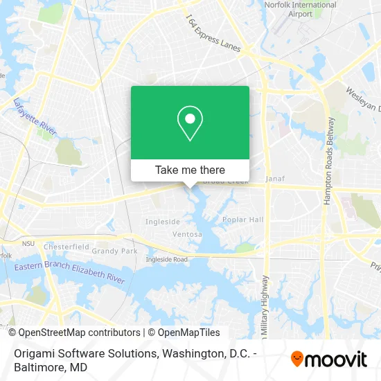
See Origami Software Solutions, Norfolk, on the map
Public Transit to Origami Software Solutions in Norfolk
Wondering how to get to Origami Software Solutions in Norfolk? Moovit helps you find the best way to get to Origami Software Solutions with step-by-step directions from the nearest public transit station.
Moovit provides free maps and live directions to help you navigate through your city. View schedules, routes, timetables, and find out how long does it take to get to Origami Software Solutions in real time.
Looking for the nearest stop or station to Origami Software Solutions? Check out this list of stops closest to your destination: Virginia Beach & Raby; Azalea Garden & Village; Ingleside Road Station.
Bus: 020, GREYHOUND US0654S, 009.Light Rail: 800.
Want to see if there’s another route that gets you there at an earlier time? Moovit helps you find alternative routes or times. Get directions from and directions to Origami Software Solutions easily from the Moovit App or Website.
We make riding to Origami Software Solutions easy, which is why over 1.7 million users, including users in Norfolk, trust Moovit as the best app for public transit. You don’t need to download an individual bus app or train app, Moovit is your all-in-one transit app that helps you find the best bus time or train time available.
For information on prices of bus, train and light rail, costs and ride fares to Origami Software Solutions, please check the Moovit app.
Use the app to navigate to popular places including to the airport, hospital, stadium, grocery store, mall, coffee shop, school, college, and university.
Origami Software Solutions Address: 968 Anna St street in Norfolk
- Virgina Army National Guard,
- Norfolk Armory,
- Virginia Army National Guard Readiness Center,
- Army National Guard,
- Norfolk Fire-Rescue Station 10,
- Station 10,
- Radio And Electronics,
- Norfolk Fire Department Federal Credit Union,
- Norfolk Radio And Electronics,
- Norfolk Traffic Operations,
- Mental Health Services,
- Norfolk Community Services Board,
- Omegas Of Norfolk Inc,
- Business Document Solutions,
- A Tidewater Women's And Lgbt Primary Care,
- Agent Wall Systems Inc,
- Builders & Contractors Exchange,
- American Electric Of Virginia,
- Jacto Sprayers Distribution,
- Blue Ribbon Results Academy
Places Near Origami Software Solutions (Norfolk)
- Amazon Hq2, Arlington County,
- Capital One Arena, Washington,
- M&T Bank Stadium, Baltimore,
- The Anthem, Washington,
- National Zoo, Washington,
- Marriott Marquis Washington, DC, Washington,
- Rock Creek Tennis Center, Washington,
- Museum Of The Bible, Washington,
- Westfield Montgomery Mall, Montgomery County,
- National Theatre, Washington,
- Pennsylvania Ave NW (3rd st and pennsylvania), Washington,
- Basilica of the National Shrine, Washington,
- National Museum of African American History and Culture, Washington,
- PG Mall, Prince George's County,
- Camden Yards, Baltimore,
- Warner Theatre, Washington,
- Washington National Cathedral, Washington,
- Sibley Memorial Hospital, Washington,
- Georgetown, Washington,
- Washington DC VA Medical Center, Washington
How to get to popular places in Washington, D.C. - Baltimore, MD with public transit
Get around Norfolk by public transit!
Traveling around Norfolk has never been so easy. See step by step directions as you travel to any attraction, street or major public transit station. View bus and train schedules, arrival times, service alerts and detailed routes on a map, so you know exactly how to get to anywhere in Norfolk.
When traveling to any destination around Norfolk use Moovit's Live Directions with Get Off Notifications to know exactly where and how far to walk, how long to wait for your line, and how many stops are left. Moovit will alert you when it's time to get off — no need to constantly re-check whether yours is the next stop.
Wondering how to use public transit in Norfolk or how to pay for public transit in Norfolk? Moovit public transit app can help you navigate your way with public transit easily, and at minimum cost. It includes public transit fees, ticket prices, and costs. Looking for a map of Norfolk public transit lines? Moovit public transit app shows all public transit maps in Norfolk with all Bus, Train, Metro, Light Rail and Ferry routes and stops on an interactive map.
Washington, D.C. - Baltimore, MD has 5 transit type(s), including: Bus, Train, Metro, Light Rail and Ferry, operated by several transit agencies, including WMATA, Montgomery County Ride On, Fairfax Connector, TheBus, PRTC, DASH - Alexandria, Arlington Transit (ART), RTA of Central Maryland, MDOT MTA, MDOT MTA Light RailLink, MDOT MTA Commuter Bus, MDOT MTA Local Bus, FXBGO!, Virginia Railway Express (VRE) and MARC