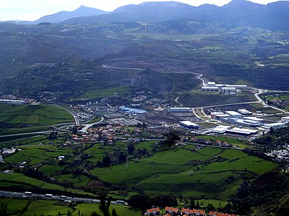
Directions to Ortuella with public transportation
The following transit lines have routes that pass near Ortuella
 Bus: A3333, A3336, A3338, A2336, A3332.
- Train: C2.
- Metro: L2.
- Funicular: FE.
How to get to Ortuella by bus?
Click on the bus route to see step by step directions with maps, line arrival times and updated time schedules.
How to get to Ortuella by train?
Click on the train route to see step by step directions with maps, line arrival times and updated time schedules.
How to get to Ortuella by metro?
Click on the metro route to see step by step directions with maps, line arrival times and updated time schedules.
Train station near Ortuella
- Urioste, 1 min walk,
Bus stops near Ortuella
- Urioste (1120), 5 min walk,
- Funikular Kalea (Udaletxea/Ayuntamiento) (1189), 10 min walk,
- San Antón (1152), 10 min walk,
- Primero De Mayo (Udaletxea/Ayuntamiento) (679), 10 min walk,
Funicular station near Ortuella
- La Escontrilla, 15 min walk,
Bus lines to Ortuella
- A2336, San Juan (Muskiz) (1066),
- A3333, El Campillo Industrialdea (1190),
- A3336, Abando (Geltokia/Estación) (4132),
- A3338, Somorrostro Ikastetxea (1366),
- A3332, Carlos VII 18 (450),
- A3331, Errepelega / Repelega (433),
- 018A, Trapagaran - Calle 1 De Mayo,
- 3718, Uni.Gasteiz - Universidad C/Aguirre Miramon,
- A3141, La Paz 43 (398),
What are the closest stations to Ortuella?
The closest stations to Ortuella are:
- Urioste is 11 meters away, 1 min walk.
- Urioste (1120) is 376 meters away, 5 min walk.
- Funikular Kalea (Udaletxea/Ayuntamiento) (1189) is 694 meters away, 10 min walk.
- San Antón (1152) is 737 meters away, 10 min walk.
- Primero De Mayo (Udaletxea/Ayuntamiento) (679) is 741 meters away, 10 min walk.
- La Escontrilla is 1123 meters away, 15 min walk.
Which bus lines stop near Ortuella?
These bus lines stop near Ortuella: A3333, A3336, A3338.
Which train line stops near Ortuella?
C2 (Bilbao-Intermod. Abando Indalecio Prieto→Muskiz)
Which metro line stops near Ortuella?
L2 (Basauri→Kabiezes)
What’s the nearest train station to Ortuella?
The nearest train station to Ortuella is Urioste. It’s a 1 min walk away.
What’s the nearest bus station to Ortuella?
The nearest bus station to Ortuella is Urioste (1120). It’s a 5 min walk away.
What’s the nearest funicular station to Ortuella?
The nearest funicular station to Ortuella is La Escontrilla. It’s a 15 min walk away.
What time is the first train to Ortuella?
The C2 is the first train that goes to Ortuella. It stops nearby at 5:18 AM.
What time is the last train to Ortuella?
The C2 is the last train that goes to Ortuella. It stops nearby at 11:38 PM.
What time is the first bus to Ortuella?
The 3718 is the first bus that goes to Ortuella. It stops nearby at 5:57 AM.
What time is the last bus to Ortuella?
The A3338 is the last bus that goes to Ortuella. It stops nearby at 11:40 PM.
What time is the first funicular to Ortuella?
The FE is the first funicular that goes to Ortuella. It stops nearby at 4:50 AM.
What time is the last funicular to Ortuella?
The FE is the last funicular that goes to Ortuella. It stops nearby at 11:10 PM.
See Ortuella on the map
Public Transportation to Ortuella
Wondering how to get to Ortuella? Moovit helps you find the best way to get to Ortuella with step-by-step directions from the nearest public transit station.
Moovit provides free maps and live directions to help you navigate through your city. View schedules, routes, timetables, and find out how long does it take to get to Ortuella in real time.
Looking for the nearest stop or station to Ortuella? Check out this list of stops closest to your destination: Urioste; Urioste (1120); Funikular Kalea (Udaletxea/Ayuntamiento) (1189); San Antón (1152); Primero De Mayo (Udaletxea/Ayuntamiento) (679); La Escontrilla.
Bus: A3333, A3336, A3338, A2336, A3332, A3331, 018A, 3718, A3141.Train: C2.Metro: L2.Funicular: FE.
Want to see if there’s another route that gets you there at an earlier time? Moovit helps you find alternative routes or times. Get directions from and directions to Ortuella easily from the Moovit App or Website.
We make riding to Ortuella easy, which is why over 1.5 million users, including users in Bilbao, trust Moovit as the best app for public transit. You don’t need to download an individual bus app or train app, Moovit is your all-in-one transit app that helps you find the best bus time or train time available.
For information on prices of train, bus and metro, costs and ride fares to Ortuella, please check the Moovit app.
Use the app to navigate to popular places including to the airport, hospital, stadium, grocery store, mall, coffee shop, school, college, and university.
Location: Bilbao
Popular routes to Ortuella
Popular routes from Ortuella
- Zuribeltza,
- Aiega,
- Argare,
- Luis,
- Amazon Counter-Panadería Charcutería Inma,
- Food Truck Vit,
- Food Truck Tic Tac Nam,
- Telepizza,
- Construcciones y Reformas Luis Asensio Perez,
- Parque Urioste,
- Beaskoetxea Miren Edurne Azpiolea,
- Sat Elektrohome,
- Miren Edurne Azpiolea Beaskoetxea,
- Princerelax,
- Vanesa Trinchete,
- Sumigas,
- Pizzería Zidan,
- Mercería Bego,
- Marve,
- Maderas Lobera
Places Near Ortuella
- Hospital Quirón Bizkaia, Erandio,
- Max Center, Barakaldo,
- Zubiarte, Bilbao,
- Centro Comercial Ballonti, Portugalete,
- Barracas Parque Etxebarria, Bilbao,
- Bec Bilbao Exhibition Centre, Barakaldo,
- hospital, Galdakao,
- UPV/EHU Campus de Bizkaia, Leioa,
- Rekalde, Bilbao,
- Megapark, Barakaldo,
- Centro Comercial Garbera, Donostia-San Sebastián,
- Ikea, Barakaldo,
- Zorroza, Bilbao,
- Centro Comercial Artea, Leioa,
- Ikea, Bilbao,
- Estación de Miribilla, Bilbao,
- Funicular De Artxanda, Bilbao,
- Hospital Galdakao-Usansolo, Galdakao,
- Bilbao Arena, Bilbao,
- Hospital Cruces, Barakaldo
How to get to popular places in Bilbao with public transit
Get around Bilbao by public transit!
Traveling around Bilbao has never been so easy. See step by step directions as you travel to any attraction, street or major public transit station. View bus and train schedules, arrival times, service alerts and detailed routes on a map, so you know exactly how to get to anywhere in Bilbao.
When traveling to any destination around Bilbao use Moovit's Live Directions with Get Off Notifications to know exactly where and how far to walk, how long to wait for your line, and how many stops are left. Moovit will alert you when it's time to get off — no need to constantly re-check whether yours is the next stop.
Wondering how to use public transit in Bilbao or how to pay for public transit in Bilbao? Moovit public transit app can help you navigate your way with public transit easily, and at minimum cost. It includes public transit fees, ticket prices, and costs. Looking for a map of Bilbao public transit lines? Moovit public transit app shows all public transit maps in Bilbao with all Bus, Train, Metro, Light Rail, Ferry, Funicular and Gondola routes and stops on an interactive map.
Bilbao has 7 transit type(s), including: Bus, Train, Metro, Light Rail, Ferry, Funicular and Gondola, operated by several transit agencies, including Metro Bilbao, Euskotren Trena, Feve, Artxandako Funikularra, Puente Colgante Bizkaia Zubia, Ascensor de Ereaga, Bilbobus, Bizkaibus, Lejoan Busa, Basauri Bus, CuadraBus, IRB Castro, Asociación de Boteros de Portugalete, RENFE and TCC Pamplona