Ostiense/Prefecture stop - Tuesday schedule
| Line | Direction | Time |
|---|---|---|
| NMB | Laurentina (Metro B) | 3:13 AM |
| NMB | Laurentina (Metro B) | 3:13 AM |
| NMB | Laurentina (Metro B) | 3:33 AM |
| NMB | Laurentina (Metro B) | 3:33 AM |
| NME | Lido Station Square | 3:39 AM |
| NMB | Laurentina (Metro B) | 3:53 AM |
| NMB | Laurentina (Metro B) | 4:12 AM |
| NMB | Laurentina (Metro B) | 4:31 AM |
| NME | Lido Station Square | 4:38 AM |
| NMB | Laurentina (Metro B) | 4:50 AM |
| NMB | Laurentina (Metro B) | 5:14 AM |
| 769 | London | 5:35 AM |
| NMB | Laurentina (Metro B) | 5:38 AM |
| 23 | Pincherle/Parravano | 5:48 AM |
| 23 | Pincherle/Parravano | 6:00 AM |
| 769 | London | 6:01 AM |
| 23 | Pincherle/Parravano | 6:13 AM |
| 792 | Eudes | 6:21 AM |
| 769 | London | 6:27 AM |
| 23 | Pincherle/Parravano | 6:28 AM |
| 23 | Pincherle/Parravano | 6:35 AM |
| 792 | Eudes | 6:41 AM |
| 23 | Pincherle/Parravano | 6:42 AM |
| 23 | Pincherle/Parravano | 6:55 AM |
| 769 | London | 6:56 AM |
Directions to Ostiense/Prefecture stop (Roma) with public transit
The following transit lines have routes that pass near Ostiense/Prefecture
 Bus: 23, 769, 792, NMB, NME.
- Train: R, R, R, RV, FL1.
- Metro: B.
How to get to Ostiense/Prefecture stop by bus?
Click on the bus route to see step by step directions with maps, line arrival times and updated time schedules.
How to get to Ostiense/Prefecture stop by metro?
Click on the metro route to see step by step directions with maps, line arrival times and updated time schedules.
Bus stops near Ostiense/Prefecture stop in Roma
- Ostiense/Garbatella (Metro B), 3 min walk,
- Ostiense/Prefecture, 3 min walk,
- Pullino-Garbatella (Metro B), 9 min walk,
- Ostiense Circle/Caffaro, 10 min walk,
Metro stations near Ostiense/Prefecture station in Roma
- Pyramid, 16 min walk,
Train stations near Ostiense/Prefecture station in Roma
- Roma Ostiense, 16 min walk,
- St. Paul's Basilica, 19 min walk,
Bus lines to Ostiense/Prefecture stop in Roma
- 792, Porta San Giovanni (MA),
- NMB, Rebibbia (Metro B),
- NME, Lido Station Square,
- 23, Clodio,
- 769, London,
- 670, Pincherle/Parravano,
- 715, Tiberio Imperatore,
- 669, Pincherle/Parravano,
- N716, Termini (Metro A-Metro B-Railway),
- 716, Ballarin,
What are the closest stations to Ostiense/Prefecture?
The closest stations to Ostiense/Prefecture are:
- Ostiense/Garbatella (Metro B) stop is 153 meters away, 3 min walk.
- Ostiense/Prefecture stop is 198 meters away, 3 min walk.
- Pullino-Garbatella (Metro B) stop is 668 meters away, 9 min walk.
- Ostiense Circle/Caffaro stop is 712 meters away, 10 min walk.
- Pyramid station is 1191 meters away, 16 min walk.
- Roma Ostiense station is 1219 meters away, 16 min walk.
- St. Paul's Basilica station is 1420 meters away, 19 min walk.
Which bus lines stop near Ostiense/Prefecture?
These bus lines stop near Ostiense/Prefecture: 23, 769, 792.
Which metro line stops near Ostiense/Prefecture?
B (Laurentina)
What’s the nearest metro station to Ostiense/Prefecture in Roma?
The nearest metro station to Ostiense/Prefecture in Roma is Pyramid. It’s a 16 min walk away.
What’s the nearest train station to Ostiense/Prefecture in Roma?
The nearest train station to Ostiense/Prefecture in Roma is Roma Ostiense. It’s a 16 min walk away.
What’s the nearest bus station to Ostiense/Prefecture in Roma?
The nearest bus stations to Ostiense/Prefecture in Roma are Ostiense/Garbatella (Metro B) and Ostiense/Prefecture. The closest one is a 3 min walk away.
What time is the first metro to Ostiense/Prefecture in Roma?
The B is the first metro that goes to Ostiense/Prefecture in Roma. It stops nearby at 5:40 AM.
What time is the last metro to Ostiense/Prefecture in Roma?
The B is the last metro that goes to Ostiense/Prefecture in Roma. It stops nearby at 11:58 PM.
What time is the first train to Ostiense/Prefecture in Roma?
The FL1 is the first train that goes to Ostiense/Prefecture in Roma. It stops nearby at 5:17 AM.
What time is the last train to Ostiense/Prefecture in Roma?
The FL1 is the last train that goes to Ostiense/Prefecture in Roma. It stops nearby at 11:59 PM.
What time is the first bus to Ostiense/Prefecture in Roma?
The NME is the first bus that goes to Ostiense/Prefecture in Roma. It stops nearby at 3:00 AM.
What time is the last bus to Ostiense/Prefecture in Roma?
The NME is the last bus that goes to Ostiense/Prefecture in Roma. It stops nearby at 3:51 AM.
Ostiense/Prefecture station
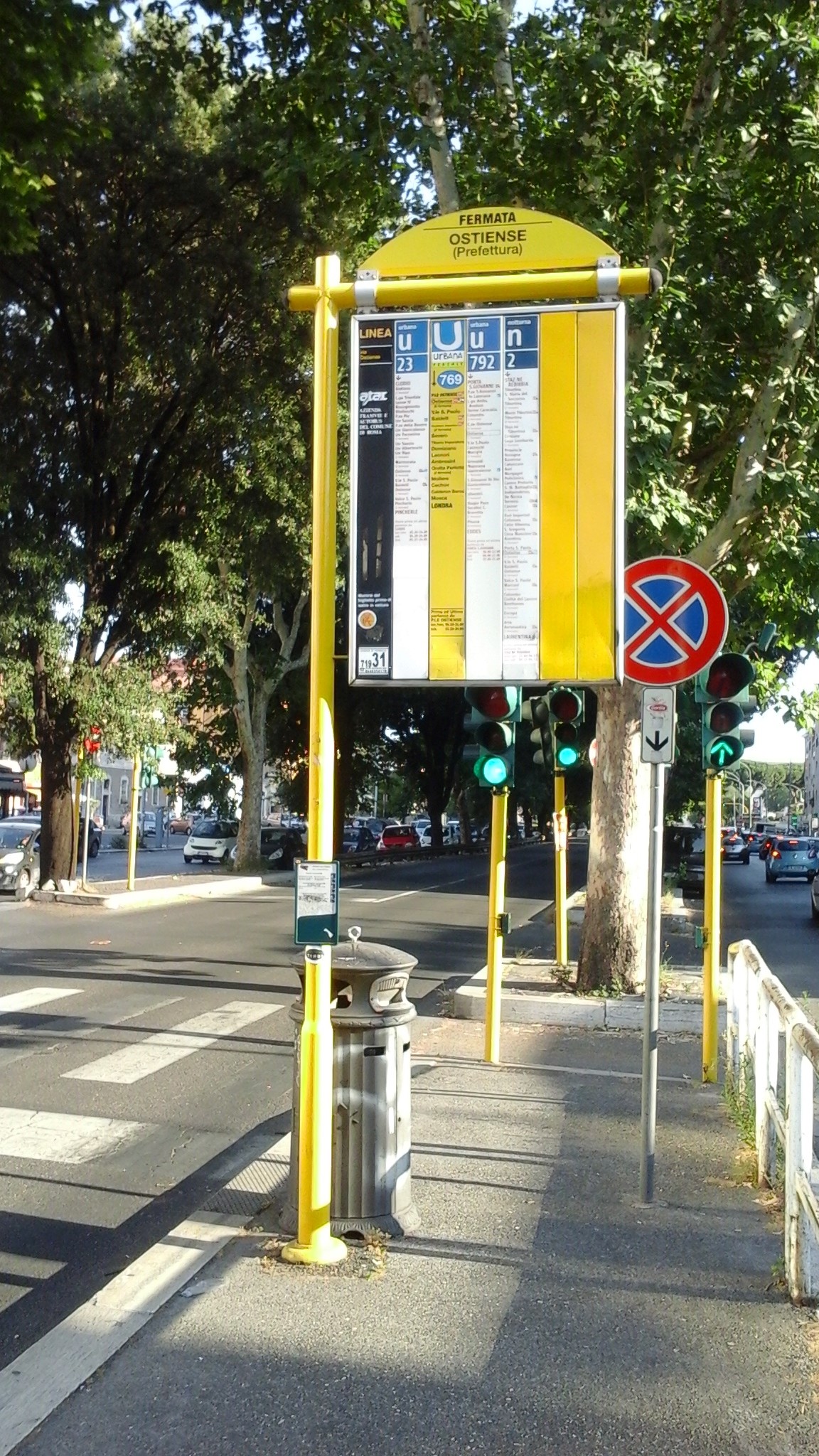 Taken by Anonymous
See Ostiense/Prefecture stop, Roma, on the map
Public transit to Ostiense/Prefecture stop (ID: 71931) in Roma
Looking for directions to Ostiense/Prefecture in Roma, Italy?
Download the Moovit App to find the current schedule and step-by-step directions for Bus or Metro routes that pass through Ostiense/Prefecture.
Looking for the nearest stops closest to Ostiense/Prefecture ? Check out this list of closest stops to your destination: Ostiense/Garbatella (Metro B); Ostiense/Prefecture; Pullino-Garbatella (Metro B); Ostiense Circle/Caffaro; Pyramid; Roma Ostiense; St. Paul's Basilica.
Bus: 23, 769, 792, NMB, NME, 670, 715.Train: R, R, R, RV, FL1, FC2.Metro: B.
We make riding on public transit to Ostiense/Prefecture easy, which is why over 1.7 billion users, including users in Roma trust Moovit as the best app for public transit.
Use the app to navigate to popular places including to the airport, hospital, stadium, grocery store, mall, coffee shop, school, college, and university.
Ostiense/Prefecture stop’s code is 71931
The first line to this stop is NMB, at 3:13 AM, and the last line is NMB at 2:53 AM.
Via Ostiense, Roma, Italy
This stop serves ATAC’s lines
- Ostiense/Garbatella (Metro B),
- Ostiense/Prefecture,
- Pullino-Garbatella (Metro B),
- Ostiense Circle/Caffaro
Bus stops near Ostiense/Prefecture stop
- Pyramid
Metro station near Ostiense/Prefecture station
- Roma Ostiense,
- St. Paul's Basilica
Train stations near Ostiense/Prefecture station
- Ponte Di Nona,
- Fara Sabina | Campo Maggiore,
- Salvo D'Acquisto Avenue 1,
- Gregory VII/St. Damaso,
- Tor Di Quinto,
- S. Maria Maggiore,
- WFP,
- Civita Castellana - Magliano,
- Chelini/Euclide,
- Cerchi/Porta Capena,
- Aprilia | Pontina Road Apriliana Road,
- Casilina/Torre Maura,
- Casal Bernocchi-Centro Giano,
- Monterotondo | Salaria Street (Piedicosta),
- Anzio | Ardeatina Road Acqua Marina Avenue,
- Maxxi,
- National/Turin,
- Maxxi,
- Via Quarto Sant'Antonio, 73,
- Portuense/Imbrecciato
Popular public transit stations in Roma
Get around Roma by public transit!
Traveling around Roma has never been so easy. See step by step directions as you travel to any attraction, street or major public transit station. View bus and train schedules, arrival times, service alerts and detailed routes on a map, so you know exactly how to get to anywhere in Roma.
When traveling to any destination around Roma use Moovit's Live Directions with Get Off Notifications to know exactly where and how far to walk, how long to wait for your line, and how many stops are left. Moovit will alert you when it's time to get off — no need to constantly re-check whether yours is the next stop.
Wondering how to use public transit in Roma or how to pay for public transit in Roma? Moovit public transit app can help you navigate your way with public transit easily, and at minimum cost. It includes public transit fees, ticket prices, and costs. Looking for a map of Roma public transit lines? Moovit public transit app shows all public transit maps in Roma with all Bus, Train, Metro, Light Rail, Ferry, Funicular and Gondola routes and stops on an interactive map.
Rome and Lazio has 7 transit type(s), including: Bus, Train, Metro, Light Rail, Ferry, Funicular and Gondola, operated by several transit agencies, including ATAC, Cotral, Trenitalia, Troiani Transportation Services, BIS, ATR Mobility, Tuscia, Shuttle, Seatour, Troiani Bus Lines, CSC Mobility, Terravision, ATRAL, Tambus and Sitbus