Ostiense/St. Paul stop - Monday schedule
| Line | Direction | Time |
|---|---|---|
| NMB | Rebibbia (Metro B) | 3:01 AM |
| NMB | Rebibbia (Metro B) | 3:01 AM |
| NMB | Rebibbia (Metro B) | 3:20 AM |
| NMB | Rebibbia (Metro B) | 3:20 AM |
| NMB | Rebibbia (Metro B) | 3:39 AM |
| NMB | Rebibbia (Metro B) | 3:39 AM |
| NME | Piazza Venezia | 3:49 AM |
| NME | Piazza Venezia | 3:49 AM |
| NMB | Rebibbia (Metro B) | 3:59 AM |
| NMB | Rebibbia (Metro B) | 3:59 AM |
| NMB | Rebibbia (Metro B) | 4:18 AM |
| NMB | Rebibbia (Metro B) | 4:18 AM |
| NMB | Rebibbia (Metro B) | 4:37 AM |
| NMB | Rebibbia (Metro B) | 4:37 AM |
| NME | Piazza Venezia | 4:44 AM |
| NME | Piazza Venezia | 4:44 AM |
| NMB | Rebibbia (Metro B) | 4:56 AM |
| NMB | Rebibbia (Metro B) | 4:56 AM |
| NMB | Rebibbia (Metro B) | 5:15 AM |
| NMB | Rebibbia (Metro B) | 5:15 AM |
| 769 | Piazzale Ostiense-Piramide (Metro B-Rail Line) | 5:20 AM |
| 23 | Clodio | 5:21 AM |
| NME | Piazza Venezia | 5:29 AM |
| NME | Piazza Venezia | 5:29 AM |
| NMB | Termini (Metro A-Metro B-Railway) | 5:32 AM |
Directions to Ostiense/St. Paul stop (Roma) with public transit
The following transit lines have routes that pass near Ostiense/St. Paul
 Bus: 128, 23, 792, NMB, NME.
- Train: FC2, R, R, R, RV.
- Metro: B.
How to get to Ostiense/St. Paul stop by bus?
Click on the bus route to see step by step directions with maps, line arrival times and updated time schedules.
How to get to Ostiense/St. Paul stop by train?
Click on the train route to see step by step directions with maps, line arrival times and updated time schedules.
How to get to Ostiense/St. Paul stop by metro?
Click on the metro route to see step by step directions with maps, line arrival times and updated time schedules.
Bus stops near Ostiense/St. Paul stop in Roma
- Ostiense/Seven Churches, 2 min walk,
- Leonardo Da Vinci/Gallieno, 5 min walk,
- Giustiniano/Settimio Severo, 5 min walk,
- Giustiniano (Mb), 7 min walk,
- Baldelli (Metro B), 7 min walk,
- Baldelli, 7 min walk,
Train stations near Ostiense/St. Paul station in Roma
- St. Paul's Basilica, 13 min walk,
- Roma Ostiense, 20 min walk,
Metro stations near Ostiense/St. Paul station in Roma
- Garbatella, 18 min walk,
Bus lines to Ostiense/St. Paul stop in Roma
- NMB, Rebibbia (Metro B),
- NME, Lido Station Square,
- 23, Clodio,
- 769, London,
- 715, Tiberio Imperatore,
- 669, Pincherle/Parravano,
- 766, Millevoi,
- C8, Laurentino Cemetery,
- 128, Crocco,
- 670, Pincherle/Parravano,
- C6, Flaminio Cemetery,
- FC2 BUS, Cristoforo Colombo Station,
- 792, Porta San Giovanni (MA),
What are the closest stations to Ostiense/St. Paul?
The closest stations to Ostiense/St. Paul are:
- Ostiense/Seven Churches stop is 85 meters away, 2 min walk.
- Leonardo Da Vinci/Gallieno stop is 316 meters away, 5 min walk.
- Giustiniano/Settimio Severo stop is 362 meters away, 5 min walk.
- Giustiniano (Mb) stop is 496 meters away, 7 min walk.
- Baldelli (Metro B) stop is 537 meters away, 7 min walk.
- Baldelli stop is 543 meters away, 7 min walk.
- St. Paul's Basilica station is 1018 meters away, 13 min walk.
- Garbatella station is 1361 meters away, 18 min walk.
- Roma Ostiense station is 1581 meters away, 20 min walk.
Which bus lines stop near Ostiense/St. Paul?
These bus lines stop near Ostiense/St. Paul: 128, 23, 792.
Which train line stops near Ostiense/St. Paul?
FC2 (Saint Paul Gate)
Which metro line stops near Ostiense/St. Paul?
B (Laurentina)
What’s the nearest metro station to Ostiense/St. Paul in Roma?
The nearest metro station to Ostiense/St. Paul in Roma is Garbatella. It’s a 18 min walk away.
What’s the nearest train station to Ostiense/St. Paul in Roma?
The nearest train station to Ostiense/St. Paul in Roma is St. Paul's Basilica. It’s a 13 min walk away.
What’s the nearest bus station to Ostiense/St. Paul in Roma?
The nearest bus station to Ostiense/St. Paul in Roma is Ostiense/Seven Churches. It’s a 2 min walk away.
What time is the first metro to Ostiense/St. Paul in Roma?
The B is the first metro that goes to Ostiense/St. Paul in Roma. It stops nearby at 5:38 AM.
What time is the last metro to Ostiense/St. Paul in Roma?
The B is the last metro that goes to Ostiense/St. Paul in Roma. It stops nearby at 12:00 AM.
What time is the first train to Ostiense/St. Paul in Roma?
The FL1 is the first train that goes to Ostiense/St. Paul in Roma. It stops nearby at 5:17 AM.
What time is the last train to Ostiense/St. Paul in Roma?
The FC2 is the last train that goes to Ostiense/St. Paul in Roma. It stops nearby at 12:04 AM.
What time is the first bus to Ostiense/St. Paul in Roma?
The NMB is the first bus that goes to Ostiense/St. Paul in Roma. It stops nearby at 3:05 AM.
What time is the last bus to Ostiense/St. Paul in Roma?
The NME is the last bus that goes to Ostiense/St. Paul in Roma. It stops nearby at 3:49 AM.
Ostiense/St. Paul station
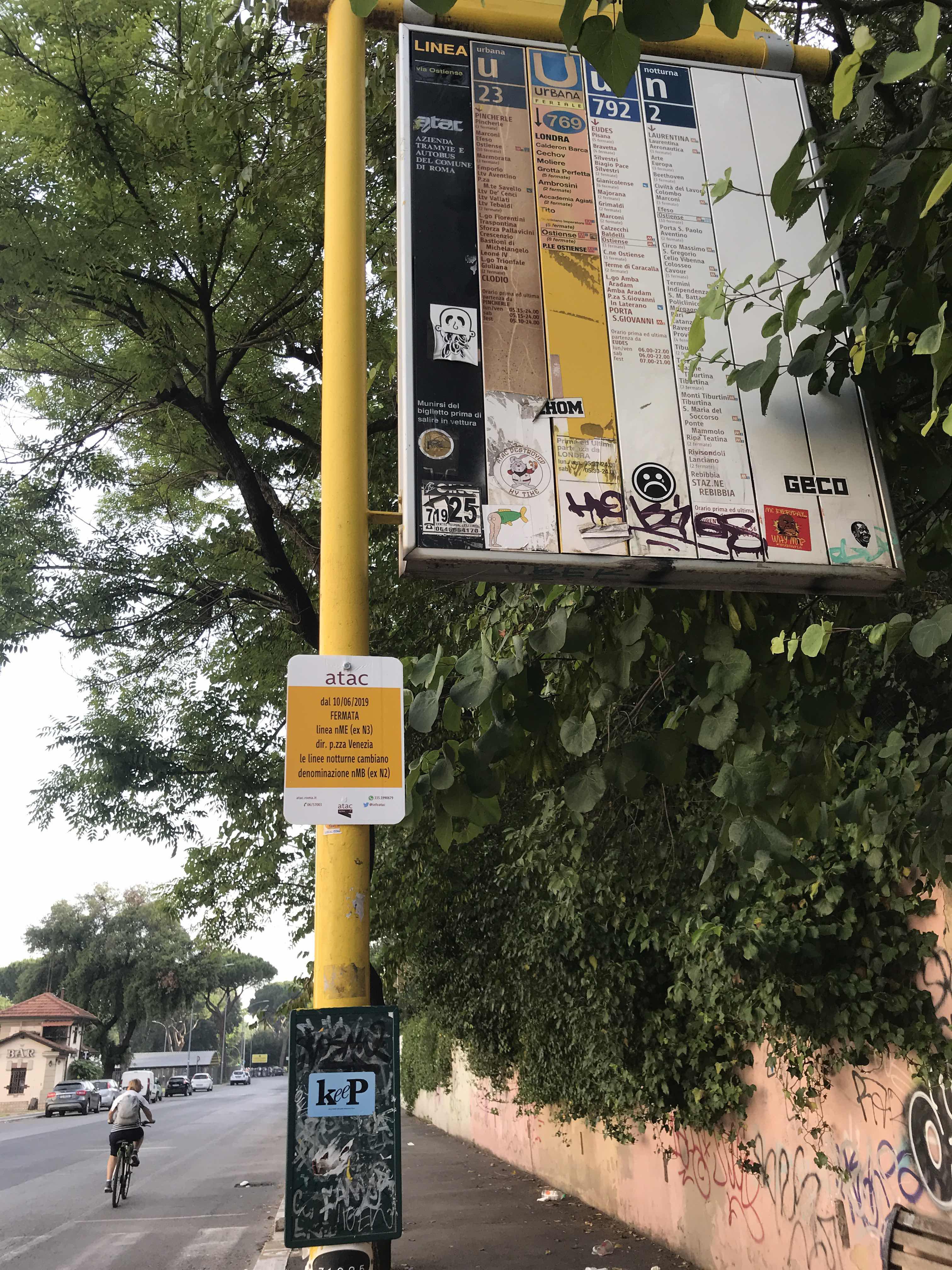 Taken by Irrel D.
See Ostiense/St. Paul stop, Roma, on the map
Public transit to Ostiense/St. Paul stop (ID: 71925) in Roma
Looking for directions to Ostiense/St. Paul in Roma, Italy?
Download the Moovit App to find the current schedule and step-by-step directions for Bus, Metro or Train routes that pass through Ostiense/St. Paul.
Looking for the nearest stops closest to Ostiense/St. Paul ? Check out this list of closest stops to your destination: Ostiense/Seven Churches; Leonardo Da Vinci/Gallieno; Giustiniano/Settimio Severo; Giustiniano (Mb); Baldelli (Metro B); Baldelli; St. Paul's Basilica; Garbatella; Roma Ostiense.
Bus: 128, 23, 792, NMB, NME, 769, 715, 669, 766, C8.Train: FC2, R, R, R, RV, FL1.Metro: B.
We make riding on public transit to Ostiense/St. Paul easy, which is why over 1.7 billion users, including users in Roma trust Moovit as the best app for public transit.
Use the app to navigate to popular places including to the airport, hospital, stadium, grocery store, mall, coffee shop, school, college, and university.
Ostiense/St. Paul stop’s code is 71925
The first line to this stop is NMB, at 3:01 AM, and the last line is NME at 2:59 AM.
This stop serves ATAC’s lines
Popular routes from Ostiense/St. Paul stop, Roma
- Ostiense/Seven Churches,
- Leonardo Da Vinci/Gallieno,
- Giustiniano/Settimio Severo,
- Giustiniano (Mb),
- Baldelli (Metro B),
- Baldelli
Bus stops near Ostiense/St. Paul stop
- St. Paul's Basilica,
- Roma Ostiense
Train stations near Ostiense/St. Paul station
- Garbatella
Metro station near Ostiense/St. Paul station
- Tor De' Schiavi/Gerani,
- Roma Trastevere,
- San Lorenzo Station,
- Sutri | Cassia Street (Km 47),
- Rome | Prenestina Street Rocca Cencia Street,
- Riano | Via Flaminia (Station),
- Terracina - Weekend Albasol Beaches,
- Santa Marinella,
- Tuscolana/Anagnina,
- Prenestina/Acqua Bullicante,
- Zanardelli,
- Nice/Queen Margherita Avenue,
- Francia Avenue/Flaminio Bridge,
- Rome Cornelia Via Tardini,
- Mameli,
- Parioli/Oxilia,
- Torre Spaccata (Mc),
- Teatro Marcello,
- Montefiascone | Cassia Road (Km 104),
- Sabaudia | Pontina Street 54th Mile
Popular public transit stations in Roma
Get around Roma by public transit!
Traveling around Roma has never been so easy. See step by step directions as you travel to any attraction, street or major public transit station. View bus and train schedules, arrival times, service alerts and detailed routes on a map, so you know exactly how to get to anywhere in Roma.
When traveling to any destination around Roma use Moovit's Live Directions with Get Off Notifications to know exactly where and how far to walk, how long to wait for your line, and how many stops are left. Moovit will alert you when it's time to get off — no need to constantly re-check whether yours is the next stop.
Wondering how to use public transit in Roma or how to pay for public transit in Roma? Moovit public transit app can help you navigate your way with public transit easily, and at minimum cost. It includes public transit fees, ticket prices, and costs. Looking for a map of Roma public transit lines? Moovit public transit app shows all public transit maps in Roma with all Bus, Train, Metro, Ferry, Funicular and Gondola routes and stops on an interactive map.
Rome and Lazio has 6 transit type(s), including: Bus, Train, Metro, Ferry, Funicular and Gondola, operated by several transit agencies, including ATAC, Cotral, Trenitalia, Troiani Transportation Services, BIS, ATR Mobility, Tuscia, Shuttle, Seatour, Troiani Bus Lines, CSC Mobility, Terravision, ATRAL, Tambus and Sitbus