How to get to Ott by bus?
Click on the bus route to see step by step directions with maps, line arrival times and updated time schedules.
From Karlsruhe Primark, Mühlhausen An Der Enz
172 minFrom 75223, Niefern-Öschelbronn
30 minFrom Enzkreisklinik Mühlacker, Vvg Der Stadt Mühlacker
89 minFrom Porsche AG, Weissach
61 minFrom Kibungu, Verwaltungsverband Heckengäu
33 minFrom Monbachtal, Liebenzell
71 minFrom Fuxini Indoor-Spielplatz, Vvg Der Stadt Mühlacker
84 minFrom Klinik Öschelbronn, Niefern-Öschelbronn
33 minFrom Kloster Maulbronn, Verwaltungsgemeinschaft Maulbronn
54 minFrom Cts-Klinik Schloßberg, Liebenzell
71 min
How to get to Ott by train?
Click on the train route to see step by step directions with maps, line arrival times and updated time schedules.
Bus stops near Ott in Pforzheim
Train stations near Ott in Pforzheim
Bus lines to Ott in Pforzheim
- 762, Renningen Bf (Industriestr.),VIEW
- 763, Mönsheim Marktplatz,VIEW
- 1, Eutingen Gartenstadt,VIEW
- 16, Haidach Dresdener Straße,VIEW
- 5, Pforzheim Hängsteig,VIEW
- 6, Pforzheim Fachmarktzentrum,VIEW
- 742, Pforzheim Zob,VIEW
- 9, Birkenfeld Jägersteig,VIEW
- E, Pforzheim J.Wittum Schule,VIEW
- 20, Brötzingen Bahnhof,VIEW
- 936, Wiernsheim Bürgersaal,VIEW
- 10, Pforzheim ZOB Bstg 10 - Brötzingen Gülichstraße,VIEW
- 17, Pforzheim Grünewaldstraße - Pforzheim Heim am Hachel,VIEW
- 2, Sonnenhof Theodor Heuss Str. - Pforzheim Unterer Wingertweg,VIEW
- 3, Pforzheim ZOB Bstg 10 - Weißenstein,VIEW
- 4, Huchenfeld Hellerichstraße - Pforzheim ZOB Bstg 13,VIEW
- 41, Würm Kirche - Pforzheim ZOB Bstg 13,VIEW
- 42, Huchenfeld Hellerichstraße - Pforzheim ZOB Bstg 13,VIEW
- 43, Büchenbronn Panoramastraße - Pforzheim ZOB Bstg 13,VIEW
- 666, Weil der Stadt Bf Bstg 1 - Pforzheim ZOB Bstg 13,VIEW
What are the closest stations to Ott?
The closest stations to Ott are:
- Pforzheim Waisenhauspl. is 149 meters away, 2 min walk.
- Pforzheim Flößerviertel is 220 meters away, 3 min walk.
- Pforzheim Marktplatz Bstg 3 is 264 meters away, 4 min walk.
- Pforzheim Bahnhofstraße is 587 meters away, 8 min walk.
- Pforzheim Hauptbahnhof is 962 meters away, 13 min walk.
- Pforzheim Hbf is 1136 meters away, 15 min walk.
Which bus lines stop near Ott?
These bus lines stop near Ott: 735, 736, 737, 739, 743, 763, 9.
Which train lines stop near Ott?
These train lines stop near Ott: 61, RE1, S6.
What’s the nearest train station to Ott in Pforzheim?
The nearest train station to Ott in Pforzheim is Pforzheim Hauptbahnhof. It’s a 13 min walk away.
What’s the nearest bus station to Ott in Pforzheim?
The nearest bus station to Ott in Pforzheim is Pforzheim Waisenhauspl.. It’s a 2 min walk away.
What time is the first light rail to Ott in Pforzheim?
The S5 is the first light rail that goes to Ott in Pforzheim. It stops nearby at 3:09 AM.
What time is the last light rail to Ott in Pforzheim?
The S5 is the last light rail that goes to Ott in Pforzheim. It stops nearby at 1:06 AM.
What time is the first train to Ott in Pforzheim?
The MEX17 is the first train that goes to Ott in Pforzheim. It stops nearby at 3:00 AM.
What time is the last train to Ott in Pforzheim?
The 34 is the last train that goes to Ott in Pforzheim. It stops nearby at 3:06 AM.
What time is the first bus to Ott in Pforzheim?
The 743 is the first bus that goes to Ott in Pforzheim. It stops nearby at 5:13 AM.
What time is the last bus to Ott in Pforzheim?
The 5 is the last bus that goes to Ott in Pforzheim. It stops nearby at 12:00 AM.
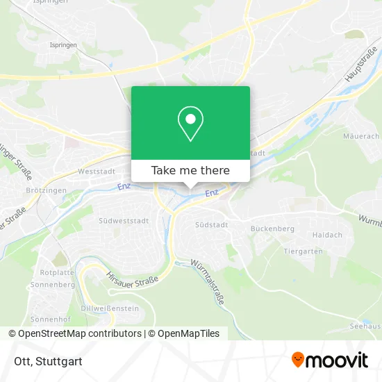
See Ott, Pforzheim, on the map
Public Transit to Ott in Pforzheim
Wondering how to get to Ott in Pforzheim? Moovit helps you find the best way to get to Ott with step-by-step directions from the nearest public transit station.
Moovit provides free maps and live directions to help you navigate through your city. View schedules, routes, timetables, and find out how long does it take to get to Ott in real time.
Looking for the nearest stop or station to Ott? Check out this list of stops closest to your destination: Pforzheim Waisenhauspl.; Pforzheim Flößerviertel; Pforzheim Marktplatz Bstg 3; Pforzheim Bahnhofstraße; Pforzheim Hauptbahnhof; Pforzheim Hbf.
Bus: 735, 736, 737, 739, 743, 763, 9, 762, 1, 16, 5, 6, 742.Train: 61, RE1, S6, MEX17, S5, S51, RE 1, S5, MEX 17A, S51, MEX17, MEX17A, RB17.
Want to see if there’s another route that gets you there at an earlier time? Moovit helps you find alternative routes or times. Get directions from and directions to Ott easily from the Moovit App or Website.
We make riding to Ott easy, which is why over 1.5 million users, including users in Pforzheim, trust Moovit as the best app for public transit. You don’t need to download an individual bus app or train app, Moovit is your all-in-one transit app that helps you find the best bus time or train time available.
For information on prices of bus and train, costs and ride fares to Ott, please check the Moovit app.
Use the app to navigate to popular places including to the airport, hospital, stadium, grocery store, mall, coffee shop, school, college, and university.
Location: Pforzheim, Stuttgart
- Parkhotel Pforzheim,
- Karl Zirenner,
- Der Flößer,
- Flüwo Bauen Wohnen Eg,
- Tiefgarage Marktplatz,
- The Irish Pub Pforzheim,
- Flößerviertel,
- L'Osteria Pforzheim,
- Eingang Neues Rathaus,
- Theater Pforzheim,
- Congresszentrum Kurzparkzone,
- Goldener Pforzheimer Weihnachtsmarkt,
- Altes Rathaus,
- Second Hand,
- Bürgercentrum,
- High Five,
- Leder Barton,
- Ladestation für Elektrofahrzeuge,
- Blumen Nestele,
- Carl Stiess
Places Near Ott (Pforzheim)
- Schleyerhalle, Bad Cannstatt,
- Porsche-Arena, Bad Cannstatt,
- Pariser Platz Stuttgart, Stuttgart-Mitte,
- FlixBus Haltestelle, Stuttgart,
- Mercedes-Benz Museum, Bad Cannstatt,
- Porsche Museum, Zuffenhausen,
- Hauptbahnhof Stuttgart, Stuttgart-Mitte,
- SI-Centrum, Möhringen,
- Marmorsaal Im Weissenburgpark, Stuttgart-Süd,
- Wilhelma (U-Bahn Wilhelma), Bad Cannstatt,
- Gleis 101/102 (tief), Stuttgart-Mitte,
- Waldfriedhof, Degerloch,
- Klinikum Stuttgart - Katharinenhospital, Stuttgart-Mitte,
- Mettingen Eros-Center Puff Laufhaus, Esslingen Am Neckar,
- Im Wizemann (Halle), Bad Cannstatt,
- Hanns-Martin-Schleyer-Halle (Stuttgart Hans-Martin-Schleyerhalle), Bad Cannstatt,
- Mercedes-Benz Museum (Mercedes Museum Stuttgart), Bad Cannstatt,
- Gasometer Pforzheim, Pforzheim,
- Hanns-Martin-Schleyer-Halle, Bad Cannstatt,
- Geilhaus Haus 33a, Reutlingen-Betzingen
How to get to popular places in Stuttgart with public transit
Get around Pforzheim by public transit!
Traveling around Pforzheim has never been so easy. See step by step directions as you travel to any attraction, street or major public transit station. View bus and train schedules, arrival times, service alerts and detailed routes on a map, so you know exactly how to get to anywhere in Pforzheim.
When traveling to any destination around Pforzheim use Moovit's Live Directions with Get Off Notifications to know exactly where and how far to walk, how long to wait for your line, and how many stops are left. Moovit will alert you when it's time to get off — no need to constantly re-check whether yours is the next stop.
Wondering how to use public transit in Pforzheim or how to pay for public transit in Pforzheim? Moovit public transit app can help you navigate your way with public transit easily, and at minimum cost. It includes public transit fees, ticket prices, and costs. Looking for a map of Pforzheim public transit lines? Moovit public transit app shows all public transit maps in Pforzheim with all Bus, Train, Subway, Light Rail, Ferry, S-Bahn and Funicular routes and stops on an interactive map.
Stuttgart has 7 transit type(s), including: Bus, Train, Subway, Light Rail, Ferry, S-Bahn and Funicular, operated by several transit agencies, including SSB - Stadtbahn, SSB, SSB - Seilbahn / Zacke, S-Bahn Stuttgart, Rhein-Neckar-Verkehr GmbH (rnv), Karlsruher Verkehrsverbund, DB AG, DB Regiobus BW, Arverio Baden-Württemberg GmbH, DB RegioNetz Verkehrs GmbH Westfrankenbahn, DB Regio AG Baden-Württemberg, Südwestdeutsche Verkehrs-AG, DB Regio AG Mitte Region Hessen, DB and Bodensee-Oberschwaben-Bahn