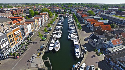
See Oud-Beijerland on the map
Directions to Oud-Beijerland with public transportation
The following transit lines have routes that pass near Oud-Beijerland
 Bus:
Bus:
How to get to Oud-Beijerland by bus?
Click on the bus route to see step by step directions with maps, line arrival times and updated time schedules.
Bus stations near Oud-Beijerland
- Oud-Beijerland, Zinkweg,1 min walk,
Bus lines to Oud-Beijerland
- OVOM,van Zuid-Beijerland naar Oud-Beijerland,
- 160,Goudswaard Dorp - Rotterdam Zuidplein,
- 163,Oud-Beijerland - Rotterdam Lombardijen,
- 171,Oud Beijerland - Rotterdam,
- 711,Oud-Beijerland-Zuid - Beijerland,
- 712,van Zuid-Beijerland - Oud-Beijerland,
- 860,Rotterdam Centraal - Goudswaard,
- 170,Rotterdam Zuidplein,
- 172,Oud-Beijerland,
What are the closest stations to Oud-Beijerland?
The closest stations to Oud-Beijerland are:
- Oud-Beijerland, Zinkweg is 1 meters away, 1 min walk.
Which bus lines stop near Oud-Beijerland?
These bus lines stop near Oud-Beijerland: 171, 172.
What’s the nearest bus stop to Oud-Beijerland?
The nearest bus stop to Oud-Beijerland is Oud-Beijerland, Zinkweg. It’s a 1 min walk away.
What time is the first bus to Oud-Beijerland?
The 171 is the first bus that goes to Oud-Beijerland. It stops nearby at 5:41 AM.
What time is the last bus to Oud-Beijerland?
The 171 is the last bus that goes to Oud-Beijerland. It stops nearby at 1:05 AM.
See Oud-Beijerland on the map
Public Transportation to Oud-Beijerland
Wondering how to get to Oud-Beijerland, Netherlands? Moovit helps you find the best way to get to Oud-Beijerland with step-by-step directions from the nearest public transit station.
Moovit provides free maps and live directions to help you navigate through your city. View schedules, routes, timetables, and find out how long does it take to get to Oud-Beijerland in real time.
Looking for the nearest stop or station to Oud-Beijerland? Check out this list of stops closest to your destination: Oud-Beijerland.
Bus:
Want to see if there’s another route that gets you there at an earlier time? Moovit helps you find alternative routes or times. Get directions from and directions to Oud-Beijerland easily from the Moovit App or Website.
We make riding to Oud-Beijerland easy, which is why over 1.5 million users, including users in Netherlands, trust Moovit as the best app for public transit. You don’t need to download an individual bus app or train app, Moovit is your all-in-one transit app that helps you find the best bus time or train time available.
For information on prices of bus, metro and light rail, costs and ride fares to Oud-Beijerland, please check the Moovit app.
Use the app to navigate to popular places including to the airport, hospital, stadium, grocery store, mall, coffee shop, school, college, and university.
Location: Netherlands
Popular routes to Oud-Beijerland
Popular routes from Oud-Beijerland
Attractions near Oud-Beijerland
Buslijn 161 (Heinenoord Busstation),Buslijn 163 (Rotterdam Kralingse Zoom),EQUANS,Koko Ruitersport,Randweg 2,Bushalte Scholengemeenschap,Eri alla,Sep*Autobedrijf Rembra,Bridgeclub Klaaswaal en Omstr.,Hoeksch Lyceum,St de Hoeksch,Koopjes.Ramon,Kledingkast,Mijke Marthe Styling,Last Mile Solutions,Kdv Body & Budo World B.V.,New York Pizza Breda 1,Nevermedia NL,Damianict,SpuiparkHow to get to popular attractions in Netherlands with public transit
Pacific Parc, Amsterdam,Brouwerij 't IJ, Amsterdam,Stadion Galgenwaard, Utrecht,Station Zwijndrecht, Zwijndrecht,Zwolle, Zwolle,Beneluxtunnel, Rotterdam,Technische Universiteit Eindhoven (TU / e), Eindhoven,Station Ede-Wageningen, Ede,Albert Heijn XL, Eindhoven,Batavia Stad Fashion Outlet, Lelystad,'s-Hertogenbosch, 'S-Hertogenbosch,Heineken Nederland B.V, Zoeterwoude,ss Rotterdam, Rotterdam,Scheveningse Pier, 'S-Gravenhage,Boulevard Scheveningen, 'S-Gravenhage,Diergaarde Blijdorp, Rotterdam,Station Geldermalsen, Geldermalsen,Apple Amsterdam, Amsterdam,Station Goes, Goes,IKEA, UtrechtGet around Netherlands by public transit!
Traveling around Netherlands has never been so easy. See step by step directions as you travel to any attraction, street or major public transit station. View bus and train schedules, arrival times, service alerts and detailed routes on a map, so you know exactly how to get to anywhere in Netherlands.
When traveling to any destination around Netherlands use Moovit's Live Directions with Get Off Notifications to know exactly where and how far to walk, how long to wait for your line, and how many stops are left. Moovit will alert you when it's time to get off — no need to constantly re-check whether yours is the next stop.
Wondering how to use public transit in Netherlands or how to pay for public transit in Netherlands? Moovit public transit app can help you navigate your way with public transit easily, and at minimum cost. It includes public transit fees, ticket prices, and costs. Looking for a map of Netherlands public transit lines? Moovit public transit app shows all public transit maps in Netherlands with all bus, metro or light rail routes and stops on an interactive map.
Netherlands has 3 transit type(s), including: bus, metro or light rail, operated by several transit agencies, including NS, NS International, GVB, GVB, GVB, GVB, U-OV, U-OV, Overal, HTM, R-net, RET, RET, De Lijn and Connexxion