How to get to Outdoor Cover Warehouse by bus?
Click on the bus route to see step by step directions with maps, line arrival times and updated time schedules.
Bus stop near Outdoor Cover Warehouse in Virginia Beach
- Haygood & Haygood, 2 min walk,VIEW
Bus lines to Outdoor Cover Warehouse in Virginia Beach
- 022, Newtown Rd Station,VIEW
What are the closest stations to Outdoor Cover Warehouse?
The closest stations to Outdoor Cover Warehouse are:
- Haygood & Haygood is 115 yards away, 2 min walk.
Which bus lines stop near Outdoor Cover Warehouse?
These bus lines stop near Outdoor Cover Warehouse: 020, 022.
What’s the nearest bus station to Outdoor Cover Warehouse in Virginia Beach?
The nearest bus station to Outdoor Cover Warehouse in Virginia Beach is Haygood & Haygood. It’s a 2 min walk away.
What time is the first bus to Outdoor Cover Warehouse in Virginia Beach?
The 022 is the first bus that goes to Outdoor Cover Warehouse in Virginia Beach. It stops nearby at 5:58 AM.
What time is the last bus to Outdoor Cover Warehouse in Virginia Beach?
The 022 is the last bus that goes to Outdoor Cover Warehouse in Virginia Beach. It stops nearby at 9:33 PM.
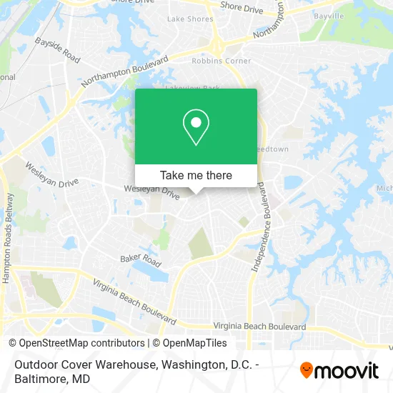
See Outdoor Cover Warehouse, Virginia Beach, on the map
Public Transit to Outdoor Cover Warehouse in Virginia Beach
Wondering how to get to Outdoor Cover Warehouse in Virginia Beach? Moovit helps you find the best way to get to Outdoor Cover Warehouse with step-by-step directions from the nearest public transit station.
Moovit provides free maps and live directions to help you navigate through your city. View schedules, routes, timetables, and find out how long does it take to get to Outdoor Cover Warehouse in real time.
Looking for the nearest stop or station to Outdoor Cover Warehouse? Check out this list of stops closest to your destination: Haygood & Haygood.
Bus: 020, 022.
Want to see if there’s another route that gets you there at an earlier time? Moovit helps you find alternative routes or times. Get directions from and directions to Outdoor Cover Warehouse easily from the Moovit App or Website.
We make riding to Outdoor Cover Warehouse easy, which is why over 1.7 million users, including users in Virginia Beach, trust Moovit as the best app for public transit. You don’t need to download an individual bus app or train app, Moovit is your all-in-one transit app that helps you find the best bus time or train time available.
For information on prices of bus, costs and ride fares to Outdoor Cover Warehouse, please check the Moovit app.
Use the app to navigate to popular places including to the airport, hospital, stadium, grocery store, mall, coffee shop, school, college, and university.
Outdoor Cover Warehouse Address: 1080 Aragona Blvd street in Virginia Beach
- 7-Eleven,
- Bayside High School,
- Williams Farm Park,
- Haygood Halls Apartments Rental Office,
- Haygood Halls Apartments,
- Haygood Physical Therapy Pc,
- Williams Farm Skatepark,
- Rosewood Memorial Park,
- Haygood Church,
- Universal Barbershop,
- Witchduck Landing Park,
- Old Donation School Baseball Field,
- Haygood Bingo,
- Ps-333; North Pump Station A Contract,
- CITGO,
- Davis Corner Fire And Rescue Station Number 2,
- Senior Feet,
- Jones Cemetery,
- Old Donation School Basketball Court,
- Ps-329;North Pump Station A Contract
Places Near Outdoor Cover Warehouse (Virginia Beach)
- Westfield Montgomery Mall, Montgomery County,
- Washington DC VA Medical Center, Washington,
- National Theatre, Washington,
- The Anthem, Washington,
- Georgetown, Washington,
- PG Mall, Prince George's County,
- Marriott Marquis Washington, DC, Washington,
- Washington National Cathedral, Washington,
- Museum Of The Bible, Washington,
- Warner Theatre, Washington,
- Pennsylvania Ave NW (3rd st and pennsylvania), Washington,
- National Zoo, Washington,
- Capital One Arena, Washington,
- National Museum of African American History and Culture, Washington,
- M&T Bank Stadium, Baltimore,
- Rock Creek Tennis Center, Washington,
- Amazon Hq2, Arlington County,
- Basilica of the National Shrine, Washington,
- Sibley Memorial Hospital, Washington,
- Camden Yards, Baltimore
How to get to popular places in Washington, D.C. - Baltimore, MD with public transit
Get around Virginia Beach by public transit!
Traveling around Virginia Beach has never been so easy. See step by step directions as you travel to any attraction, street or major public transit station. View bus and train schedules, arrival times, service alerts and detailed routes on a map, so you know exactly how to get to anywhere in Virginia Beach.
When traveling to any destination around Virginia Beach use Moovit's Live Directions with Get Off Notifications to know exactly where and how far to walk, how long to wait for your line, and how many stops are left. Moovit will alert you when it's time to get off — no need to constantly re-check whether yours is the next stop.
Wondering how to use public transit in Virginia Beach or how to pay for public transit in Virginia Beach? Moovit public transit app can help you navigate your way with public transit easily, and at minimum cost. It includes public transit fees, ticket prices, and costs. Looking for a map of Virginia Beach public transit lines? Moovit public transit app shows all public transit maps in Virginia Beach with all Bus, Train, Metro, Light Rail and Ferry routes and stops on an interactive map.
Washington, D.C. - Baltimore, MD has 5 transit type(s), including: Bus, Train, Metro, Light Rail and Ferry, operated by several transit agencies, including WMATA, Montgomery County Ride On, Fairfax Connector, TheBus, PRTC, DASH - Alexandria, Arlington Transit (ART), RTA of Central Maryland, MDOT MTA, MDOT MTA Light RailLink, MDOT MTA Commuter Bus, MDOT MTA Local Bus, FXBGO!, Virginia Railway Express (VRE) and MARC