How to get to Outta the Rabbit by bus?
Click on the bus route to see step by step directions with maps, line arrival times and updated time schedules.
From I-270 Exit 9A/B (I-370 / Sam Eig Hwy. Interchange), Montgomery County
61 minFrom Canopy By Hilton Washington DC Bethesda North North Bethesda, Montgomery County
45 minFrom Bethesda North Marriott Hotel & Conference Center, Montgomery County
44 minFrom Rockville, MD, Montgomery County
37 minFrom Wheaton High School, Montgomery County
65 minFrom Pike & Rose (Pike and Rose), Montgomery County
46 minFrom Georgia Ave & Icc Park & Ride Lot, Montgomery County
55 minFrom Montgomery County Fairgrounds, Montgomery County
33 minFrom Park Potomac Place, Montgomery County
62 minFrom Walmart Supercenter, Montgomery County
51 min
How to get to Outta the Rabbit by metro?
Click on the metro route to see step by step directions with maps, line arrival times and updated time schedules.
Bus stops near Outta the Rabbit in Montgomery County
Metro station near Outta the Rabbit in Montgomery County
- Shady Grove, 47 min walk,VIEW
Train station near Outta the Rabbit in Montgomery County
- Washington Grove Marc Wb, 52 min walk,VIEW
Bus lines to Outta the Rabbit in Montgomery County
What are the closest stations to Outta the Rabbit?
The closest stations to Outta the Rabbit are:
- Redland Rd & Mill Run Dr is 39 yards away, 1 min walk.
- Shady Grove Rd & Mill Run Dr is 580 yards away, 7 min walk.
- Shady Grove is 4020 yards away, 47 min walk.
- Washington Grove Marc Wb is 4443 yards away, 52 min walk.
Which bus lines stop near Outta the Rabbit?
These bus lines stop near Outta the Rabbit: 53, 57.
Which metro line stops near Outta the Rabbit?
RED (Shady Grove)
What’s the nearest bus station to Outta the Rabbit in Montgomery County?
The nearest bus station to Outta the Rabbit in Montgomery County is Redland Rd & Mill Run Dr. It’s a 1 min walk away.
What time is the first metro to Outta the Rabbit in Montgomery County?
The RED is the first metro that goes to Outta the Rabbit in Montgomery County. It stops nearby at 5:00 AM.
What time is the last metro to Outta the Rabbit in Montgomery County?
The RED is the last metro that goes to Outta the Rabbit in Montgomery County. It stops nearby at 12:42 AM.
What time is the first train to Outta the Rabbit in Montgomery County?
The MARC is the first train that goes to Outta the Rabbit in Montgomery County. It stops nearby at 5:32 AM.
What time is the last train to Outta the Rabbit in Montgomery County?
The MARC is the last train that goes to Outta the Rabbit in Montgomery County. It stops nearby at 7:54 PM.
What time is the first bus to Outta the Rabbit in Montgomery County?
The 57 is the first bus that goes to Outta the Rabbit in Montgomery County. It stops nearby at 4:48 AM.
What time is the last bus to Outta the Rabbit in Montgomery County?
The 57 is the last bus that goes to Outta the Rabbit in Montgomery County. It stops nearby at 12:08 AM.
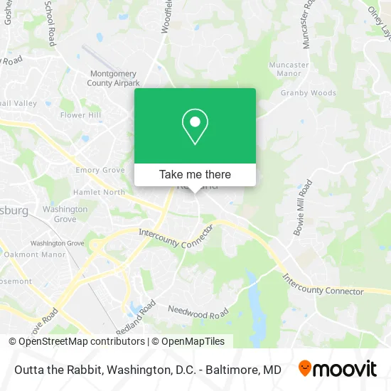
See Outta the Rabbit, Montgomery County, on the map
Public Transit to Outta the Rabbit in Montgomery County
Wondering how to get to Outta the Rabbit in Montgomery County? Moovit helps you find the best way to get to Outta the Rabbit with step-by-step directions from the nearest public transit station.
Moovit provides free maps and live directions to help you navigate through your city. View schedules, routes, timetables, and find out how long does it take to get to Outta the Rabbit in real time.
Looking for the nearest stop or station to Outta the Rabbit? Check out this list of stops closest to your destination: Redland Rd & Mill Run Dr; Shady Grove Rd & Mill Run Dr; Shady Grove; Washington Grove Marc Wb.
Bus: 53, 57, 58, 90.Train: MARC.Metro: RED.
Want to see if there’s another route that gets you there at an earlier time? Moovit helps you find alternative routes or times. Get directions from and directions to Outta the Rabbit easily from the Moovit App or Website.
We make riding to Outta the Rabbit easy, which is why over 1.5 million users, including users in Montgomery County, trust Moovit as the best app for public transit. You don’t need to download an individual bus app or train app, Moovit is your all-in-one transit app that helps you find the best bus time or train time available.
For information on prices of bus and metro, costs and ride fares to Outta the Rabbit, please check the Moovit app.
Use the app to navigate to popular places including to the airport, hospital, stadium, grocery store, mall, coffee shop, school, college, and university.
Outta the Rabbit Address: 17511 Redland Rd Derwood, MD 20855 street in Montgomery County
- Outtatherabbithole,
- Heady Fredy E-Cigs & Smoke Shop,
- Fast Lockout Service,
- Derwood Pizza,
- Beauty Ink,
- Ibu Campbell Indonesian Grocery (Indonesian & Asian Market),
- H&C Kitchen and Bath Design Center,
- Farmers,
- H&C Construction,
- Chiropractic Auto Accident Services,
- Banana Head,
- Post Office,
- United Healthcare,
- American Lock & Key,
- Derwood Locksmith Service Call,
- Shred Nations,
- 17701 Muncaster Rd Parking,
- Pest Control Services Spiders,
- Redland Liberty Service Center,
- Chase
Places Near Outta the Rabbit (Montgomery County)
- Museum Of The Bible, Washington,
- The Anthem, Washington,
- Amazon Hq2, Arlington County,
- M&T Bank Stadium, Baltimore,
- Capital One Arena, Washington,
- National Mall, Washington,
- Westfield Montgomery Mall, Montgomery County,
- Georgetown, Washington,
- National Museum of African American History and Culture, Washington,
- Washington DC VA Medical Center, Washington,
- Camden Yards, Baltimore,
- Rock Creek Tennis Center, Washington,
- Basilica of the National Shrine, Washington,
- Warner Theatre, Washington,
- PG Mall, Prince George's County,
- Sibley Memorial Hospital, Washington,
- Pennsylvania Ave NW (3rd st and pennsylvania), Washington,
- National Zoo, Washington,
- Washington National Cathedral, Washington,
- Marriott Marquis Washington, DC, Washington
How to get to popular places in Washington, D.C. - Baltimore, MD with public transit
Get around Montgomery County by public transit!
Traveling around Montgomery County has never been so easy. See step by step directions as you travel to any attraction, street or major public transit station. View bus and train schedules, arrival times, service alerts and detailed routes on a map, so you know exactly how to get to anywhere in Montgomery County.
When traveling to any destination around Montgomery County use Moovit's Live Directions with Get Off Notifications to know exactly where and how far to walk, how long to wait for your line, and how many stops are left. Moovit will alert you when it's time to get off — no need to constantly re-check whether yours is the next stop.
Wondering how to use public transit in Montgomery County or how to pay for public transit in Montgomery County? Moovit public transit app can help you navigate your way with public transit easily, and at minimum cost. It includes public transit fees, ticket prices, and costs. Looking for a map of Montgomery County public transit lines? Moovit public transit app shows all public transit maps in Montgomery County with all Bus, Train, Metro, Light Rail and Ferry routes and stops on an interactive map.
Washington, D.C. - Baltimore, MD has 5 transit type(s), including: Bus, Train, Metro, Light Rail and Ferry, operated by several transit agencies, including WMATA, Montgomery County Ride On, Fairfax Connector, TheBus, PRTC, DASH - Alexandria, Arlington Transit (ART), RTA of Central Maryland, MDOT MTA, MDOT MTA Light RailLink, MDOT MTA Commuter Bus, MDOT MTA Local Bus, FXBGO!, Virginia Railway Express (VRE) and MARC