How to get to P by bus?
Click on the bus route to see step by step directions with maps, line arrival times and updated time schedules.
From Qinglin Bay (West District West Third Gate), Jiangbei District
56 minFrom Route 1 (Bus Zhuangshi Station - Ningbo Railway Station South Square), Zhenhai District
61 minFrom East Qian Lake Small Putuo, Yinzhou District
51 minFrom Wanda Plaza (Entrance to Yintai Department Store), Yinzhou District
31 minFrom Ningbo North Bus Station, Jiangbei District
50 minFrom Ningbo Kang Ning Hospital - Inpatient Building, Zhenhai District
57 minFrom No Origin Coffee Shop (Yinzhou Branch), Yinzhou District
38 minFrom Corning Hospital Outpatient Department (Ningbo), Zhenhai District
58 minFrom New Oriental (Cuibai Campus), Haishu District
40 minFrom Xiangyang Fishing Port (Suka Gulou Branch), Haishu District
40 min
How to get to P by metro?
Click on the metro route to see step by step directions with maps, line arrival times and updated time schedules.
Bus stops near P in Yinzhou District
Metro station near P in Yinzhou District
- Fuming Road, 23 min walk,VIEW
Bus lines to P in Yinzhou District
- Route 138, Jinyuan Road Bus Stop,VIEW
- Route 291 Night Line, Jinyuan Road Bus Station - Sunshine Plaza,VIEW
- Route 29, Meixu North District Bus Station - Zijun Bus Station,VIEW
- Route 117, Jinyuan Complex - Jiacun,VIEW
- Route 123, Wangchun Industrial Zone Station - Red Star Macalline,VIEW
- Route 131, Tianggong Manor - Jinyuan Community,VIEW
- Route 132, Ningbo Transport Center - Panhuo Overpass,VIEW
- Route 136, Transit East Ring South Road Station - Transit Xuejia Station,VIEW
- Route 157, Shuguang New Village - Aiyimei Building,VIEW
- Route 158, Shuguang New Village - Youngor Zoo,VIEW
- Route 168, Mingzhou Hospital North - International Financial Center,VIEW
- Route 350, Agate Road - Zijun Bus Station,VIEW
- Route 354, Ningbo Railway Station - Xiaying Huarong,VIEW
- Route 639, Jinghu Waterfront Station - Fuming Station,VIEW
- Route 137, Transit Zijun,VIEW
- 3, Tianshui Garden Bus Station,VIEW
- Route 801, City Taxi Service Center,VIEW
- Route 129, Zhang Jiaying,VIEW
- Route 907, East Bus Terminal,VIEW
What are the closest stations to P?
The closest stations to P are:
- Yongda Road-Canghai Road Intersection is 293 meters away, 5 min walk.
- New Jiayuan is 520 meters away, 8 min walk.
- Red Star Macalline is 685 meters away, 10 min walk.
- City Special Police Brigade is 754 meters away, 11 min walk.
- Fuming Road is 1729 meters away, 23 min walk.
- IKEA is 1819 meters away, 24 min walk.
Which bus lines stop near P?
These bus lines stop near P: Route 117, Route 123, Route 131, Route 132, Route 168, Route 350, Route 354.
Which metro line stops near P?
Line 1 (Xiapu)
What’s the nearest metro station to P in Yinzhou District?
The nearest metro station to P in Yinzhou District is Fuming Road. It’s a 23 min walk away.
What’s the nearest bus station to P in Yinzhou District?
The nearest bus station to P in Yinzhou District is Yongda Road-Canghai Road Intersection. It’s a 5 min walk away.
What time is the first metro to P in Yinzhou District?
The Line 1 is the first metro that goes to P in Yinzhou District. It stops nearby at 6:04 AM.
What time is the last metro to P in Yinzhou District?
The Line 1 is the last metro that goes to P in Yinzhou District. It stops nearby at 10:43 PM.
What time is the first bus to P in Yinzhou District?
The Route 29 is the first bus that goes to P in Yinzhou District. It stops nearby at 5:35 AM.
What time is the last bus to P in Yinzhou District?
The Route 291 Night Line is the last bus that goes to P in Yinzhou District. It stops nearby at 10:23 PM.
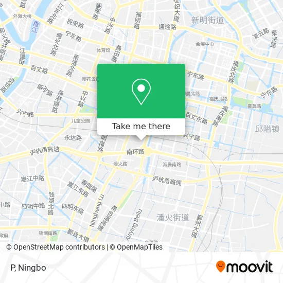
See P, Yinzhou District, on the map
Public Transit to P in Yinzhou District
Wondering how to get to P in Yinzhou District? Moovit helps you find the best way to get to P with step-by-step directions from the nearest public transit station.
Moovit provides free maps and live directions to help you navigate through your city. View schedules, routes, timetables, and find out how long does it take to get to P in real time.
Looking for the nearest stop or station to P? Check out this list of stops closest to your destination: Yongda Road-Canghai Road Intersection; New Jiayuan; Red Star Macalline; City Special Police Brigade; Fuming Road; IKEA.
Bus: Route 117, Route 123, Route 131, Route 132, Route 168, Route 350, Route 354, Route 138, Route 291 Night Line, Route 29, Route 117, Route 123, Route 131, Route 137, 3, Route 801.Metro: Line 1, Line 1.
Want to see if there’s another route that gets you there at an earlier time? Moovit helps you find alternative routes or times. Get directions from and directions to P easily from the Moovit App or Website.
We make riding to P easy, which is why over 1.5 million users, including users in Yinzhou District, trust Moovit as the best app for public transit. You don’t need to download an individual bus app or train app, Moovit is your all-in-one transit app that helps you find the best bus time or train time available.
For information on prices of bus and metro, costs and ride fares to P, please check the Moovit app.
Use the app to navigate to popular places including to the airport, hospital, stadium, grocery store, mall, coffee shop, school, college, and university.
P Address: 浙江省宁波市鄞州区永达路1583号北70米 street in Yinzhou District
- Parking Lot (Southeast of Century Garden B Area),
- Yinjia Garden - Southeast Gate,
- Yongda Road,
- Guanai Tang (Century Garden Store),
- Hualong Used Tires (Canghai Road),
- Pan Huojie Street Century Garden Owners Committee,
- Yin Family Community Residents Committee,
- Chinese Communist Party Ningbo Yinzhou District Panhuo Street Yinjia Community (Yinjia Pit Shareholding Economic Cooperative) Branch Committee,
- Century Garden North Bicycle Rental Point,
- Midea (Jiangdong Canghai Road Midea Xing Store),
- Ningbo Yongda Property Management Co., Ltd. Yin Family Garden Service Center,
- Yin Family Garden Kindergarten - East Gate,
- Rui Qing Pharmacy,
- Dong Ying Property,
- Yin Family Garden - Northeast Gate,
- Yin Family Garden - No. 6,
- Simai Education,
- Xinghe Chenguang East District,
- M6 Fresh (Century Garden Store),
- Morning Light Supermarket
Places Near P (Yinzhou District)
- Ningbo Second Hospital-Emergency, Haishu District,
- Wanxiang City (Under Construction), Jiangbei District,
- City Hero (New City Wuyue Plaza), Zhenhai District,
- Ningbo Medical Center Li Huili Hospital East Hospital - Outpatient, Yinzhou District,
- Ningbo Traditional Chinese Medicine Hospital, Haishu District,
- Ningbo Medical Center Li Huili Eastern Hospital, Yinzhou District,
- Ningbo Foreigner Beach, Jiangbei District,
- Li Huili Eastern Hospital, Yinzhou District,
- Zhongle Dance Hall, Jiangbei District,
- Ningbo Jintian Copper (Group) Co., Ltd., Jiangbei District,
- Sam's Club (Qinghe Road), Jiangbei District,
- Ningbo Cultural Creative Port, Jiangbei District,
- Ayuwang Temple, Yinzhou District,
- Gas Station, Yinzhou District,
- Ningbo No. 6 Hospital, Jiangdong District,
- Ningbo Lishe International Airport, Yinzhou District,
- Wanxiang City, Jiangbei District,
- Nantang Old Street, Haishu District,
- Ningbo First Hospital - Inpatient Department, Haishu District,
- France · Woodpecker
How to get to popular places in Ningbo with public transit
Get around Yinzhou District by public transit!
Traveling around Yinzhou District has never been so easy. See step by step directions as you travel to any attraction, street or major public transit station. View bus and train schedules, arrival times, service alerts and detailed routes on a map, so you know exactly how to get to anywhere in Yinzhou District.
When traveling to any destination around Yinzhou District use Moovit's Live Directions with Get Off Notifications to know exactly where and how far to walk, how long to wait for your line, and how many stops are left. Moovit will alert you when it's time to get off — no need to constantly re-check whether yours is the next stop.
Wondering how to use public transit in Yinzhou District or how to pay for public transit in Yinzhou District? Moovit public transit app can help you navigate your way with public transit easily, and at minimum cost. It includes public transit fees, ticket prices, and costs. Looking for a map of Yinzhou District public transit lines? Moovit public transit app shows all public transit maps in Yinzhou District with all Bus and Metro routes and stops on an interactive map.
Ningbo has 2 transit type(s), including: Bus and Metro, operated by several transit agencies, including Ningbo Metro, Ningbo Bus and Yuyao Bus