How to get to P by bus?
Click on the bus route to see step by step directions with maps, line arrival times and updated time schedules.
From Zhaogong Hall West Gate Opposite, Tiexi District
34 minFrom Baita River First Road, Hunnan District
42 minFrom Baogong North Street/Baogong South Street (Intersection), Tiexi District
28 minFrom Gaoguan Residential Area - Northeast Gate, Shenhe District
53 minFrom Dragon Dream Mall, Tiexi District
30 minFrom Yingshiman Beauty Club, Shenhe District
48 minFrom Thirteen Road Comprehensive Market - West Gate, Tiexi District
28 minFrom Oriental Oubocheng Courtyard - Building G1, Dadong District
43 min
How to get to P by metro?
Click on the metro route to see step by step directions with maps, line arrival times and updated time schedules.
Bus stops near P in Heping District
Metro stations near P in Heping District
Bus lines to P in Heping District
- Route 280, Zhongxing Street Shayang Road,VIEW
- 501, Shaling Terminal,VIEW
- Route 103, Changke West,VIEW
- Route 207, Dragon Dream Asia Pacific City,VIEW
- Route 223, Jiangnan Water Town,VIEW
- Route 246, Shenyang South,VIEW
- Route 256, Hebei Street,VIEW
- Route 523, Oriental Venice,VIEW
- Route 263, Yulong City,VIEW
- Route 253, Oriental Rose Garden,VIEW
- Route 272, South 13th Latitude Road,VIEW
- Route 249, Vanke Four Seasons Flower City,VIEW
- Route 297, Wanliutang Park,VIEW
- Route 188, Malu Bay,VIEW
- Route 151, Seventh Hospital South,VIEW
- Route 258, Taochang Community,VIEW
- Route 265, Yinshan Community,VIEW
- Route 109, Yaowangmiao Road West Electronics Market,VIEW
What are the closest stations to P?
The closest stations to P are:
- 13th Latitude 3rd Longitude Street is 52 meters away, 1 min walk.
- 13th Latitude 5th Longitude Street is 61 meters away, 1 min walk.
- South 13th Latitude Road is 261 meters away, 4 min walk.
- Consulate is 335 meters away, 5 min walk.
- Consulate West is 362 meters away, 5 min walk.
- Seventh Hospital South is 367 meters away, 5 min walk.
- Seventh Hospital is 464 meters away, 6 min walk.
- Industrial Exhibition Hall is 748 meters away, 11 min walk.
- Taiyuan Street is 1431 meters away, 19 min walk.
Which bus lines stop near P?
These bus lines stop near P: Route 103, Route 151, Route 207, Route 256, Route 263, Route 272, 501.
Which metro line stops near P?
Line 1 (13th Street)
What’s the nearest metro station to P in Heping District?
The nearest metro station to P in Heping District is Industrial Exhibition Hall. It’s a 11 min walk away.
What’s the nearest bus station to P in Heping District?
The nearest bus stations to P in Heping District are 13th Latitude 3rd Longitude Street and 13th Latitude 5th Longitude Street. The closest one is a 1 min walk away.
What time is the first metro to P in Heping District?
The Line 1 is the first metro that goes to P in Heping District. It stops nearby at 6:11 AM.
What time is the last metro to P in Heping District?
The Line 2 is the last metro that goes to P in Heping District. It stops nearby at 10:33 PM.
What time is the first bus to P in Heping District?
The Route 103 is the first bus that goes to P in Heping District. It stops nearby at 5:01 AM.
What time is the last bus to P in Heping District?
The Route 207 is the last bus that goes to P in Heping District. It stops nearby at 10:15 PM.
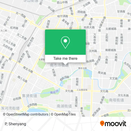
See P, Heping District, on the map
Public Transit to P in Heping District
Wondering how to get to P in Heping District? Moovit helps you find the best way to get to P with step-by-step directions from the nearest public transit station.
Moovit provides free maps and live directions to help you navigate through your city. View schedules, routes, timetables, and find out how long does it take to get to P in real time.
Looking for the nearest stop or station to P? Check out this list of stops closest to your destination: 13th Latitude 3rd Longitude Street; 13th Latitude 5th Longitude Street; South 13th Latitude Road; Consulate; Consulate West; Seventh Hospital South; Seventh Hospital; Industrial Exhibition Hall; Taiyuan Street.
Bus: Route 103, Route 151, Route 207, Route 256, Route 263, Route 272, 501, Route 280, 501, Route 103, Route 207, Route 223, Route 246, Route 256, Route 263, Route 253.Metro: Line 1, Line 2, Line 1.
Want to see if there’s another route that gets you there at an earlier time? Moovit helps you find alternative routes or times. Get directions from and directions to P easily from the Moovit App or Website.
We make riding to P easy, which is why over 1.5 million users, including users in Heping District, trust Moovit as the best app for public transit. You don’t need to download an individual bus app or train app, Moovit is your all-in-one transit app that helps you find the best bus time or train time available.
For information on prices of bus, light rail and metro, costs and ride fares to P, please check the Moovit app.
Use the app to navigate to popular places including to the airport, hospital, stadium, grocery store, mall, coffee shop, school, college, and university.
P Address: 辽宁省沈阳市和平区南四经街76号附近 street in Heping District
- Shao Cheng Kitchen Utensils,
- Air Negative Ion Health Club,
- Heping No. 1 Education Group (Sijing Street Branch),
- Midea Electromagnetic Kitchen Equipment 4S Store,
- No. 4 Jing Street First Primary School - Southwest Gate,
- Huiquan Kitchenware,
- Northeast Cookware City,
- Brothers Take a Puff,
- Xinhe Feng Cookware,
- Consulate Green Land - West Gate 1,
- Jinqiu Cookware City,
- Heping District South Market Street Consulate Community Service Station,
- Xinyang Public Bath,
- Lotte Mart Supermarket,
- Fadu Hair Culture,
- Weixia Professional Wear,
- Harmony Beautiful Uniform,
- South Fourth Street - Building 96,
- People's Insurance Auto Insurance Sales Service Co., Ltd. Liaoning Branch,
- Huashen Cookware Co., Ltd.
Places Near P (Heping District)
- Shenyang Shimao Wuyue Plaza,
- Puhe Grand Market, Shenbei New District,
- Parlement Dance Hall, Heping District,
- First Affiliated Hospital of China Medical University, Heping District,
- Sam's Club Shenyang, Hunnan District,
- Red National Dance Hall, Huanggu District,
- Shenyang Fourth People's Hospital, Huanggu District,
- Liaoning Provincial People's Hospital, Shenhe District,
- Zaohua Grand Market,
- Heavy Industry Dance Hall, Tiexi District,
- Harbor Dance Hall, Tiexi District,
- Tianxiang Dance Hall, Huanggu District,
- Sate Outlet, Tiexi District,
- Hundred Flowers Dance Hall, Tiexi District,
- China Medical University First Hospital Hunnan Branch, Hunnan District,
- Puhe Grand Market, Shenbei New District,
- High-Speed Guchengzi Service Area (North) Gas Station, Hunnan District,
- Da Xi Dance Hall, Shenhe District,
- Liaoning Provincial People's Hospital, Shenhe District,
- Big World Dance Hall (Bashan Road), Huanggu District
How to get to popular places in Shenyang with public transit
Get around Heping District by public transit!
Traveling around Heping District has never been so easy. See step by step directions as you travel to any attraction, street or major public transit station. View bus and train schedules, arrival times, service alerts and detailed routes on a map, so you know exactly how to get to anywhere in Heping District.
When traveling to any destination around Heping District use Moovit's Live Directions with Get Off Notifications to know exactly where and how far to walk, how long to wait for your line, and how many stops are left. Moovit will alert you when it's time to get off — no need to constantly re-check whether yours is the next stop.
Wondering how to use public transit in Heping District or how to pay for public transit in Heping District? Moovit public transit app can help you navigate your way with public transit easily, and at minimum cost. It includes public transit fees, ticket prices, and costs. Looking for a map of Heping District public transit lines? Moovit public transit app shows all public transit maps in Heping District with all Bus, Metro and Light Rail routes and stops on an interactive map.
Shenyang has 3 transit type(s), including: Bus, Metro and Light Rail, operated by several transit agencies, including Shenyang Metro Group Co., Ltd., Shenyang Hunnan Modern Tram and Shenyang Bus
Public transit lines with stations closest to P in Heping District
Metro lines with stations closest to P in Heping District
Bus lines with stations closest to P in Heping District
13th Latitude 5th Longitude Street
 Route 103Changke West Station (Transit Hub) - Wuai Market
- Route 207Shenyang University of Technology Xingshun Campus - Dragon Dream Asia Pacific City
- Route 223Shenyang Station South (South First Horse Road) - Jiangnan Water Town
- Route 246Shenyang Station South - Fangling Road
- Route 256Hebei Street - Liaomei Printing Factory