How to get to PALLADIUM by bus?
Click on the bus route to see step by step directions with maps, line arrival times and updated time schedules.
From Ningbo Olympic Sports Center Swimming Pool - Gate 3, Jiangbei District
55 minFrom Bank of China (Ningbo Zhenhai Mechanical and Electrical Park Branch), Zhenhai District
22 minFrom Yinzhou Vocational High School - West Gate, Yinzhou District
45 minFrom Ningbo Dongqian Lake Tourism Resort, Yinzhou District
53 minFrom Mountain Outside Mountain (Luotuo Branch), Zhenhai District
22 minFrom Golden Finger Massage SPA Foot Therapy, Yinzhou District
43 minFrom New Gas Business Hall, Yinzhou District
48 minFrom Impression City, Yinzhou District
29 minFrom Ningbo No. 9 Hospital Inpatient Department - North Gate, Jiangbei District
42 minFrom Ningbo Pan-Pacific Hotel - Parking Lot, Jiangdong District
30 min
How to get to PALLADIUM by metro?
Click on the metro route to see step by step directions with maps, line arrival times and updated time schedules.
Bus stops near PALLADIUM in Jiangbei District
Metro stations near PALLADIUM in Jiangbei District
Bus lines to PALLADIUM in Jiangbei District
- 1, Ningbo Railway Station - Zhuangshi Bus Station,VIEW
- Route 4, Zhuangqiao Shangshao Station - Dongmenkou,VIEW
- Route 19, Nanyuan New Village - Transit Qingfeng Bridge Station,VIEW
- Route 331, Cicheng Bus Station - Dongmenkou,VIEW
- Route 541, Zhaobaoshan Bus Station - Ningbo Railway Station,VIEW
- 541 Express, Ningbo Railway Station - Zhaobao Mountain,VIEW
- Route 8, Engineering College East Campus - East Bus Station,VIEW
- Route 13, Qingfeng Bridge Station - Guangsha Yiting,VIEW
- Route 350, Agate Road - Zijun Bus Station,VIEW
- Route 352, Donghuan South Road Station - Ningbo University Affiliated Hospital,VIEW
- 370, Agate Road - Ningbo Chemical Industry Zone,VIEW
- 508, Zhejiang University Software Institute - Qingfeng Bridge Bus Station,VIEW
- Route 370 Night, Luotuo Central Bus Station - Manao Road,VIEW
- Route 202 Night Line, Ningbo Railway Station - Ningbo Railway Station,VIEW
- Route 20, Xuejia Bus Stop,VIEW
- 11, Baisha Bus Center,VIEW
- Route 341, Zhaobaoshan Bus Station,VIEW
- 384, Jiulong Lake Bus,VIEW
- Route 16, Baisha Bus Center,VIEW
- Route 343, Guisi Industrial Zone,VIEW
What are the closest stations to PALLADIUM?
The closest stations to PALLADIUM are:
- The Bund is 211 meters away, 3 min walk.
- Ningbo University Affiliated Hospital is 318 meters away, 5 min walk.
- Station Road is 384 meters away, 6 min walk.
- Public Transit Baisha Central Station is 476 meters away, 7 min walk.
- Huaishu Road is 522 meters away, 7 min walk.
- East Gate is 559 meters away, 8 min walk.
- Drum Tower is 673 meters away, 9 min walk.
Which bus lines stop near PALLADIUM?
These bus lines stop near PALLADIUM: Route 19, Route 303, Route 30, Route 352, Route 363, Route 378, Route 541.
Which metro line stops near PALLADIUM?
Line 2 (Lishie International Airport)
What’s the nearest metro station to PALLADIUM in Jiangbei District?
The nearest metro station to PALLADIUM in Jiangbei District is East Gate. It’s a 8 min walk away.
What’s the nearest bus station to PALLADIUM in Jiangbei District?
The nearest bus station to PALLADIUM in Jiangbei District is The Bund. It’s a 3 min walk away.
What time is the first metro to PALLADIUM in Jiangbei District?
The Line 1 is the first metro that goes to PALLADIUM in Jiangbei District. It stops nearby at 6:15 AM.
What time is the last metro to PALLADIUM in Jiangbei District?
The Line 1 is the last metro that goes to PALLADIUM in Jiangbei District. It stops nearby at 10:50 PM.
What time is the first bus to PALLADIUM in Jiangbei District?
The Route 202 Night Line is the first bus that goes to PALLADIUM in Jiangbei District. It stops nearby at 3:04 AM.
What time is the last bus to PALLADIUM in Jiangbei District?
The Route 202 Night Line is the last bus that goes to PALLADIUM in Jiangbei District. It stops nearby at 3:05 AM.
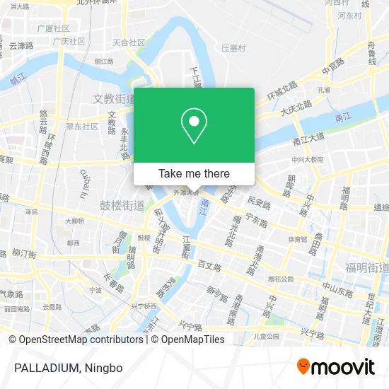
See PALLADIUM, Jiangbei District, on the map
Public Transit to PALLADIUM in Jiangbei District
Wondering how to get to PALLADIUM in Jiangbei District? Moovit helps you find the best way to get to PALLADIUM with step-by-step directions from the nearest public transit station.
Moovit provides free maps and live directions to help you navigate through your city. View schedules, routes, timetables, and find out how long does it take to get to PALLADIUM in real time.
Looking for the nearest stop or station to PALLADIUM? Check out this list of stops closest to your destination: The Bund; Ningbo University Affiliated Hospital; Station Road; Public Transit Baisha Central Station; Huaishu Road; East Gate; Drum Tower.
Bus: Route 19, Route 303, Route 30, Route 352, Route 363, Route 378, Route 541, 1, Route 4, Route 19, Route 331, Route 541, Route 20, 541 Express, Route 8, Route 13, Route 350, Route 352, 11.Metro: Line 2, Line 1, Line 2.
Want to see if there’s another route that gets you there at an earlier time? Moovit helps you find alternative routes or times. Get directions from and directions to PALLADIUM easily from the Moovit App or Website.
We make riding to PALLADIUM easy, which is why over 1.7 million users, including users in Jiangbei District, trust Moovit as the best app for public transit. You don’t need to download an individual bus app or train app, Moovit is your all-in-one transit app that helps you find the best bus time or train time available.
For information on prices of bus and metro, costs and ride fares to PALLADIUM, please check the Moovit app.
Use the app to navigate to popular places including to the airport, hospital, stadium, grocery store, mall, coffee shop, school, college, and university.
PALLADIUM Address: 宁波市江北区大闸南路500号来福士广场F3 street in Jiangbei District
- Xiao Peng's Hotpot,
- Golden Pepper Thai Cuisine (Raffles Plaza Branch),
- Dafengsheng Fish Restaurant (Raffles Plaza Branch),
- Maya Marie,
- Wife's Favorite (Raffles Plaza),
- Sugar Paper,
- Jue Coffee,
- N2U Barbecue Korean Ironing Barbecue (Raffles Store),
- New Balance (Ningbo Raffles Plaza),
- Adidas (Laifushi Plaza Store),
- Hot Wind (Raffles Plaza Store),
- Ningbo Raffles Plaza,
- SONY,
- Hefeng Ji,
- He Mi Tang (Raffles Store),
- Zheng Hao Big Chicken Cutlet,
- Canard (Raffles Plaza Branch),
- Axiang Rice Noodles (Laifushi Store),
- Meiyue Club,
- Siyu Hair Salon (Laifushi Branch)
Places Near PALLADIUM (Jiangbei District)
- Zhongle Dance Hall, Jiangbei District,
- Ningbo Traditional Chinese Medicine Hospital, Haishu District,
- Nantang Old Street, Haishu District,
- Ningbo No. 6 Hospital, Jiangdong District,
- Ningbo Medical Center Li Huili Eastern Hospital, Yinzhou District,
- Ningbo Cultural Creative Port, Jiangbei District,
- Ningbo Lishe International Airport, Yinzhou District,
- City Hero (New City Wuyue Plaza), Zhenhai District,
- Gas Station, Yinzhou District,
- Wanxiang City (Under Construction), Jiangbei District,
- Ningbo First Hospital - Inpatient Department, Haishu District,
- Li Huili Eastern Hospital, Yinzhou District,
- Wanxiang City, Jiangbei District,
- Ningbo Jintian Copper (Group) Co., Ltd., Jiangbei District,
- Ningbo Second Hospital-Emergency, Haishu District,
- Sam's Club (Qinghe Road), Jiangbei District,
- Ningbo Foreigner Beach, Jiangbei District,
- Ningbo Medical Center Li Huili Hospital East Hospital - Outpatient, Yinzhou District,
- France · Woodpecker,
- Ayuwang Temple, Yinzhou District
How to get to popular places in Ningbo with public transit
Get around Jiangbei District by public transit!
Traveling around Jiangbei District has never been so easy. See step by step directions as you travel to any attraction, street or major public transit station. View bus and train schedules, arrival times, service alerts and detailed routes on a map, so you know exactly how to get to anywhere in Jiangbei District.
When traveling to any destination around Jiangbei District use Moovit's Live Directions with Get Off Notifications to know exactly where and how far to walk, how long to wait for your line, and how many stops are left. Moovit will alert you when it's time to get off — no need to constantly re-check whether yours is the next stop.
Wondering how to use public transit in Jiangbei District or how to pay for public transit in Jiangbei District? Moovit public transit app can help you navigate your way with public transit easily, and at minimum cost. It includes public transit fees, ticket prices, and costs. Looking for a map of Jiangbei District public transit lines? Moovit public transit app shows all public transit maps in Jiangbei District with all Bus and Metro routes and stops on an interactive map.
Ningbo has 2 transit type(s), including: Bus and Metro, operated by several transit agencies, including Ningbo Metro, Ningbo Bus and Yuyao Bus