How to get to PANADERIA CHELO by bus?
Click on the bus route to see step by step directions with maps, line arrival times and updated time schedules.
From Paseos de Cienega Grande 110, Aguascalientes
59 minFrom Fraccionamiento Villa Taurina, Aguascalientes
46 minFrom Unidad Deportiva Jesús María, Aguascalientes
46 minFrom Villa Sur, Aguascalientes
61 minFrom Parque Industrial Valle de Aguascalientes (PIVA), Aguascalientes
48 minFrom Parque Municipal (Ex-pensión), Aguascalientes
38 minFrom Zona Centro, Aguascalientes
44 minFrom Fracc Rinconada Jesús María, Aguascalientes
71 minFrom Betulia, Aguascalientes
46 minFrom Ruiseñores [Fraccionamiento], Aguascalientes
67 min
Bus stops near PANADERIA CHELO in Aguascalientes
Bus lines to PANADERIA CHELO in Aguascalientes
- RUTA 16, Bellavista,VIEW
- RUTA 30, Martínez Dóminguez,VIEW
- RUTA 40, Terminal Oriente - Terminal Oriente (N),VIEW
- RUTA 40, Terminal Oriente - Terminal Oriente (S),VIEW
- RUTA 23, Villa Montaña,VIEW
- RUTA 24, Vistas De Oriente - Los Negritos,VIEW
- RUTA 25, Las Palmas,VIEW
- RUTA 41, Terminal Oriente (Penal),VIEW
- RUTA 41, Terminal Oriente (Alameda),VIEW
- RUTA 20S, Terminal Oriente - Terminal Oriente (S),VIEW
- RUTA 27, Vicente Guerrero,VIEW
- RUTA 33, Jesús María,VIEW
- RUTA 20N, Terminal Oriente - Terminal Oriente (N),VIEW
What are the closest stations to PANADERIA CHELO?
The closest stations to PANADERIA CHELO are:
- Avenida Aguascalientes, 802c is 223 meters away, 3 min walk.
- Avenida Aguascalientes Poniente, 101 is 348 meters away, 5 min walk.
- Calvillo - Aguascalientes, 1508-B is 659 meters away, 9 min walk.
- Avenida De La Convención De 1914 Poniente, 427 is 862 meters away, 12 min walk.
- Convencion 1914 Poniente, 420 is 900 meters away, 12 min walk.
Which bus lines stop near PANADERIA CHELO?
These bus lines stop near PANADERIA CHELO: RUTA 16, RUTA 30, RUTA 40.
What’s the nearest bus station to PANADERIA CHELO in Aguascalientes?
The nearest bus station to PANADERIA CHELO in Aguascalientes is Avenida Aguascalientes, 802c. It’s a 3 min walk away.
What time is the first bus to PANADERIA CHELO in Aguascalientes?
The RUTA 41 is the first bus that goes to PANADERIA CHELO in Aguascalientes. It stops nearby at 5:51 AM.
What time is the last bus to PANADERIA CHELO in Aguascalientes?
The RUTA 30 is the last bus that goes to PANADERIA CHELO in Aguascalientes. It stops nearby at 10:10 PM.
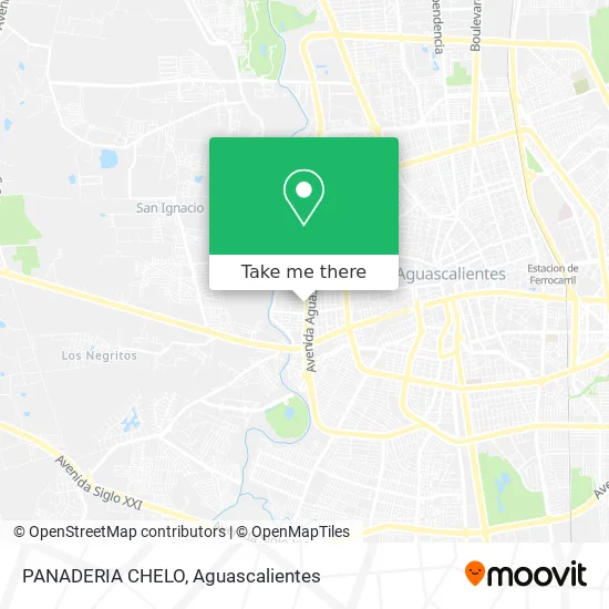
See PANADERIA CHELO, Aguascalientes, on the map
Public Transit to PANADERIA CHELO in Aguascalientes
Wondering how to get to PANADERIA CHELO in Aguascalientes? Moovit helps you find the best way to get to PANADERIA CHELO with step-by-step directions from the nearest public transit station.
Moovit provides free maps and live directions to help you navigate through your city. View schedules, routes, timetables, and find out how long does it take to get to PANADERIA CHELO in real time.
Looking for the nearest stop or station to PANADERIA CHELO? Check out this list of stops closest to your destination: Avenida Aguascalientes; Avenida Aguascalientes Poniente; Calvillo - Aguascalientes; Avenida De La Convención De 1914 Poniente; Convencion 1914 Poniente.
Bus: RUTA 16, RUTA 30, RUTA 40, RUTA 23, RUTA 24, RUTA 25, RUTA 41, RUTA 41, RUTA 20S, RUTA 27, RUTA 33, RUTA 20N.
Want to see if there’s another route that gets you there at an earlier time? Moovit helps you find alternative routes or times. Get directions from and directions to PANADERIA CHELO easily from the Moovit App or Website.
We make riding to PANADERIA CHELO easy, which is why over 1.5 million users, including users in Aguascalientes, trust Moovit as the best app for public transit. You don’t need to download an individual bus app or train app, Moovit is your all-in-one transit app that helps you find the best bus time or train time available.
For information on prices of bus, costs and ride fares to PANADERIA CHELO, please check the Moovit app.
Use the app to navigate to popular places including to the airport, hospital, stadium, grocery store, mall, coffee shop, school, college, and university.
PANADERIA CHELO Address: PANADERIA CHELO, Calle Navarrete 1005, Fraccionamiento San Marcos, 20078 Aguascalientes, Aguascalie street in Aguascalientes
- Mariachi Juvenil Real Mexicanisimo,
- Auto Electrico y Ref. La 30 del Sur,
- Recicladora San Marcos,
- Suministros Integrales para La Industria,
- Coparmex Lth Ags II,
- Birrieria Don Julio,
- Alonso Cosío-Quiropractico,
- Veterinaria La Chiripa,
- WESTERN UNION,
- Farmacia Guadalajara,
- Pinturas Jambled,
- Uniformes Go Chambing,
- Nomura Sushi Sucursal Poniente,
- Grupo Santa Fe Empresa,
- Iglesia De Cristo Redentor,
- HATO Hamburguesas al carbon,
- Club Minecraft,
- Villa Sara,
- Venta de Tamales,
- Taller Electrico Hermanos Lara
Places Near PANADERIA CHELO (Aguascalientes)
- Imss Clinica 1, Aguascalientes,
- Universidad Autónoma de Aguascalientes, Aguascalientes,
- Centro Comercial Altaria, Aguascalientes,
- ESPACIOS, Aguascalientes,
- Centro, Aguascalientes,
- Villasuncion, Aguascalientes,
- Aeropuerto de Aguascalientes S.A. de C.V., Aguascalientes,
- Jesús María, Aguascalientes,
- Agropecuario, Aguascalientes,
- clinica 3 uaa, Aguascalientes,
- Villas de Nuestra Señora de la Asunción, Aguascalientes,
- Blvd. Luis Donaldo Colosio, Aguascalientes,
- Nuevo Hospital Hidalgo, Aguascalientes,
- Central De Autobuses, Aguascalientes,
- Terminal De Combis, Aguascalientes,
- Hospital Imss No. 3, Aguascalientes,
- La Isla San Marcos, Aguascalientes,
- Isla San Marcos, Aguascalientes,
- Parque Las Tres Centurias, Aguascalientes,
- Ciudad industrial, Aguascalientes
How to get to popular places in Aguascalientes with public transit
Get around Aguascalientes by public transit!
Traveling around Aguascalientes has never been so easy. See step by step directions as you travel to any attraction, street or major public transit station. View bus and train schedules, arrival times, service alerts and detailed routes on a map, so you know exactly how to get to anywhere in Aguascalientes.
When traveling to any destination around Aguascalientes use Moovit's Live Directions with Get Off Notifications to know exactly where and how far to walk, how long to wait for your line, and how many stops are left. Moovit will alert you when it's time to get off — no need to constantly re-check whether yours is the next stop.
Wondering how to use public transit in Aguascalientes or how to pay for public transit in Aguascalientes? Moovit public transit app can help you navigate your way with public transit easily, and at minimum cost. It includes public transit fees, ticket prices, and costs. Looking for a map of Aguascalientes public transit lines? Moovit public transit app shows all public transit maps in Aguascalientes with all bus routes and stops on an interactive map.
Aguascalientes has 1 transit type(s), including: bus, operated by several transit agencies, including Coordinación General de Movilidad